

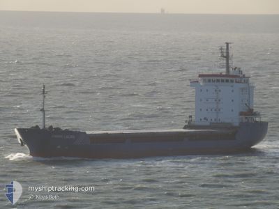
AK BROTHERS
General Cargo

Current Trip
| Time Travelled | 14 days |
|---|---|
| Remaining Time | 2 days |
| Distance Travelled | 1235.85 nm |
| Remaining Distance | 614.52 nm |
| AVG Speed | 7.2 Knopen |
| MAX Speed | 7.2 Knopen |
| AVG Wind | 16.1 knots |
| MAX Wind | 28.4 knots |
| MIN Temp | -2°C / 28.4°F |
| MAX Temp | 8.3°C / 46.94°F |
| Diepgang | 6.2 M |
| Positie ontvangen | 3 m geleden |
Current Position
| Lengtegraad | --- |
|---|---|
| Breedtegraat | --- |
| Status | Under way using engine |
| Snelheid | 9.4 Knopen |
| Koers | 202.6° |
| Gebied | Aegean Sea |
| Station | T-AIS |
| Positie ontvangen | 3 m geleden |
Information
The current position of AK BROTHERS is in Aegean Sea with coordinates 37.15557° / 23.92200° as reported on 2025-02-21 11:17 by AIS to our vessel tracker app. The vessel's current speed is 9.4 Knopen and is heading at the port of SALERNO. The estimated time of arrival as calculated by MyShipTracking vessel tracking app is 2025-02-24 03:34 LT
The vessel AK BROTHERS (IMO: 9053842, MMSI: 352001563) is a General Cargo that was built in 1997 ( 28 Jaar oud ). It's sailing under the flag of [PA] Panama.
In this page you can find informations about the vessels current position, last detected port calls, and current voyage information. If the vessels is not in coverage by AIS you will find the latest position.
The current position of AK BROTHERS is detected by our AIS receivers and we are not responsible for the reliability of the data. The last position was recorded while the vessel was in Coverage by the Ais receivers of our vessel tracking app.
The current draught of AK BROTHERS as reported by AIS is 6.2 meters
Weather
| Temperature | 8.3°C / 46.94°F |
|---|---|
| Wind Speed | 21 knots |
| Direction | 26° NNE |
| Pressure | 1031 hPa |
| Humidity | 60.6 % |
| Cloud Coverage | 100 % |


Featured Company
Last Port Calls
| Port | Arrival | Departure | Time In Port |
|---|---|---|---|
| 2025-02-03 11:55 | 2025-02-06 12:07 | 3 d | |
| 2025-01-24 05:32 | 2025-01-28 11:50 | 4 d | |
| 2025-01-20 07:26 | 2025-01-23 07:27 | 3 d | |
| 2025-01-10 17:37 | 2025-01-13 14:04 | 2 d | |
| 2025-01-07 12:51 | 2025-01-07 15:29 | 2 h | |
| 2025-01-03 23:58 | 2025-01-06 07:19 | 2 d | |
| 2024-12-20 06:19 | 2024-12-24 14:23 | 4 d | |
| 2024-12-14 21:17 | 2024-12-17 18:49 | 2 d | |
| 2024-12-12 04:29 | 2024-12-13 11:17 | 1 d | |
| 2024-12-02 21:52 |
Last Trips
| Origin | Departure | Destination | Arrival | Distance | |
|---|---|---|---|---|---|
| 2025-01-28 12:50 | 2025-02-03 14:55 | 640.30 nm | |||
| 2025-01-23 08:27 | 2025-01-24 06:32 | 105.36 nm | |||
| 2025-01-13 16:04 | 2025-01-20 08:26 | 932.81 nm | |||
| 2025-01-07 17:29 | 2025-01-10 19:37 | 377.97 nm | |||
| 2025-01-06 10:19 | 2025-01-07 14:51 | 150.97 nm | |||
| 2024-12-24 15:23 | 2025-01-04 02:58 | 924.01 nm | |||
| 2024-12-17 19:49 | 2024-12-20 07:19 | 563.39 nm | |||
| 2024-12-13 12:17 | 2024-12-14 22:17 | 345.79 nm | |||
| 2024-12-03 00:52 | 2024-12-12 05:29 | 1574.52 nm |
Events
| Tijd | Evenement | Details | Positie / Bestemming | Info |
|---|---|---|---|---|
| 2025-02-21 10:10 | Status Changed | Under way using engine Default |
37.32131 / 24.00599
ITSAL
|
Snelheid: 9.9 kn Koers: 203° |
| 2025-02-21 09:54 | Status Changed | Default Under way using engine |
37.36133 / 24.02537
ITSAL
|
Snelheid: 9.8 kn Koers: 202.8° |
| 2025-02-21 09:53 | Status Changed | Under way using engine Default |
37.36516 / 24.02731
ITSAL
|
Snelheid: 9.8 kn Koers: 200° |
| 2025-02-21 09:04 | Status Changed | Default Under way using engine |
37.48918 / 24.08805
ITSAL
|
Snelheid: 9.4 kn Koers: 203.4° |
| 2025-02-20 22:58 | ETA Changed | 2025/02/24 08:00 2025/02/21 17:00 |
38.80248 / 25.15741
ITSAL
|
Snelheid: 9.5 kn Koers: 206.2° |
| 2025-02-20 22:37 | Status Changed | Under way using engine Default |
38.85317 / 25.18850
ITSAL
|
Snelheid: 9.4 kn Koers: 202° |
| 2025-02-20 22:37 | Binnenbereik |
38.85317 / 25.18850
Aegean Sea
ITSAL
|
Snelheid: 9.5 kn Koers: 206.3° |
|
| 2025-02-20 20:43 | Status Changed | Default Under way using engine |
39.12362 / 25.34979
ITSAL
|
Snelheid: 9.2 kn Koers: 205.7° |
| 2025-02-20 19:46 | Buitenbereik |
39.25726 / 25.43569
Aegean Sea
ITSAL
|
Snelheid: 9.2 kn Koers: 205.7° |
|
| 2025-02-20 16:09 | Status Changed | Under way using engine Default |
39.75594 / 25.77736
ITSAL
|
Snelheid: 9.4 kn Koers: 208° |