

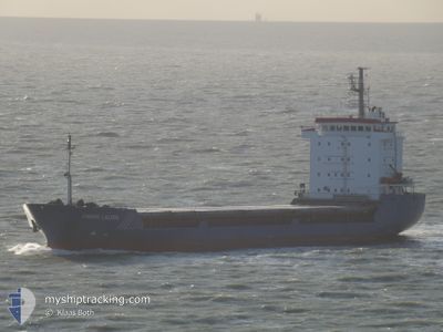
AK BROTHERS
General Cargo

Current Trip
LBSDN
| Time Travelled | 1 day |
|---|---|
| Remaining Time | --- |
| Distance Travelled | 20.26 nm |
| Remaining Distance | --- |
| AVG Speed | 8 Noeuds |
| MAX Speed | 10.1 Noeuds |
| AVG Wind | 4.7 knots |
| MAX Wind | 6 knots |
| MIN Temp | 21.4°C / 70.52°F |
| MAX Temp | 24.2°C / 75.56°F |
| Tirant d eau | 5 m |
| Position reçue | 1 d depuis |
Current Position
| Longitude | --- |
|---|---|
| Latitude | --- |
| Etat | Under way using engine |
| Vitesse | 9.1 Noeuds |
| Parcours | 19.1° |
| Zone | Mediterranean Sea - Eastern Basin |
| Station | T-AIS |
| Position reçue | 1 d depuis |
Information
The current position of AK BROTHERS is in Mediterranean Sea - Eastern Basin with coordinates 33.65057° / 35.08732° as reported on 2025-03-28 15:45 by AIS to our vessel tracker app. The vessel's current speed is 9.1 Noeuds
The vessel AK BROTHERS (IMO: 9053842, MMSI: 352001563) is a General Cargo that was built in 1997 ( 28 Age ). It's sailing under the flag of [PA] Panama.
In this page you can find informations about the vessels current position, last detected port calls, and current voyage information. If the vessels is not in coverage by AIS you will find the latest position.
The current position of AK BROTHERS is detected by our AIS receivers and we are not responsible for the reliability of the data. The last position was recorded while the vessel was in Coverage by the Ais receivers of our vessel tracking app.
The current draught of AK BROTHERS as reported by AIS is 5 meters
Weather
| Temperature | 21.4°C / 70.52°F |
|---|---|
| Wind Speed | 3 knots |
| Direction | 345° NNW |
| Pressure | 1005.8 hPa |
| Humidity | 67 % |
| Cloud Coverage | 69 % |


Featured Company
Last Port Calls
| Port | Arrival | Departure | Time In Port |
|---|---|---|---|
| 2025-03-27 08:14 | 2025-03-28 11:54 | 1 d | |
| 2025-03-07 08:32 | 2025-03-14 22:26 | 7 d | |
| 2025-02-24 17:41 | 2025-02-27 14:59 | 2 d | |
| 2025-02-03 14:55 | 2025-02-06 15:07 | 3 d | |
| 2025-01-24 06:32 | 2025-01-28 12:50 | 4 d | |
| 2025-01-20 08:26 | 2025-01-23 08:27 | 3 d | |
| 2025-01-10 19:37 | 2025-01-13 16:04 | 2 d | |
| 2025-01-07 14:51 | 2025-01-07 17:29 | 2 h | |
| 2025-01-04 02:58 | 2025-01-06 10:19 | 2 d |
Last Trips
| Origin | Departure | Destination | Arrival | Distance | |
|---|---|---|---|---|---|
| 2025-03-14 22:26 | 2025-03-27 08:14 | 1526.18 nm | |||
| 2025-02-27 14:59 | 2025-03-07 08:32 | 360.97 nm | |||
| 2025-02-06 15:07 | 2025-02-24 17:41 | 1855.21 nm | |||
| 2025-01-28 12:50 | 2025-02-03 14:55 | 640.30 nm | |||
| 2025-01-23 08:27 | 2025-01-24 06:32 | 105.36 nm | |||
| 2025-01-13 16:04 | 2025-01-20 08:26 | 932.81 nm | |||
| 2025-01-07 17:29 | 2025-01-10 19:37 | 377.97 nm | |||
| 2025-01-06 10:19 | 2025-01-07 14:51 | 150.97 nm | |||
| 2024-12-24 15:23 | 2025-01-04 02:58 | 924.01 nm |
Events
| Heure | Evenement | Détails | Position/ Destination | Info |
|---|---|---|---|---|
| 2025-03-28 15:45 | Hors de la zone couverte |
33.65057 / 35.08732
Mediterranean Sea - Eastern Basin
|
Vitesse: 9.1 kn Parcours: 19.1° |
|
| 2025-03-28 13:55 | Etat Changé | Under way using engine At anchor |
33.57152 / 35.30788
LBSDN
|
Vitesse: 5 kn Parcours: 263.6° |
| 2025-03-28 13:50 | Démarrage | 2.6 nm, West of SIDON |
33.57214 / 35.31426
LBSDN
|
Vitesse: 3.3 kn Parcours: 270° |
| 2025-03-28 13:39 | Arret | 2.41 nm, West of SIDON |
33.57128 / 35.31801
LBSDN
|
Vitesse: Parcours: 308° |
| 2025-03-28 13:33 | Etat Changé | At anchor Default |
33.57097 / 35.31903
LBSDN
|
Vitesse: 1 kn Parcours: 288° |
| 2025-03-28 13:25 | Etat Changé | Default At anchor |
33.57067 / 35.32128
LBSDN
|
Vitesse: 1.4 kn Parcours: 283° |
| 2025-03-28 12:55 | Démarrage | 1.01 nm, West of SIDON |
33.56959 / 35.34645
LBSDN
|
Vitesse: 3.3 kn Parcours: 275° |
| 2025-03-28 11:33 | Etat Changé | At anchor Default |
33.56768 / 35.34938
LBSDN
|
Vitesse: Parcours: 17° |
| 2025-03-28 11:15 | Etat Changé | Default At anchor |
33.56740 / 35.34800
LBSDN
|
Vitesse: Parcours: 10° |
| 2025-03-28 10:21 | Arret | 0.89 nm, West of SIDON |
33.56829 / 35.34848
LBSDN
|
Vitesse: 0.2 kn Parcours: 322° |