
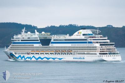
AIDABELLA
Passengers Ship
Current Trip
| Time Travelled | 4 h, 56 mins |
|---|---|
| Remaining Time | 5 h, 58 mins |
| Distance Travelled | 70.35 nm |
| Remaining Distance | 117.20 nm |
| AVG Speed | 13.2 Knopen |
| MAX Speed | 18.1 Knopen |
| AVG Wind | 17.7 knots |
| MAX Wind | 20 knots |
| MIN Temp | 25.7°C / 78.26°F |
| MAX Temp | 25.9°C / 78.62°F |
| Diepgang | 7.3 M |
| Positie ontvangen | 5 m geleden |
Current Position
| Lengtegraad | --- |
|---|---|
| Breedtegraat | --- |
| Status | Under way using engine |
| Snelheid | 18.1 Knopen |
| Koers | 111.4° |
| Gebied | Caribbean Sea |
| Station | T-AIS |
| Positie ontvangen | 5 m geleden |
Info
Information
The current position of AIDABELLA is in Caribbean Sea with coordinates 17.87937° / -63.53992° as reported on 2025-02-20 04:53 by AIS to our vessel tracker app. The vessel's current speed is 18.1 Knopen and is heading at the port of ST JOHNS. The estimated time of arrival as calculated by MyShipTracking vessel tracking app is 2025-02-20 10:56 LT
The vessel AIDABELLA (IMO: 9362542, MMSI: 247229700) is a Passengers Ship that was built in 2008 ( 17 Jaar oud ). It's sailing under the flag of [IT] Italy.
In this page you can find informations about the vessels current position, last detected port calls, and current voyage information. If the vessels is not in coverage by AIS you will find the latest position.
The current position of AIDABELLA is detected by our AIS receivers and we are not responsible for the reliability of the data. The last position was recorded while the vessel was in Coverage by the Ais receivers of our vessel tracking app.
The current draught of AIDABELLA as reported by AIS is 7.3 meters
Weather
| Temperature | 25.8°C / 78.44°F |
|---|---|
| Wind Speed | 20 knots |
| Direction | 97° E |
| Pressure | 1017.1 hPa |
| Humidity | 73.3 % |
| Cloud Coverage | 12 % |
Featured Company
Last Port Calls
| Port | Arrival | Departure | Time In Port |
|---|---|---|---|
| 2025-02-19 13:07 | 2025-02-20 00:02 | 10 h | |
| 2025-02-16 13:03 | 2025-02-17 02:20 | 13 h | |
| 2025-02-13 15:31 | 2025-02-14 02:35 | 11 h | |
| 2025-02-12 01:16 | 2025-02-13 01:43 | 1 d | |
| 2025-02-08 10:57 | 2025-02-09 02:09 | 15 h | |
| 2025-02-03 13:29 | 2025-02-04 00:01 | 10 h | |
| 2025-02-02 11:54 | 2025-02-03 02:13 | 14 h | |
| 2025-02-01 10:54 | 2025-02-01 22:37 | 11 h | |
| 2025-01-31 10:55 | 2025-01-31 22:21 | 11 h | |
| 2025-01-30 09:11 | 2025-01-31 01:50 | 16 h |
Last Trips
| Origin | Departure | Destination | Arrival | Distance | |
|---|---|---|---|---|---|
| 2025-02-16 21:20 | 2025-02-19 09:07 | 861.40 nm | |||
| 2025-02-13 20:35 | 2025-02-16 08:03 | 633.49 nm | |||
| 2025-02-12 20:43 | 2025-02-13 09:31 | 217.67 nm | |||
| 2025-02-08 22:09 | 2025-02-11 20:16 | 1087.18 nm | |||
| 2025-02-03 20:01 | 2025-02-08 06:57 | 1019.83 nm | |||
| 2025-02-02 22:13 | 2025-02-03 09:29 | 162.03 nm | |||
| 2025-02-01 18:37 | 2025-02-02 07:54 | 129.79 nm | |||
| 2025-01-31 18:21 | 2025-02-01 06:54 | 121.59 nm | |||
| 2025-01-30 21:50 | 2025-01-31 06:55 | 88.06 nm | |||
| 2025-01-29 20:31 | 2025-01-30 05:11 | 64.55 nm |
Events
| Tijd | Evenement | Details | Positie / Bestemming | Info |
|---|---|---|---|---|
| 2025-02-20 04:53 | Status Changed | Under way using engine Default |
17.87937 / -63.53992
AGSJO
|
Snelheid: 18 kn Koers: 112° |
| 2025-02-20 04:46 | Status Changed | Default Under way using engine |
17.89218 / -63.57065
AGSJO
|
Snelheid: 17.8 kn Koers: 114.4° |
| 2025-02-20 04:40 | Gevonden in zee | Saba part of the Caribbean Sea |
17.90489 / -63.59846
Caribbean Sea
AGSJO
|
Snelheid: 17.8 kn Koers: 114.4° |
| 2025-02-20 04:40 | Status Changed | Under way using engine Default |
17.90489 / -63.59846
AGSJO
|
Snelheid: 17.8 kn Koers: 115° |
| 2025-02-20 04:21 | Status Changed | Default Under way using engine |
17.94630 / -63.68872
AGSJO
|
Snelheid: 17.4 kn Koers: 108.6° |
| 2025-02-20 04:10 | Wijzig zee gebeid | Anguilla part of the Caribbean Sea British Virgin Islands part of the Caribbean Sea |
17.96631 / -63.74111
Caribbean Sea
AGSJO
|
Snelheid: 17.6 kn Koers: 107.8° |
| 2025-02-20 04:10 | Status Changed | Under way using engine Default |
17.96631 / -63.74111
AGSJO
|
Snelheid: 17.7 kn Koers: 108° |
| 2025-02-20 03:53 | Binnenbereik |
17.96631 / -63.74111
Caribbean Sea
AGSJO
|
Snelheid: 17.6 kn Koers: 107.8° |
|
| 2025-02-20 02:07 | Status Changed | Default Under way using engine |
18.20538 / -64.22921
AGSJO
|
Snelheid: 13.3 kn Koers: 115.5° |
| 2025-02-20 02:01 | Buitenbereik |
18.21384 / -64.24789
Caribbean Sea
AGSJO
|
Snelheid: 13.3 kn Koers: 115.5° |