
AFRICAN LION
Cargo
Current Trip
| Time Travelled | 8 days |
|---|---|
| Remaining Time | --- |
| Distance Travelled | 1832.35 nm |
| Remaining Distance | 286.63 nm |
| AVG Speed | 10.7 Knopen |
| MAX Speed | 18.5 Knopen |
| AVG Wind | 8.5 knots |
| MAX Wind | 18.9 knots |
| MIN Temp | 26.5°C / 79.7°F |
| MAX Temp | 30.8°C / 87.44°F |
| Diepgang | 6.8 M |
| Positie ontvangen | 2 d geleden |
Current Position
| Lengtegraad | 115.64029° |
|---|---|
| Breedtegraat | -8.02100° |
| Status | Under way using engine |
| Snelheid | 12.2 Knopen |
| Koers | 141° |
| Gebied | Bali Sea |
| Station | T-AIS |
| Positie ontvangen | 2 d geleden |
Info
Information
The current position of AFRICAN LION is in Bali Sea with coordinates -8.02100° / 115.64029° as reported on 2024-05-11 21:25 by AIS to our vessel tracker app. The vessel's current speed is 12.2 Knopen and is heading at the port of WYNDHAM. The estimated time of arrival as calculated by MyShipTracking vessel tracking app is 2024-05-14 04:00 LT
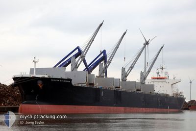
The vessel AFRICAN LION (IMO: 9636450, MMSI: 353884000) is a Cargo It's sailing under the flag of [PA] Panama.
In this page you can find informations about the vessels current position, last detected port calls, and current voyage information. If the vessels is not in coverage by AIS you will find the latest position.
The current position of AFRICAN LION is detected by our AIS receivers and we are not responsible for the reliability of the data. The last position was recorded while the vessel was in Coverage by the Ais receivers of our vessel tracking app.
The current draught of AFRICAN LION as reported by AIS is 6.8 meters
Weather
| Temperature | 27.8°C / 82.04°F |
|---|---|
| Wind Speed | 12 knots |
| Direction | 110° ESE |
| Pressure | 1011.5 hPa |
| Humidity | 71 % |
| Cloud Coverage | 10 % |
Featured Company
Events
| Tijd | Evenement | Details | Positie / Bestemming | Info |
|---|---|---|---|---|
| 2024-05-11 21:31 | Status Changed | Default Under way using engine |
-8.03640 / 115.65232
AUWYN
|
Snelheid: 12.2 kn Koers: 141° |
| 2024-05-11 21:25 | Status Changed | Under way using engine Default |
-8.02100 / 115.64029
AUWYN
|
Snelheid: 12.1 kn Koers: 142° |
| 2024-05-11 21:25 | Buitenbereik |
-8.02100 / 115.64029
Bali Sea
AUWYN
|
Snelheid: 12.2 kn Koers: 141° |
|
| 2024-05-11 20:51 | Status Changed | Default Under way using engine |
-7.93203 / 115.57086
AUWYN
|
Snelheid: 12 kn Koers: 141° |
| 2024-05-11 20:43 | Wijzig zee gebeid | Indonesian part of the Bali Sea Malaysian part of the Singapore Strait |
-7.91078 / 115.55378
Bali Sea
AUWYN
|
Snelheid: 12.1 kn Koers: 141° |
| 2024-05-11 20:42 | Status Changed | Under way using engine Default |
-7.90769 / 115.55132
AUWYN
|
Snelheid: 12 kn Koers: 141° |
| 2024-05-11 20:27 | Binnenbereik |
-7.91078 / 115.55378
Bali Sea
AUWYN
|
Snelheid: 12.1 kn Koers: 141° |
|
| 2024-05-08 19:16 | Status Changed | Default Under way using engine |
1.29551 / 104.34766
AUWYN
|
Snelheid: 15.5 kn Koers: 77° |
| 2024-05-08 19:12 | Buitenbereik |
1.28471 / 104.33102
Singapore Strait
AUWYN
|
Snelheid: 15.5 kn Koers: 77° |
|
| 2024-05-08 18:35 | Wijzig zee gebeid | Malaysian part of the Singapore Strait Indonesian part of the Singapore Strait |
1.25687 / 104.17525
Singapore Strait
AUWYN
|
Snelheid: 15.3 kn Koers: 80° |