
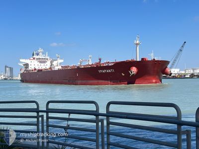
YPAPANTI
Tanker A
Current Trip
| Trip Time | --- |
|---|---|
| Trip Distance | --- |
| AVG Speed | --- |
| MAX Speed | --- |
| Tirant d eau | --- |
| AVG Wind | --- |
| MAX Wind | --- |
| MIN Temp | --- |
| MAX Temp | --- |
| Position reçue | 4 d depuis |
Current Position
| Longitude | 32.55096° |
|---|---|
| Latitude | 29.86937° |
| Etat | Under way using engine |
| Vitesse | 8.2 Noeuds |
| Parcours | 172° |
| Zone | Gulf of Suez |
| Station | T-AIS |
| Position reçue | 4 d depuis |
Info
Information
The current position of YPAPANTI is in Gulf of Suez with coordinates 29.86937° / 32.55096° as reported on 2024-06-03 13:35 by AIS to our vessel tracker app. The vessel's current speed is 8.2 Noeuds and is currently inside the port of YANBU.
The vessel YPAPANTI (IMO: 9693082, MMSI: 249279000) is a Tanker A It's sailing under the flag of [MT] Malta.
In this page you can find informations about the vessels current position, last detected port calls, and current voyage information. If the vessels is not in coverage by AIS you will find the latest position.
The current position of YPAPANTI is detected by our AIS receivers and we are not responsible for the reliability of the data. The last position was recorded while the vessel was in Coverage by the Ais receivers of our vessel tracking app.
The current draught of YPAPANTI as reported by AIS is 14.5 meters
Weather
| Temperature | 33.2°C / 91.76°F |
|---|---|
| Wind Speed | 17 knots |
| Direction | 234° SW |
| Pressure | 1002.6 hPa |
| Humidity | 54.4 % |
| Cloud Coverage | 48 % |
Featured Company
Last Port Calls
| Port | Arrival | Departure | Time In Port |
|---|---|---|---|
| 2024-06-03 04:19 | 2024-06-03 12:52 | 8 h | |
| 2024-05-16 04:17 | 2024-05-17 12:19 | 1 d | |
| 2024-05-14 03:16 | 2024-05-15 21:20 | 1 d | |
| 2024-04-23 06:00 | 2024-04-24 18:06 | 1 d | |
| 2024-04-13 08:52 | 2024-04-15 22:51 | 2 d | |
| 2024-04-03 05:39 | 2024-04-04 20:21 | 1 d |
Most Visited Ports (Last year)
| Port | Arrivals | |
|---|---|---|
| 4 | ||
| 3 | ||
| 2 | ||
| 1 | ||
| 1 | ||
| 1 |
Last Trips
| Origin | Departure | Destination | Arrival | Distance | |
|---|---|---|---|---|---|
| 2024-05-17 15:19 | 2024-06-03 06:19 | 5061.40 nm | |||
| 2024-05-16 00:20 | 2024-05-16 07:17 | 41.72 nm | |||
| 2024-04-24 19:06 | 2024-05-14 06:16 | 1499.81 nm | |||
| 2024-04-15 23:51 | 2024-04-23 07:00 | 262.40 nm | |||
| 2024-04-04 21:21 | 2024-04-13 09:52 | 2232.37 nm | |||
| 2024-03-21 21:54 | 2024-04-03 06:39 | 2424.85 nm |
Events
| Heure | Evenement | Détails | Position/ Destination | Info |
|---|---|---|---|---|
| 2024-06-05 14:20 | Arret |
24.01333 / 37.49833
PORT SAID
|
Vitesse: Parcours: -1° |
|
| 2024-06-05 12:41 | Démarrage |
24.00770 / 37.48338
PORT SAID
|
Vitesse: 4.1 kn Parcours: 270° |
|
| 2024-06-05 12:17 | Arret |
24.00167 / 37.48667
PORT SAID
|
Vitesse: Parcours: -1° |
|
| 2024-06-05 08:38 | Démarrage |
23.91410 / 36.94433
PORT SAID
|
Vitesse: 3.6 kn Parcours: 75° |
|
| 2024-06-05 00:38 | Arret |
24.02333 / 36.95167
PORT SAID
|
Vitesse: Parcours: -1° |
|
| 2024-06-03 13:39 | Etat Changé | Default Under way using engine |
29.86004 / 32.55233
PORT SAID
|
Vitesse: 8.2 kn Parcours: 172° |
| 2024-06-03 13:35 | Hors de la zone couverte |
29.86937 / 32.55096
Gulf of Suez
|
Vitesse: 8.2 kn Parcours: 172° |
|
| 2024-06-03 12:52 | Changement de zone | Egyptian part of the Gulf of Suez Egyptian part of the Mediterranean Sea - Eastern Basin |
29.94463 / 32.57672
Gulf of Suez
|
Vitesse: 9.1 kn Parcours: 215.2° |
| 2024-06-03 12:52 | PORT DE DEPART |
|
29.94571 / 32.57757
PORT SAID
|
Vitesse: 9.2 kn Parcours: 215° |
| 2024-06-03 10:35 | Etat Changé | Under way using engine Default |
30.28276 / 32.43708
[EG] SUEZ CANAL
|
Vitesse: 10 kn Parcours: -1° |