
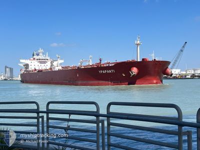
YPAPANTI
Tanker
Current Trip
| Time Travelled | 18 days |
|---|---|
| Remaining Time | 2 days |
| Distance Travelled | 1579.86 nm |
| Remaining Distance | 485.11 nm |
| AVG Speed | 11.4 Knots |
| MAX Speed | 11.4 Knots |
| AVG Wind | 8.3 knots |
| MAX Wind | 22 knots |
| MIN Temp | -2.5°C / 27.5°F |
| MAX Temp | 34.2°C / 93.56°F |
| Dybgang | 12.9 m |
| Position Modtaget | 4 h, 26 m siden |
Current Position
| Longitude | --- |
|---|---|
| Latitude | --- |
| Status | Under way using engine |
| Fart | 10.4 Knots |
| Kurs | 172.8° |
| Område | Gulf of Suez |
| Station | T-AIS |
| Position Modtaget | 4 h, 26 m siden |
Information
The current position of YPAPANTI is in Gulf of Suez with coordinates 29.86970° / 32.55111° as reported on 2025-03-27 14:27 by AIS to our vessel tracker app. The vessel's current speed is 10.4 Knots and is heading at the port of YANBU. The estimated time of arrival as calculated by MyShipTracking vessel tracking app is 2025-03-30 01:35 LT
The vessel YPAPANTI (IMO: 9693082, MMSI: 249279000) is a Tanker It's sailing under the flag of [MT] Malta.
In this page you can find informations about the vessels current position, last detected port calls, and current voyage information. If the vessels is not in coverage by AIS you will find the latest position.
The current position of YPAPANTI is detected by our AIS receivers and we are not responsible for the reliability of the data. The last position was recorded while the vessel was in Coverage by the Ais receivers of our vessel tracking app.
The current draught of YPAPANTI as reported by AIS is 12.9 meters
Weather
| Temperature | 23°C / 73.4°F |
|---|---|
| Wind Speed | 9 knots |
| Direction | 179° S |
| Pressure | 1008.5 hPa |
| Humidity | 50.3 % |
| Cloud Coverage | 98 % |
Featured Company
Last Port Calls
| Port | Arrival | Departure | Time In Port |
|---|---|---|---|
| 2025-03-27 04:44 | 2025-03-27 13:50 | 9 h | |
| 2025-03-09 05:41 | 2025-03-09 15:05 | 9 h | |
| 2025-03-08 11:45 | 2025-03-08 16:56 | 5 h | |
| 2025-02-24 04:20 | 2025-03-01 08:20 | 5 d | |
| 2025-01-21 09:02 | 2025-01-22 16:39 | 1 d |
Most Visited Ports (Last year)
| Port | Arrivals | |
|---|---|---|
| 4 | ||
| 3 | ||
| 2 | ||
| 2 | ||
| 1 | ||
| 1 |
Last Trips
| Origin | Departure | Destination | Arrival | Distance | |
|---|---|---|---|---|---|
| 2025-03-09 18:05 | 2025-03-27 06:44 | 1474.77 nm | |||
| 2025-03-08 19:56 | 2025-03-09 08:41 | 121.73 nm | |||
| 2025-03-01 10:20 | 2025-03-08 14:45 | 1128.00 nm | |||
| 2025-01-22 17:39 | 2025-02-24 06:20 | 3067.91 nm |
Events
| Tid | Hændelsen | Detaljer | Position / Dest | Info |
|---|---|---|---|---|
| 2025-03-27 14:34 | Status er ændret | Default Under way using engine |
29.84954 / 32.55244
SA YNB
|
Fart: 10.4 kn Kurs: 172.8° |
| 2025-03-27 14:27 | Udenfor Dækning |
29.86970 / 32.55111
Gulf of Suez
SA YNB
|
Fart: 10.4 kn Kurs: 172.8° |
|
| 2025-03-27 14:13 | Destination er ændret | SA YNB EG PSD |
29.90592 / 32.54592
SA YNB
|
Fart: 7 kn Kurs: 183° |
| 2025-03-27 14:11 | ETA er ændret | 2025/03/29 08:00 2025/03/26 17:00 |
29.91015 / 32.54638
EG PSD
|
Fart: 6.9 kn Kurs: 194.8° |
| 2025-03-27 13:52 | Ændre havområde | Egyptian part of the Gulf of Suez Egyptian part of the Mediterranean Sea - Eastern Basin |
29.94224 / 32.57468
Gulf of Suez
|
Fart: 10.5 kn Kurs: 219.9° |
| 2025-03-27 13:50 | Afsejlet fra sidste havn |
|
29.94578 / 32.57769
EG PSD
|
Fart: 10.3 kn Kurs: 215° |
| 2025-03-27 11:13 | Status er ændret | Under way using engine Default |
30.28375 / 32.43546
[EG] SUEZ CANAL
|
Fart: 10.5 kn Kurs: 143° |
| 2025-03-27 11:13 | Indenfor Dækning |
30.28375 / 32.43546
Mediterranean Sea - Eastern Basin
[EG] SUEZ CANAL
|
Fart: 9.7 kn Kurs: 142.7° |
|
| 2025-03-27 08:00 | Status er ændret | Default Under way using engine |
30.73569 / 32.33107
[EG] SUEZ CANAL
|
Fart: 8.5 kn Kurs: 151° |
| 2025-03-27 07:57 | Udenfor Dækning |
30.74148 / 32.32701
Mediterranean Sea - Eastern Basin
[EG] SUEZ CANAL
|
Fart: 8.5 kn Kurs: 154.7° |