
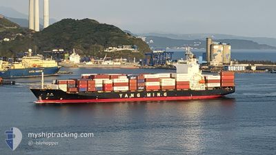
YM IMAGE
Container Ship
Current Trip
| Time Travelled | 8 h, 53 mins |
|---|---|
| Remaining Time | 1 h, 38 mins |
| Distance Travelled | 38.01 nm |
| Remaining Distance | 188.51 nm |
| AVG Speed | 20 Noeuds |
| MAX Speed | 23 Noeuds |
| AVG Wind | 12.5 knots |
| MAX Wind | 14.8 knots |
| MIN Temp | 22.3°C / 72.14°F |
| MAX Temp | 24.5°C / 76.1°F |
| Tirant d eau | 8.3 m |
| Position reçue | 7 h, 14 m depuis |
Current Position
| Longitude | 121.26940° |
|---|---|
| Latitude | 25.27283° |
| Etat | Under way using engine |
| Vitesse | 20.7 Noeuds |
| Parcours | 249° |
| Zone | South China Sea |
| Station | T-AIS |
| Position reçue | 7 h, 14 m depuis |
Info
Information
The current position of YM IMAGE is in South China Sea with coordinates 25.27283° / 121.26940° as reported on 2024-06-05 12:51 by AIS to our vessel tracker app. The vessel's current speed is 20.7 Noeuds and is heading at the port of KAOHSIUNG. The estimated time of arrival as calculated by MyShipTracking vessel tracking app is 2024-06-06 05:43 LT
The vessel YM IMAGE (IMO: 9319088, MMSI: 636012796) is a Container Ship that was built in 2006 ( 18 Age ). It's sailing under the flag of [LR] Liberia.
In this page you can find informations about the vessels current position, last detected port calls, and current voyage information. If the vessels is not in coverage by AIS you will find the latest position.
The current position of YM IMAGE is detected by our AIS receivers and we are not responsible for the reliability of the data. The last position was recorded while the vessel was in Coverage by the Ais receivers of our vessel tracking app.
The current draught of YM IMAGE as reported by AIS is 8.3 meters
Weather
| Temperature | 23.8°C / 74.84°F |
|---|---|
| Wind Speed | 5 knots |
| Direction | 211° SSW |
| Pressure | 1012.4 hPa |
| Humidity | 92.2 % |
| Cloud Coverage | 100 % |
Featured Company
Last Port Calls
| Port | Arrival | Departure | Time In Port |
|---|---|---|---|
| 2024-06-05 08:07 | 2024-06-05 19:12 | 11 h | |
| 2024-06-02 18:56 | 2024-06-03 01:47 | 6 h | |
| 2024-06-02 12:35 | 2024-06-02 18:12 | 5 h | |
| 2024-06-01 07:30 | 2024-06-01 21:10 | 13 h | |
| 2024-05-31 06:50 | 2024-05-31 16:23 | 9 h | |
| 2024-05-30 07:11 | 2024-05-30 18:19 | 11 h | |
| 2024-05-26 17:12 | 2024-05-27 10:23 | 17 h | |
| 2024-05-25 22:13 | 2024-05-26 10:44 | 12 h | |
| 2024-05-24 19:20 | 2024-05-25 14:57 | 19 h | |
| 2024-05-23 06:41 | 2024-05-23 16:25 | 9 h |
Last Trips
| Origin | Departure | Destination | Arrival | Distance | |
|---|---|---|---|---|---|
| 2024-06-03 01:47 | 2024-06-05 08:07 | 946.62 nm | |||
| 2024-06-02 18:12 | 2024-06-02 18:56 | 7.79 nm | |||
| 2024-06-01 21:10 | 2024-06-02 12:35 | 241.81 nm | |||
| 2024-05-31 16:23 | 2024-06-01 07:30 | 201.21 nm | |||
| 2024-05-30 18:19 | 2024-05-31 06:50 | 15.66 nm | |||
| 2024-05-27 10:23 | 2024-05-30 07:11 | 1150.75 nm | |||
| 2024-05-26 10:44 | 2024-05-26 17:12 | 117.01 nm | |||
| 2024-05-25 14:57 | 2024-05-25 22:13 | 129.78 nm | |||
| 2024-05-23 16:25 | 2024-05-24 19:20 | 380.14 nm | |||
| 2024-05-18 15:30 | 2024-05-23 06:41 | 1559.11 nm |
Events
| Heure | Evenement | Détails | Position/ Destination | Info |
|---|---|---|---|---|
| 2024-06-05 12:55 | Etat Changé | Default Under way using engine |
25.26297 / 121.24115
TW KHH
|
Vitesse: 20.7 kn Parcours: 249° |
| 2024-06-05 12:51 | Hors de la zone couverte |
25.27283 / 121.26940
South China Sea
TW KHH
|
Vitesse: 20.7 kn Parcours: 249° |
|
| 2024-06-05 12:49 | Changement de zone | Taiwanese part of the South China Sea Taiwanese part of the Eastern China Sea |
25.27603 / 121.27890
South China Sea
TW KHH
|
Vitesse: 20.5 kn Parcours: 249° |
| 2024-06-05 12:49 | Etat Changé | Under way using engine Default |
25.27603 / 121.27890
TW KHH
|
Vitesse: 20.4 kn Parcours: 253° |
| 2024-06-05 12:08 | Etat Changé | Default Under way using engine |
25.34115 / 121.54200
TW KHH
|
Vitesse: 21.9 kn Parcours: 277° |
| 2024-06-05 11:12 | PORT DE DEPART |
|
25.16478 / 121.75205
TW KHH
|
Vitesse: 12.5 kn Parcours: 353° |
| 2024-06-05 11:02 | Démarrage |
25.14407 / 121.75478
[TW] KEELUNG
|
Vitesse: 4.7 kn Parcours: 32° |
|
| 2024-06-05 10:54 | Changement d'ETA | 2024/06/06 00:00 2024/06/06 00:30 |
25.14210 / 121.75492
[TW] KEELUNG
|
Vitesse: 0.5 kn Parcours: 237° |
| 2024-06-05 10:52 | Etat Changé | Under way using engine Moored |
25.14198 / 121.75500
[TW] KEELUNG
|
Vitesse: Parcours: 238° |
| 2024-06-05 10:32 | Tirant d'eau modifié | 8.3 8 |
25.14197 / 121.75500
[TW] KEELUNG
|
Vitesse: Parcours: 238° |