
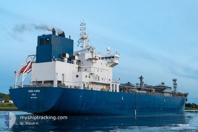
YARA KARA
Tanker D
Current Trip
| Time Travelled | 18 days |
|---|---|
| Remaining Time | 3 days |
| Distance Travelled | 3982.89 nm |
| Remaining Distance | 1492.06 nm |
| AVG Speed | 11.6 Noeuds |
| MAX Speed | 17 Noeuds |
| AVG Wind | 11.5 knots |
| MAX Wind | 30 knots |
| MIN Temp | 14.1°C / 57.38°F |
| MAX Temp | 27.7°C / 81.86°F |
| Tirant d eau | 7.4 m |
| Position reçue | 3 d depuis |
Current Position
| Longitude | --- |
|---|---|
| Latitude | --- |
| Etat | Under way using engine |
| Vitesse | 13.4 Noeuds |
| Parcours | 227.2° |
| Zone | North Atlantic Ocean |
| Station | T-AIS |
| Position reçue | 3 d depuis |
Info
Information
The current position of YARA KARA is in North Atlantic Ocean with coordinates 36.47445° / -28.63891° as reported on 2024-09-26 11:37 by AIS to our vessel tracker app. The vessel's current speed is 13.4 Noeuds and is heading at the port of POINT LISAS. The estimated time of arrival as calculated by MyShipTracking vessel tracking app is 2024-10-03 22:56 LT
The vessel YARA KARA (IMO: 9734836, MMSI: 258915000) is a Tanker D It's sailing under the flag of [NO] Norway.
In this page you can find informations about the vessels current position, last detected port calls, and current voyage information. If the vessels is not in coverage by AIS you will find the latest position.
The current position of YARA KARA is detected by our AIS receivers and we are not responsible for the reliability of the data. The last position was recorded while the vessel was in Coverage by the Ais receivers of our vessel tracking app.
The current draught of YARA KARA as reported by AIS is 7.4 meters
Weather
| Temperature | 27.6°C / 81.68°F |
|---|---|
| Wind Speed | 18 knots |
| Direction | 151° SSE |
| Pressure | 1010.7 hPa |
| Humidity | 84.4 % |
| Cloud Coverage | 16 % |
Featured Company
Last Port Calls
| Port | Arrival | Departure | Time In Port |
|---|---|---|---|
| 2024-09-10 16:19 | 2024-09-11 19:20 | 1 d | |
| 2024-08-21 15:51 | 2024-08-22 13:24 | 21 h | |
| 2024-08-09 03:52 | 2024-08-09 04:07 | 14 m | |
| 2024-08-05 01:36 | |||
| 2024-08-05 01:13 | 2024-08-05 01:27 | 14 m | |
| 2024-07-30 19:18 | 2024-07-31 12:20 | 17 h | |
| 2024-07-18 22:54 | 2024-07-19 18:13 | 19 h | |
| 2024-07-12 08:40 | 2024-07-13 16:26 | 1 d | |
| 2024-07-04 10:07 | 2024-07-05 15:08 | 1 d | |
| 2024-07-04 07:28 |
Last Trips
| Origin | Departure | Destination | Arrival | Distance | |
|---|---|---|---|---|---|
| 2024-08-22 13:24 | 2024-09-10 16:19 | 5186.09 nm | |||
| 2024-08-09 04:07 | 2024-08-21 15:51 | 4014.51 nm | |||
| 2024-08-05 01:27 | 2024-08-09 03:52 | 0.61 nm | |||
| 2024-08-05 01:27 | 2024-08-05 01:36 | 0.12 nm | |||
| 2024-07-31 12:20 | 2024-08-05 01:13 | 1113.92 nm | |||
| 2024-07-19 18:13 | 2024-07-30 19:18 | 1154.42 nm | |||
| 2024-07-13 16:26 | 2024-07-18 22:54 | 1010.69 nm | |||
| 2024-07-05 15:08 | 2024-07-12 08:40 | 2131.87 nm | |||
| 2024-07-04 07:21 | 2024-07-04 10:07 | 6.58 nm | |||
| 2024-06-26 15:23 | 2024-07-04 07:28 | 2401.44 nm |
Events
| Heure | Evenement | Détails | Position/ Destination | Info |
|---|---|---|---|---|
| 2024-09-26 11:45 | Etat Changé | Default Under way using engine |
36.45368 / -28.66717
FRAMS >> TTPTS
|
Vitesse: 13.4 kn Parcours: 227.2° |
| 2024-09-26 11:36 | Hors de la zone couverte |
36.47534 / -28.63771
North Atlantic Ocean
FRAMS >> TTPTS
|
Vitesse: 13.3 kn Parcours: 227.9° |
|
| 2024-09-26 11:30 | Etat Changé | Under way using engine Default |
36.49118 / -28.61616
FRAMS >> TTPTS
|
Vitesse: 13.2 kn Parcours: 228° |
| 2024-09-26 11:30 | Dans la zone couverte |
36.47534 / -28.63771
North Atlantic Ocean
FRAMS >> TTPTS
|
Vitesse: 13.3 kn Parcours: 227.9° |
|
| 2024-09-26 10:31 | Etat Changé | Default Under way using engine |
36.63747 / -28.41390
FRAMS >> TTPTS
|
Vitesse: 13.6 kn Parcours: 228.3° |
| 2024-09-26 10:16 | Hors de la zone couverte |
36.67507 / -28.36193
North Atlantic Ocean
FRAMS >> TTPTS
|
Vitesse: 13.6 kn Parcours: 228.3° |
|
| 2024-09-26 10:15 | Etat Changé | Under way using engine Default |
36.67893 / -28.35665
FRAMS >> TTPTS
|
Vitesse: 13.4 kn Parcours: 230° |
| 2024-09-26 10:01 | Etat Changé | Default Under way using engine |
36.71341 / -28.30813
FRAMS >> TTPTS
|
Vitesse: 13.3 kn Parcours: 229.5° |
| 2024-09-26 09:56 | Etat Changé | Under way using engine Default |
36.72605 / -28.29000
FRAMS >> TTPTS
|
Vitesse: 13.5 kn Parcours: 228° |
| 2024-09-26 09:47 | Dans la zone couverte |
36.72156 / -28.29643
North Atlantic Ocean
FRAMS >> TTPTS
|
Vitesse: 13.3 kn Parcours: 229.5° |