

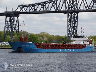
WILSON BORG
General Cargo

Current Trip
BEWLB
| Time Travelled | 4 days |
|---|---|
| Remaining Time | --- |
| Distance Travelled | 791.71 nm |
| Remaining Distance | --- |
| AVG Speed | 9.3 Noeuds |
| MAX Speed | 13.7 Noeuds |
| AVG Wind | 16 knots |
| MAX Wind | 29.2 knots |
| MIN Temp | -8.1°C / 17.42°F |
| MAX Temp | 6.7°C / 44.06°F |
| Tirant d eau | 5.7 m |
| Position reçue | 2 m depuis |
Current Position
| Longitude | --- |
|---|---|
| Latitude | --- |
| Etat | Under way using engine |
| Vitesse | 6.4 Noeuds |
| Parcours | 219.4° |
| Zone | Norwegian Sea |
| Station | T-AIS |
| Position reçue | 2 m depuis |
Information
The current position of WILSON BORG is in Norwegian Sea with coordinates 64.42608° / 8.70263° as reported on 2025-02-28 13:29 by AIS to our vessel tracker app. The vessel's current speed is 6.4 Noeuds
The vessel WILSON BORG (IMO: 9106924, MMSI: 314545000) is a General Cargo that was built in 1994 ( 31 Age ). It's sailing under the flag of [BB] Barbados.
In this page you can find informations about the vessels current position, last detected port calls, and current voyage information. If the vessels is not in coverage by AIS you will find the latest position.
The current position of WILSON BORG is detected by our AIS receivers and we are not responsible for the reliability of the data. The last position was recorded while the vessel was in Coverage by the Ais receivers of our vessel tracking app.
The current draught of WILSON BORG as reported by AIS is 5.7 meters
Weather
| Temperature | 6.4°C / 43.52°F |
|---|---|
| Wind Speed | 20 knots |
| Direction | 270° W |
| Pressure | 1016.5 hPa |
| Humidity | 72.1 % |
| Cloud Coverage | 78 % |


Featured Company
Last Port Calls
| Port | Arrival | Departure | Time In Port |
|---|---|---|---|
| 2025-02-22 19:45 | 2025-02-23 17:17 | 21 h | |
| 2025-02-19 03:29 | 2025-02-19 08:05 | 4 h | |
| 2025-02-11 03:01 | 2025-02-17 08:26 | 6 d | |
| 2025-02-11 01:46 | 2025-02-11 02:13 | 27 m | |
| 2025-02-04 02:11 | 2025-02-06 16:31 | 2 d | |
| 2025-02-02 11:42 | 2025-02-03 17:58 | 1 d | |
| 2025-01-29 05:28 | 2025-01-29 20:48 | 15 h | |
| 2025-01-27 09:38 | 2025-01-28 14:17 | 1 d | |
| 2025-01-21 14:26 | 2025-01-22 19:51 | 1 d | |
| 2025-01-14 12:28 | 2025-01-15 05:04 | 16 h |
Most Visited Ports (Last year)
| Port | Arrivals | |
|---|---|---|
| 4 | ||
| 3 | ||
| 3 | ||
| 3 | ||
| 2 | ||
| 2 |
Last Trips
| Origin | Departure | Destination | Arrival | Distance | |
|---|---|---|---|---|---|
| 2025-02-19 09:05 | 2025-02-22 20:45 | 815.83 nm | |||
| 2025-02-17 09:26 | 2025-02-19 04:29 | 101.31 nm | |||
| 2025-02-11 03:13 | 2025-02-11 04:01 | 7.25 nm | |||
| 2025-02-06 17:31 | 2025-02-11 02:46 | 854.00 nm | |||
| 2025-02-03 18:58 | 2025-02-04 03:11 | 79.65 nm | |||
| 2025-01-29 20:48 | 2025-02-02 12:42 | 828.24 nm | |||
| 2025-01-28 14:17 | 2025-01-29 05:28 | 153.77 nm | |||
| 2025-01-22 19:51 | 2025-01-27 09:38 | 845.96 nm | |||
| 2025-01-15 06:04 | 2025-01-21 14:26 | 919.44 nm | |||
| 2025-01-14 13:11 | 2025-01-14 13:28 | 2.16 nm |
Events
| Heure | Evenement | Détails | Position/ Destination | Info |
|---|---|---|---|---|
| 2025-02-28 03:42 | Tirant d'eau modifié | 5.7 5.8 |
65.36328 / 9.75695
BEWLB
|
Vitesse: 7.2 kn Parcours: 224.3° |
| 2025-02-27 00:04 | Tirant d'eau modifié | 5.8 5.5 |
68.23087 / 15.65181
BEWLB
|
Vitesse: 9.2 kn Parcours: 226.6° |
| 2025-02-26 15:35 | Démarrage | 2.31 nm, East of FINNSNES |
69.22361 / 18.07327
BEWLB
|
Vitesse: 4.5 kn Parcours: 256° |
| 2025-02-26 15:28 | Tirant d'eau modifié | 5.5 3.7 |
69.22294 / 18.07871
BEWLB
|
Vitesse: 0.2 kn Parcours: 66° |
| 2025-02-26 15:28 | Changement de destination | BEWLB NOFNE |
69.22294 / 18.07871
BEWLB
|
Vitesse: 0.2 kn Parcours: 66° |
| 2025-02-26 15:28 | Changement d'ETA | 2025/03/05 12:00 2025/02/25 12:00 |
69.22294 / 18.07871
BEWLB
|
Vitesse: 0.2 kn Parcours: 66° |
| 2025-02-26 13:00 | Etat Changé | Under way using engine Default |
69.22298 / 18.07940
NOFNE
|
Vitesse: Parcours: 59° |
| 2025-02-26 12:51 | Etat Changé | Default Under way using engine |
69.22300 / 18.07936
NOFNE
|
Vitesse: Parcours: 59° |
| 2025-02-26 11:33 | Etat Changé | Under way using engine Default |
69.22302 / 18.07946
NOFNE
|
Vitesse: Parcours: 59° |
| 2025-02-26 11:15 | Etat Changé | Default Under way using engine |
69.22298 / 18.07951
NOFNE
|
Vitesse: Parcours: 59° |