
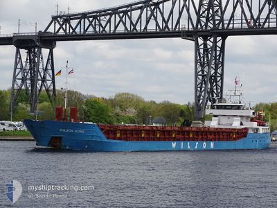
WILSON BORG
General Cargo
Current Trip
| Time Travelled | 21 h, 21 mins |
|---|---|
| Remaining Time | --- |
| Distance Travelled | 215.11 nm |
| Remaining Distance | --- |
| AVG Speed | 9.8 Knots |
| MAX Speed | 11.7 Knots |
| AVG Wind | 7.9 knots |
| MAX Wind | 13 knots |
| MIN Temp | 7.4°C / 45.32°F |
| MAX Temp | 8.9°C / 48.02°F |
| Dybgang | 5.2 m |
| Position Modtaget | 1 m siden |
Current Position
| Longitude | --- |
|---|---|
| Latitude | --- |
| Status | Under way using engine |
| Fart | 10.3 Knots |
| Kurs | 333.9° |
| Område | North Sea |
| Station | T-AIS |
| Position Modtaget | 1 m siden |
Info
Information
The current position of WILSON BORG is in North Sea with coordinates 54.90010° / 1.21171° as reported on 2025-01-16 02:24 by AIS to our vessel tracker app. The vessel's current speed is 10.3 Knots and is heading at the port of KYLEAKIN. The estimated time of arrival as calculated by MyShipTracking vessel tracking app is 2025-01-18 06:00 LT
The vessel WILSON BORG (IMO: 9106924, MMSI: 314545000) is a General Cargo that was built in 1994 ( 31 år gamle ). It's sailing under the flag of [BB] Barbados.
In this page you can find informations about the vessels current position, last detected port calls, and current voyage information. If the vessels is not in coverage by AIS you will find the latest position.
The current position of WILSON BORG is detected by our AIS receivers and we are not responsible for the reliability of the data. The last position was recorded while the vessel was in Coverage by the Ais receivers of our vessel tracking app.
The current draught of WILSON BORG as reported by AIS is 5.2 meters
Weather
| Temperature | 8.6°C / 47.48°F |
|---|---|
| Wind Speed | 8 knots |
| Direction | 248° WSW |
| Pressure | 1030.6 hPa |
| Humidity | 78.8 % |
| Cloud Coverage | 47 % |
Featured Company
Last Port Calls
| Port | Arrival | Departure | Time In Port |
|---|---|---|---|
| 2025-01-14 12:28 | 2025-01-15 05:04 | 16 h | |
| 2025-01-13 16:34 | 2025-01-14 12:11 | 19 h | |
| 2025-01-12 19:06 | 2025-01-13 13:44 | 18 h | |
| 2025-01-09 08:35 | 2025-01-10 15:04 | 1 d | |
| 2025-01-04 23:05 | 2025-01-07 17:09 | 2 d | |
| 2025-01-03 02:36 | 2025-01-03 11:40 | 9 h | |
| 2025-01-02 17:22 | 2025-01-02 17:48 | 25 m | |
| 2024-12-31 04:20 | 2025-01-02 16:19 | 2 d | |
| 2024-12-31 02:58 | 2024-12-31 03:29 | 30 m | |
| 2024-12-23 15:36 | 2024-12-26 15:30 | 2 d |
Last Trips
| Origin | Departure | Destination | Arrival | Distance | |
|---|---|---|---|---|---|
| 2025-01-14 13:11 | 2025-01-14 13:28 | 2.16 nm | |||
| 2025-01-13 14:44 | 2025-01-13 17:34 | 29.71 nm | |||
| 2025-01-10 16:04 | 2025-01-12 20:06 | 492.87 nm | |||
| 2025-01-07 18:09 | 2025-01-09 09:35 | 292.44 nm | |||
| 2025-01-03 12:40 | 2025-01-05 00:05 | 297.74 nm | |||
| 2025-01-02 18:48 | 2025-01-03 03:36 | 80.04 nm | |||
| 2025-01-02 17:19 | 2025-01-02 18:22 | 5.59 nm | |||
| 2024-12-31 04:29 | 2024-12-31 05:20 | 7.20 nm | |||
| 2024-12-26 16:30 | 2024-12-31 03:58 | 845.68 nm | |||
| 2024-12-22 14:29 | 2024-12-23 16:36 | 85.57 nm |
Events
| Tid | Hændelsen | Detaljer | Position / Dest | Info |
|---|---|---|---|---|
| 2025-01-16 01:13 | Status er ændret | Under way using engine Default |
54.71417 / 1.39230
GBKYN
|
Fart: 11.2 kn Kurs: 325° |
| 2025-01-16 01:05 | Status er ændret | Default Under way using engine |
54.69431 / 1.41641
GBKYN
|
Fart: 11.2 kn Kurs: 324.7° |
| 2025-01-16 00:59 | Status er ændret | Under way using engine Default |
54.67797 / 1.43634
GBKYN
|
Fart: 11.2 kn Kurs: 324° |
| 2025-01-16 00:41 | Status er ændret | Default Under way using engine |
54.63291 / 1.49070
GBKYN
|
Fart: 11.4 kn Kurs: 329.5° |
| 2025-01-15 23:42 | Status er ændret | Under way using engine Default |
54.47054 / 1.64667
GBKYN
|
Fart: 11.2 kn Kurs: 331° |
| 2025-01-15 23:41 | Status er ændret | Default Under way using engine |
54.46808 / 1.64888
GBKYN
|
Fart: 11 kn Kurs: 299.1° |
| 2025-01-15 22:46 | Status er ændret | Under way using engine Default |
54.40063 / 1.89950
GBKYN
|
Fart: 9.9 kn Kurs: 291° |
| 2025-01-15 22:41 | Status er ændret | Default Under way using engine |
54.39587 / 1.92024
GBKYN
|
Fart: 10.2 kn Kurs: 340.8° |
| 2025-01-15 22:36 | Status er ændret | Under way using engine Default |
54.38981 / 1.94235
GBKYN
|
Fart: 10.3 kn Kurs: 339° |
| 2025-01-15 22:33 | Status er ændret | Default Under way using engine |
54.38277 / 1.94675
GBKYN
|
Fart: 10.1 kn Kurs: 334.4° |