
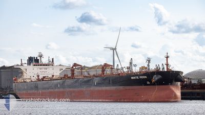
WHITE MOON
Crude Oil Tanker
Current Trip
| Time Travelled | 22 days |
|---|---|
| Remaining Time | --- |
| Distance Travelled | 4116.83 nm |
| Remaining Distance | --- |
| AVG Speed | 9.4 Noeuds |
| MAX Speed | 15.1 Noeuds |
| AVG Wind | 13.8 knots |
| MAX Wind | 31 knots |
| MIN Temp | 1.7°C / 35.06°F |
| MAX Temp | 17.4°C / 63.32°F |
| Tirant d eau | 9.6 m |
| Position reçue | 2 d depuis |
Current Position
| Longitude | --- |
|---|---|
| Latitude | --- |
| Etat | Under way using engine |
| Vitesse | 11.1 Noeuds |
| Parcours | 63.1° |
| Zone | Black Sea |
| Station | T-AIS |
| Position reçue | 2 d depuis |
Info
Information
The current position of WHITE MOON is in Black Sea with coordinates 42.46621° / 31.73025° as reported on 2026-01-02 22:40 by AIS to our vessel tracker app. The vessel's current speed is 11.1 Noeuds
The vessel WHITE MOON (IMO: 9588158, MMSI: 636016128) is a Crude Oil Tanker that was built in 2012 ( 14 Age ). It's sailing under the flag of [LR] Liberia.
In this page you can find informations about the vessels current position, last detected port calls, and current voyage information. If the vessels is not in coverage by AIS you will find the latest position.
The current position of WHITE MOON is detected by our AIS receivers and we are not responsible for the reliability of the data. The last position was recorded while the vessel was in Coverage by the Ais receivers of our vessel tracking app.
The current draught of WHITE MOON as reported by AIS is 9.6 meters
Weather
| Temperature | 10.7°C / 51.26°F |
|---|---|
| Wind Speed | 5 knots |
| Direction | 225° SW |
| Pressure | 1022.2 hPa |
| Humidity | 84.8 % |
| Cloud Coverage | 100 % |
Featured Company
Last Trips
Events
| Heure | Evenement | Détails | Position/ Destination | Info |
|---|---|---|---|---|
| 2026-01-05 12:31 | Arret |
44.14413 / 37.31865
RUNVS
|
Vitesse: 0.2 kn Parcours: 209° |
|
| 2026-01-02 22:48 | Etat Changé | Default Under way using engine |
42.47722 / 31.75952
RUNVS
|
Vitesse: 11.1 kn Parcours: 63.1° |
| 2026-01-02 22:40 | Hors de la zone couverte |
42.46621 / 31.73025
Black Sea
|
Vitesse: 11.1 kn Parcours: 63.1° |
|
| 2026-01-02 22:35 | Etat Changé | Under way using engine Default |
42.46015 / 31.71401
RUNVS
|
Vitesse: 11 kn Parcours: 63° |
| 2026-01-02 22:09 | Etat Changé | Default Under way using engine |
42.42263 / 31.61666
RUNVS
|
Vitesse: 11 kn Parcours: 61.5° |
| 2026-01-02 21:57 | Etat Changé | Under way using engine Default |
42.40618 / 31.57411
RUNVS
|
Vitesse: 11.4 kn Parcours: 62° |
| 2026-01-02 21:47 | Etat Changé | Default Under way using engine |
42.39082 / 31.53458
RUNVS
|
Vitesse: 11.4 kn Parcours: 59.3° |
| 2026-01-02 20:42 | Etat Changé | Under way using engine Default |
42.28627 / 31.29376
RUNVS
|
Vitesse: 11.6 kn Parcours: 60° |
| 2026-01-02 20:28 | Dans la zone couverte |
42.28870 / 31.29947
Black Sea
|
Vitesse: 11.6 kn Parcours: 60.1° |
|
| 2026-01-02 12:36 | Hors de la zone couverte |
41.49005 / 29.45776
Black Sea
|
Vitesse: 9.8 kn Parcours: 48.4° |