

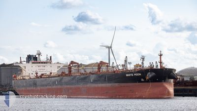
WHITE MOON
Crude Oil Tanker

Current Trip
FOR ORDERS
| Time Travelled | --- |
|---|---|
| Remaining Time | --- |
| Distance Travelled | 4864.50 nm |
| Remaining Distance | --- |
| AVG Speed | 10.9 Knots |
| MAX Speed | 14.3 Knots |
| AVG Wind | 9.4 knots |
| MAX Wind | 26.8 knots |
| MIN Temp | 21.1°C / 69.98°F |
| MAX Temp | 30.7°C / 87.26°F |
| Dybgang | 9.2 m |
| Position Modtaget | 2024-12-17 11:07 |
Current Position
| Longitude | --- |
|---|---|
| Latitude | --- |
| Status | Under way using engine |
| Fart | 1.9 Knots |
| Kurs | 314° |
| Område | North Atlantic Ocean |
| Station | T-AIS |
| Position Modtaget | 2024-12-17 11:07 |
Information
The current position of WHITE MOON is in North Atlantic Ocean with coordinates 17.60735° / -21.61019° as reported on 2024-12-17 11:07 by AIS to our vessel tracker app. The vessel's current speed is 1.9 Knots
The vessel WHITE MOON (IMO: 9588158, MMSI: 636016128) is a Crude Oil Tanker that was built in 2012 ( 13 år gamle ). It's sailing under the flag of [LR] Liberia.
In this page you can find informations about the vessels current position, last detected port calls, and current voyage information. If the vessels is not in coverage by AIS you will find the latest position.
The current position of WHITE MOON is detected by our AIS receivers and we are not responsible for the reliability of the data. The last position was recorded while the vessel was in Coverage by the Ais receivers of our vessel tracking app.
The current draught of WHITE MOON as reported by AIS is 9.2 meters
Weather
| Temperature | 1.2°C / 34.16°F |
|---|---|
| Wind Speed | 15 knots |
| Direction | 285° WNW |
| Pressure | 1004.3 hPa |
| Humidity | 56.8 % |
| Cloud Coverage | 95 % |


Featured Company
Last Port Calls
Most Visited Ports (Last year)
| Port | Arrivals | |
|---|---|---|
| 1 | ||
| 1 | ||
| 1 | ||
| 1 | ||
| 1 |
Last Trips
| Origin | Departure | Destination | Arrival | Distance |
|---|
Events
| Tid | Hændelsen | Detaljer | Position / Dest | Info |
|---|---|---|---|---|
| 2025-03-09 17:07 | STOP Sejllads | 14.05 nm, South of CANAPORT LNG |
44.97408 / -65.93386
FOR ORDERS
|
Fart: 0.1 kn Kurs: 343° |
| 2025-03-07 20:40 | START Sejllads | 7.96 nm, East of CANAPORT LNG |
45.17799 / -65.79472
FOR ORDERS
|
Fart: 3.2 kn Kurs: 231° |
| 2025-03-07 16:40 | STOP Sejllads | 5.65 nm, South of CANAPORT LNG |
45.11232 / -65.96500
FOR ORDERS
|
Fart: 0.2 kn Kurs: 265° |
| 2025-03-07 15:48 | START Sejllads | 3.14 nm, South of CANAPORT LNG |
45.15755 / -66.00610
FOR ORDERS
|
Fart: 3.2 kn Kurs: 131° |
| 2025-03-06 00:35 | STOP Sejllads | 3.61 nm, South West of CANAPORT LNG |
45.15438 / -66.02158
FOR ORDERS
|
Fart: 0.3 kn Kurs: 95° |
| 2025-03-05 23:16 | START Sejllads | 1.35 nm, South West of CANAPORT LNG |
45.19244 / -66.00344
FOR ORDERS
|
Fart: 3.6 kn Kurs: 228° |
| 2025-03-05 14:39 | STOP Sejllads | 0.61 nm, South West of CANAPORT LNG |
45.19690 / -65.98433
FOR ORDERS
|
Fart: 0.2 kn Kurs: 276° |