

WAN HAI 288
Cargo

Current Trip
| Time Travelled | 2 days |
|---|---|
| Remaining Time | --- |
| Distance Travelled | 786.70 nm |
| Remaining Distance | 0.86 nm |
| AVG Speed | 16.5 Noeuds |
| MAX Speed | 19 Noeuds |
| AVG Wind | 8.7 knots |
| MAX Wind | 14 knots |
| MIN Temp | 23.2°C / 73.76°F |
| MAX Temp | 25.6°C / 78.08°F |
| Tirant d eau | 10.5 m |
| Position reçue | 2 d depuis |
Current Position
| Longitude | --- |
|---|---|
| Latitude | --- |
| Etat | Under way using engine |
| Vitesse | 17.8 Noeuds |
| Parcours | 229.9° |
| Zone | South China Sea |
| Station | T-AIS |
| Position reçue | 2 d depuis |
Information
The current position of WAN HAI 288 is in South China Sea with coordinates 22.52392° / 120.20557° as reported on 2025-03-27 18:05 by AIS to our vessel tracker app. The vessel's current speed is 17.8 Noeuds and is heading at the port of DA NANG. The estimated time of arrival as calculated by MyShipTracking vessel tracking app is 2025-03-27 23:30 LT
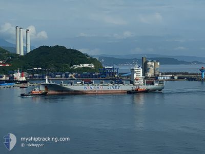
The vessel WAN HAI 288 (IMO: 9871359, MMSI: 563134400) is a Cargo It's sailing under the flag of [SG] Singapore.
In this page you can find informations about the vessels current position, last detected port calls, and current voyage information. If the vessels is not in coverage by AIS you will find the latest position.
The current position of WAN HAI 288 is detected by our AIS receivers and we are not responsible for the reliability of the data. The last position was recorded while the vessel was in Coverage by the Ais receivers of our vessel tracking app.
The current draught of WAN HAI 288 as reported by AIS is 10.5 meters
Weather
| Temperature | 23.4°C / 74.12°F |
|---|---|
| Wind Speed | 3 knots |
| Direction | 111° ESE |
| Pressure | 1013 hPa |
| Humidity | 93.7 % |
| Cloud Coverage | 98 % |


Featured Company
Last Port Calls
| Port | Arrival | Departure | Time In Port |
|---|---|---|---|
| 2025-03-27 13:02 | 2025-03-28 01:50 | 12 h | |
| 2025-03-26 07:06 | 2025-03-26 19:26 | 12 h | |
| 2025-03-23 14:20 | 2025-03-24 08:18 | 17 h | |
| 2025-03-20 18:23 | 2025-03-21 10:59 | 16 h | |
| 2025-03-20 08:43 | 2025-03-20 17:16 | 8 h | |
| 2025-03-17 07:27 | 2025-03-17 19:55 | 12 h | |
| 2025-03-16 01:25 | 2025-03-16 16:10 | 14 h | |
| 2025-03-06 04:41 | 2025-03-06 19:13 | 14 h | |
| 2025-03-04 18:45 | 2025-03-05 11:37 | 16 h | |
| 2025-03-02 13:01 | 2025-03-03 02:13 | 13 h |
Last Trips
| Origin | Departure | Destination | Arrival | Distance | |
|---|---|---|---|---|---|
| 2025-03-26 19:26 | 2025-03-27 13:02 | 243.99 nm | |||
| 2025-03-24 08:18 | 2025-03-26 07:06 | 713.19 nm | |||
| 2025-03-21 10:59 | 2025-03-23 14:20 | 508.54 nm | |||
| 2025-03-20 17:16 | 2025-03-20 18:23 | 8.42 nm | |||
| 2025-03-17 19:55 | 2025-03-20 08:43 | 953.87 nm | |||
| 2025-03-16 16:10 | 2025-03-17 07:27 | 202.69 nm | |||
| 2025-03-06 19:13 | 2025-03-16 01:25 | 2449.09 nm | |||
| 2025-03-05 11:37 | 2025-03-06 04:41 | 247.57 nm | |||
| 2025-03-03 02:13 | 2025-03-04 18:45 | 713.53 nm | |||
| 2025-03-01 17:31 | 2025-03-02 13:01 | 70.65 nm |
Events
| Heure | Evenement | Détails | Position/ Destination | Info |
|---|---|---|---|---|
| 2025-03-29 18:18 | Arret | 1.43 nm, North of DA NANG |
16.12119 / 108.21082
VNDAD
|
Vitesse: 0.3 kn Parcours: 145° |
| 2025-03-29 16:21 | Démarrage | 9.91 nm, North East of DA NANG |
16.24817 / 108.29338
VNDAD
|
Vitesse: 4.1 kn Parcours: 235° |
| 2025-03-29 14:46 | Arret | 10.89 nm, North East of DA NANG |
16.26527 / 108.29548
VNDAD
|
Vitesse: 0.2 kn Parcours: 17° |
| 2025-03-27 18:06 | Etat Changé | Default Under way using engine |
22.52231 / 120.20349
VNDAD
|
Vitesse: 17.8 kn Parcours: 229.9° |
| 2025-03-27 18:05 | Etat Changé | Under way using engine Default |
22.52392 / 120.20557
VNDAD
|
Vitesse: 16.7 kn Parcours: 227° |
| 2025-03-27 18:05 | Hors de la zone couverte |
22.52392 / 120.20557
South China Sea
VNDAD
|
Vitesse: 17.8 kn Parcours: 229.9° |
|
| 2025-03-27 18:02 | Dans la zone couverte |
22.52392 / 120.20557
South China Sea
VNDAD
|
Vitesse: 17.8 kn Parcours: 229.9° |
|
| 2025-03-27 17:50 | PORT DE DEPART |
|
22.54716 / 120.27125
VNDAD
|
Vitesse: 13.1 kn Parcours: 265° |
| 2025-03-27 17:18 | Démarrage |
22.57523 / 120.30486
[TW] KAOHSIUNG
|
Vitesse: 4.6 kn Parcours: 145° |
|
| 2025-03-27 16:52 | Hors de la zone couverte |
22.57839 / 120.30348
South China Sea
VNDAD
|
Vitesse: 0.1 kn Parcours: 120.8° |