
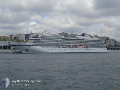
VIKING SKY
Passenger
Current Trip
| Time Travelled | 11 h, 4 mins |
|---|---|
| Remaining Time | 1 day |
| Distance Travelled | 133.46 nm |
| Remaining Distance | 333.72 nm |
| AVG Speed | 12.1 Noeuds |
| MAX Speed | 13.4 Noeuds |
| AVG Wind | 16.6 knots |
| MAX Wind | 23.4 knots |
| MIN Temp | 12.4°C / 54.32°F |
| MAX Temp | 14.8°C / 58.64°F |
| Tirant d eau | 6.6 m |
| Position reçue | 7 h, 45 m depuis |
Current Position
| Longitude | --- |
|---|---|
| Latitude | --- |
| Etat | Under way using engine |
| Vitesse | 13.1 Noeuds |
| Parcours | 276.8° |
| Zone | Aegean Sea |
| Station | T-AIS |
| Position reçue | 7 h, 45 m depuis |
Info
Information
The current position of VIKING SKY is in Aegean Sea with coordinates 35.74633° / 23.64884° as reported on 2024-11-24 18:38 by AIS to our vessel tracker app. The vessel's current speed is 13.1 Noeuds and is heading at the port of MESSINA. The estimated time of arrival as calculated by MyShipTracking vessel tracking app is 2024-11-26 03:27 LT
The vessel VIKING SKY (IMO: 9650420, MMSI: 259186000) is a Passenger It's sailing under the flag of [NO] Norway.
In this page you can find informations about the vessels current position, last detected port calls, and current voyage information. If the vessels is not in coverage by AIS you will find the latest position.
The current position of VIKING SKY is detected by our AIS receivers and we are not responsible for the reliability of the data. The last position was recorded while the vessel was in Coverage by the Ais receivers of our vessel tracking app.
The current draught of VIKING SKY as reported by AIS is 6.6 meters
Weather
| Temperature | 14.8°C / 58.64°F |
|---|---|
| Wind Speed | 5 knots |
| Direction | 286° WNW |
| Pressure | 1029.4 hPa |
| Humidity | 48.5 % |
| Cloud Coverage | 4 % |
Featured Company
Last Port Calls
| Port | Arrival | Departure | Time In Port |
|---|---|---|---|
| 2024-11-24 05:02 | 2024-11-24 15:20 | 10 h | |
| 2024-11-23 03:59 | 2024-11-23 14:07 | 10 h | |
| 2024-11-20 04:36 | 2024-11-22 16:36 | 2 d | |
| 2024-11-19 04:57 | 2024-11-19 15:32 | 10 h | |
| 2024-11-18 05:19 | 2024-11-18 15:30 | 10 h | |
| 2024-11-17 04:35 | 2024-11-17 15:03 | 10 h | |
| 2024-11-13 03:06 | 2024-11-15 17:19 | 2 d | |
| 2024-11-11 03:27 | 2024-11-11 14:31 | 11 h | |
| 2024-11-10 04:27 | 2024-11-10 15:22 | 10 h | |
| 2024-11-09 04:56 | 2024-11-09 15:33 | 10 h |
Last Trips
| Origin | Departure | Destination | Arrival | Distance | |
|---|---|---|---|---|---|
| 2024-11-23 17:07 | 2024-11-24 07:02 | 215.04 nm | |||
| 2024-11-22 18:36 | 2024-11-23 06:59 | 192.12 nm | |||
| 2024-11-19 17:32 | 2024-11-20 06:36 | 177.86 nm | |||
| 2024-11-18 17:30 | 2024-11-19 06:57 | 169.28 nm | |||
| 2024-11-17 18:03 | 2024-11-18 07:19 | 183.78 nm | |||
| 2024-11-15 20:19 | 2024-11-17 07:35 | 345.22 nm | |||
| 2024-11-11 17:31 | 2024-11-13 06:06 | 344.63 nm | |||
| 2024-11-10 17:22 | 2024-11-11 06:27 | 182.23 nm | |||
| 2024-11-09 17:33 | 2024-11-10 06:27 | 167.18 nm | |||
| 2024-11-08 18:07 | 2024-11-09 06:56 | 177.19 nm |
Events
| Heure | Evenement | Détails | Position/ Destination | Info |
|---|---|---|---|---|
| 2024-11-24 18:42 | Etat Changé | Default Under way using engine |
35.74753 / 23.63059
MESSINA, ITALY
|
Vitesse: 13.1 kn Parcours: 276.8° |
| 2024-11-24 18:38 | Hors de la zone couverte |
35.74633 / 23.64884
Aegean Sea
MESSINA, ITALY
|
Vitesse: 13.1 kn Parcours: 276.8° |
|
| 2024-11-24 15:20 | PORT DE DEPART |
|
35.48721 / 24.11785
MESSINA, ITALY
|
Vitesse: 11.4 kn Parcours: 101° |
| 2024-11-24 15:04 | Démarrage |
35.49363 / 24.07402
[GR] SOUDA
|
Vitesse: 3.1 kn Parcours: 68° |
|
| 2024-11-24 14:51 | Etat Changé | Under way using engine Moored |
35.49160 / 24.07254
[GR] SOUDA
|
Vitesse: Parcours: 106° |
| 2024-11-24 13:56 | Changement de destination | MESSINA, ITALY SOUDA BAY, GREECE |
35.49160 / 24.07253
[GR] SOUDA
|
Vitesse: Parcours: 106° |
| 2024-11-24 13:56 | Changement d'ETA | 2024/11/26 05:00 2024/11/24 05:00 |
35.49160 / 24.07253
[GR] SOUDA
|
Vitesse: Parcours: 106° |
| 2024-11-24 05:51 | Etat Changé | Moored Under way using engine |
35.49159 / 24.07253
[GR] SOUDA
|
Vitesse: 0.1 kn Parcours: 105° |
| 2024-11-24 05:39 | Arret |
35.49188 / 24.07291
[GR] SOUDA
|
Vitesse: 0.3 kn Parcours: 102° |
|
| 2024-11-24 05:02 | Port d'arrivée |
|
35.48765 / 24.11485
[GR] SOUDA
|
Vitesse: 4.9 kn Parcours: 293° |