
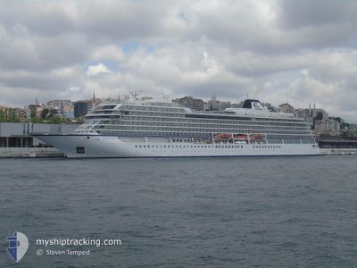
VIKING SKY
Passenger
Current Trip
| Time Travelled | 10 h, 27 mins |
|---|---|
| Remaining Time | --- |
| Distance Travelled | 142.93 nm |
| Remaining Distance | --- |
| AVG Speed | 14 Knots |
| MAX Speed | 15.3 Knots |
| AVG Wind | 17.4 knots |
| MAX Wind | 20 knots |
| MIN Temp | 22°C / 71.6°F |
| MAX Temp | 26.6°C / 79.88°F |
| Draught | 6.7 m |
| Position Received | Now |
Current Position
| Longitude | -17.69286° |
|---|---|
| Latitude | 16.79426° |
| Status | Under way using engine |
| Speed | 13.3 Knots |
| Course | 356.7° |
| Area | North Atlantic Ocean |
| Station | T-AIS |
| Position Received | Now |
Info
Information
The current position of VIKING SKY is in North Atlantic Ocean with coordinates 16.79426° / -17.69286° as reported on 2024-04-20 04:09 by AIS to our vessel tracker app. The vessel's current speed is 13.3 Knots and is heading at the port of WALVIS BAY. The estimated time of arrival as calculated by MyShipTracking vessel tracking app is 2024-04-11 03:00 LT
The vessel VIKING SKY (IMO: 9650420, MMSI: 259186000) is a Passenger It's sailing under the flag of [NO] Norway.
In this page you can find informations about the vessels current position, last detected port calls, and current voyage information. If the vessels is not in coverage by AIS you will find the latest position.
The current position of VIKING SKY is detected by our AIS receivers and we are not responsible for the reliability of the data. The last position was recorded while the vessel was in Coverage by the Ais receivers of our vessel tracking app.
The current draught of VIKING SKY as reported by AIS is 6.7 meters
Weather
| Temperature | 22°C / 71.6°F |
|---|---|
| Wind Speed | 19 knots |
| Direction | 353° N |
| Pressure | 1010.1 hPa |
| Humidity | 80 % |
| Cloud Coverage | 100 % |
Featured Company
Last Port Calls
| Port | Arrival | Departure | Time In Port |
|---|---|---|---|
| 2024-04-19 07:41 | 2024-04-19 17:42 | 10 h | |
| 2024-04-11 03:17 | 2024-04-11 15:40 | 12 h | |
| 2024-04-08 09:21 | 2024-04-09 11:20 | 1 d | |
| 2024-04-06 05:00 | 2024-04-06 17:16 | 12 h | |
| 2024-04-04 05:00 | 2024-04-04 17:19 | 12 h | |
| 2024-03-31 03:43 | 2024-03-31 13:58 | 10 h | |
| 2024-03-30 03:59 | 2024-03-30 14:42 | 10 h | |
| 2024-03-24 00:25 | 2024-03-24 12:43 | 12 h | |
| 2024-03-21 07:48 | 2024-03-22 13:12 | 1 d | |
| 2024-03-14 21:34 | 2024-03-15 10:07 | 12 h |
Last Trips
| Origin | Departure | Destination | Arrival | Distance | |
|---|---|---|---|---|---|
| 2024-04-11 17:40 | 2024-04-19 07:41 | 3128.72 nm | |||
| 2024-04-09 13:20 | 2024-04-11 05:17 | 719.60 nm | |||
| 2024-04-06 19:16 | 2024-04-08 11:21 | 459.60 nm | |||
| 2024-04-04 19:19 | 2024-04-06 07:00 | 475.67 nm | |||
| 2024-03-31 17:58 | 2024-04-04 07:00 | 1360.32 nm | |||
| 2024-03-30 18:42 | 2024-03-31 07:43 | 132.56 nm | |||
| 2024-03-24 18:13 | 2024-03-30 07:59 | 2152.15 nm | |||
| 2024-03-22 18:42 | 2024-03-24 05:55 | 327.45 nm | |||
| 2024-03-15 18:07 | 2024-03-21 13:18 | 1520.89 nm | |||
| 2024-03-13 23:32 | 2024-03-15 05:34 | 202.02 nm |
Events
| Time | Event | Details | Position / Dest | Info |
|---|---|---|---|---|
| 2024-04-20 03:56 | Status Changed | Under way using engine Default |
16.74669 / -17.68861
WALVIS BAY
|
Speed: 13 kn Course: 355° |
| 2024-04-20 03:53 | Status Changed | Default Under way using engine |
16.73500 / -17.68833
WALVIS BAY
|
Speed: 13.2 kn Course: 357.4° |
| 2024-04-20 01:20 | Status Changed | Under way using engine Default |
16.16252 / -17.67847
WALVIS BAY
|
Speed: 13.8 kn Course: 359° |
| 2024-04-20 01:13 | Status Changed | Default Under way using engine |
16.13813 / -17.67837
WALVIS BAY
|
Speed: 13.6 kn Course: 357.8° |
| 2024-04-20 01:07 | Change Sea Area | Mauritanian part of the North Atlantic Ocean Senegalese part of the North Atlantic Ocean |
16.11444 / -17.67812
North Atlantic Ocean
|
Speed: 13.6 kn Course: 0.6° |
| 2024-04-20 01:05 | Status Changed | Under way using engine Default |
16.10685 / -17.67772
WALVIS BAY
|
Speed: 13.8 kn Course: 343° |
| 2024-04-20 00:34 | Status Changed | Default Under way using engine |
15.98889 / -17.65315
WALVIS BAY
|
Speed: 13.9 kn Course: 358.3° |
| 2024-04-20 00:24 | Status Changed | Under way using engine Default |
15.95270 / -17.65117
WALVIS BAY
|
Speed: 14.2 kn Course: 356° |
| 2024-04-20 00:20 | Status Changed | Default Under way using engine |
15.93827 / -17.65033
WALVIS BAY
|
Speed: 14 kn Course: 355.9° |
| 2024-04-20 00:15 | Status Changed | Under way using engine Default |
15.91794 / -17.64924
WALVIS BAY
|
Speed: 14 kn Course: 358° |