
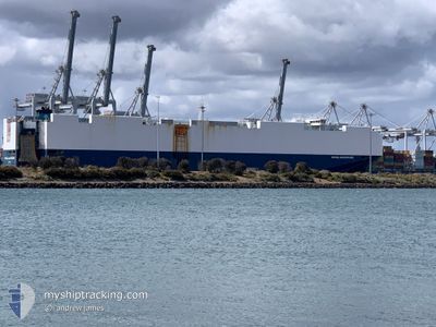
VIKING ADVENTURE
Cargo
Current Trip
| Time Travelled | 7 days |
|---|---|
| Remaining Time | --- |
| Distance Travelled | 2876.93 nm |
| Remaining Distance | --- |
| AVG Speed | 15.4 Noeuds |
| MAX Speed | 18.8 Noeuds |
| AVG Wind | 16.9 knots |
| MAX Wind | 32.3 knots |
| MIN Temp | -0.3°C / 31.46°F |
| MAX Temp | 13°C / 55.4°F |
| Tirant d eau | 8.2 m |
| Position reçue | 7 d depuis |
Current Position
| Longitude | --- |
|---|---|
| Latitude | --- |
| Etat | Under way using engine |
| Vitesse | 9.7 Noeuds |
| Parcours | 121.5° |
| Zone | North Atlantic Ocean |
| Station | T-AIS |
| Position reçue | 7 d depuis |
Info
Information
The current position of VIKING ADVENTURE is in North Atlantic Ocean with coordinates 36.81156° / -75.77787° as reported on 2025-03-08 05:04 by AIS to our vessel tracker app. The vessel's current speed is 9.7 Noeuds and is heading at the port of PORTBURY. The estimated time of arrival as calculated by MyShipTracking vessel tracking app is 2025-03-16 08:00 LT
The vessel VIKING ADVENTURE (IMO: 9673018, MMSI: 538009728) is a Cargo It's sailing under the flag of [MH] Marshall Is.
In this page you can find informations about the vessels current position, last detected port calls, and current voyage information. If the vessels is not in coverage by AIS you will find the latest position.
The current position of VIKING ADVENTURE is detected by our AIS receivers and we are not responsible for the reliability of the data. The last position was recorded while the vessel was in Coverage by the Ais receivers of our vessel tracking app.
The current draught of VIKING ADVENTURE as reported by AIS is 8.2 meters
Weather
| Temperature | 10.1°C / 50.18°F |
|---|---|
| Wind Speed | 11 knots |
| Direction | 110° ESE |
| Pressure | 1025.2 hPa |
| Humidity | 59.1 % |
| Cloud Coverage | 100 % |
Featured Company
Last Port Calls
| Port | Arrival | Departure | Time In Port |
|---|---|---|---|
| 2025-03-07 05:18 | 2025-03-07 13:27 | 8 h | |
| 2025-03-06 11:18 | 2025-03-07 05:01 | 17 h | |
| 2025-02-19 14:15 | 2025-02-20 10:35 | 20 h | |
| 2025-02-03 06:56 | 2025-02-03 13:34 | 6 h | |
| 2025-02-02 06:29 | 2025-02-02 17:08 | 10 h | |
| 2025-01-31 07:21 | 2025-01-31 17:57 | 10 h | |
| 2025-01-30 01:29 | 2025-01-31 00:09 | 22 h | |
| 2025-01-29 07:17 | 2025-01-29 15:22 | 8 h | |
| 2025-01-26 07:28 | 2025-01-26 17:33 | 10 h | |
| 2025-01-21 13:00 | 2025-01-24 16:04 | 3 d |
Last Trips
| Origin | Departure | Destination | Arrival | Distance | |
|---|---|---|---|---|---|
| 2025-03-07 05:01 | 2025-03-07 05:18 | 0.83 nm | |||
| 2025-02-20 10:35 | 2025-03-06 11:18 | 3896.09 nm | |||
| 2025-02-03 13:34 | 2025-02-19 14:15 | 6216.84 nm | |||
| 2025-02-02 17:08 | 2025-02-03 06:56 | 207.29 nm | |||
| 2025-01-31 17:57 | 2025-02-02 06:29 | 412.22 nm | |||
| 2025-01-31 00:09 | 2025-01-31 07:21 | 89.86 nm | |||
| 2025-01-29 15:22 | 2025-01-30 01:29 | 153.96 nm | |||
| 2025-01-26 17:33 | 2025-01-29 07:17 | 401.76 nm | |||
| 2025-01-24 16:04 | 2025-01-26 07:28 | 357.17 nm | |||
| 2025-01-20 11:13 | 2025-01-21 13:00 | 250.21 nm |
Events
| Heure | Evenement | Détails | Position/ Destination | Info |
|---|---|---|---|---|
| 2025-03-08 05:12 | Etat Changé | Default Under way using engine |
36.80485 / -75.75275
GBBRS
|
Vitesse: 9.7 kn Parcours: 121.5° |
| 2025-03-08 05:04 | Hors de la zone couverte |
36.81156 / -75.77787
North Atlantic Ocean
GBBRS
|
Vitesse: 9.7 kn Parcours: 121.5° |
|
| 2025-03-08 02:18 | Etat Changé | Under way using engine Default |
37.29006 / -76.11421
GBBRS
|
Vitesse: 18.2 kn Parcours: 198° |
| 2025-03-08 02:08 | Dans la zone couverte |
37.28628 / -76.11579
North Atlantic Ocean
GBBRS
|
Vitesse: 17.8 kn Parcours: 198.4° |
|
| 2025-03-08 00:28 | Etat Changé | Default Under way using engine |
37.77716 / -76.17905
GBBRS
|
Vitesse: 17 kn Parcours: 149° |
| 2025-03-07 23:54 | Hors de la zone couverte |
37.93526 / -76.18666
North Atlantic Ocean
GBBRS
|
Vitesse: 17 kn Parcours: 149° |
|
| 2025-03-07 23:51 | Etat Changé | Under way using engine Default |
37.95222 / -76.19640
GBBRS
|
Vitesse: 17 kn Parcours: 170° |
| 2025-03-07 23:46 | Etat Changé | Default Under way using engine |
37.96927 / -76.20376
GBBRS
|
Vitesse: 17.2 kn Parcours: 169.8° |
| 2025-03-07 23:30 | Etat Changé | Under way using engine Default |
38.04275 / -76.21997
GBBRS
|
Vitesse: 17.1 kn Parcours: 180° |
| 2025-03-07 23:24 | Etat Changé | Default Under way using engine |
38.07451 / -76.22078
GBBRS
|
Vitesse: 17.1 kn Parcours: 177.7° |