
VERITY
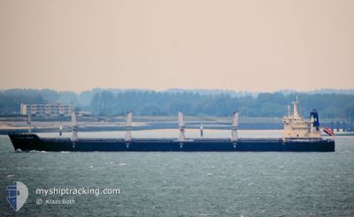
Bulk Carrier
Current Trip
| Time Travelled | 21 days |
|---|---|
| Remaining Time | 5 days |
| Distance Travelled | 2450.26 nm |
| Remaining Distance | 1701.69 nm |
| AVG Speed | 10.9 Noeuds |
| MAX Speed | 13.4 Noeuds |
| AVG Wind | 12.4 knots |
| MAX Wind | 26 knots |
| MIN Temp | 14.4°C / 57.92°F |
| MAX Temp | 31.4°C / 88.52°F |
| Tirant d eau | 8.7 m |
| Position reçue | 3 d depuis |
Current Position
| Longitude | --- |
|---|---|
| Latitude | --- |
| Etat | Under way using engine |
| Vitesse | 10.2 Noeuds |
| Parcours | 270.8° |
| Zone | Indian Ocean |
| Station | T-AIS |
| Position reçue | 3 d depuis |
Info
Information
The current position of VERITY is in Indian Ocean with coordinates -35.49259° / 117.47504° as reported on 2025-01-22 06:10 by AIS to our vessel tracker app. The vessel's current speed is 10.2 Noeuds and is heading at the port of SINGAPORE. The estimated time of arrival as calculated by MyShipTracking vessel tracking app is 2025-01-31 09:29 LT
The vessel VERITY (IMO: 9577604, MMSI: 538004179) is a Bulk Carrier that was built in 2012 ( 13 Age ). It's sailing under the flag of [MH] Marshall Is.
In this page you can find informations about the vessels current position, last detected port calls, and current voyage information. If the vessels is not in coverage by AIS you will find the latest position.
The current position of VERITY is detected by our AIS receivers and we are not responsible for the reliability of the data. The last position was recorded while the vessel was in Coverage by the Ais receivers of our vessel tracking app.
The current draught of VERITY as reported by AIS is 8.7 meters
Weather
| Temperature | 24.6°C / 76.28°F |
|---|---|
| Wind Speed | 18 knots |
| Direction | 171° S |
| Pressure | 1011.6 hPa |
| Humidity | 81 % |
| Cloud Coverage | 56 % |
Featured Company
Last Port Calls
| Port | Arrival | Departure | Time In Port |
|---|---|---|---|
| 2024-12-28 02:36 | 2025-01-04 11:20 | 7 d | |
| 2024-11-16 11:36 | 2024-11-25 09:48 | 8 d | |
| 2024-11-11 09:08 | 2024-11-15 11:28 | 4 d |
Most Visited Ports (Last year)
| Port | Arrivals | |
|---|---|---|
| 2 | ||
| 2 | ||
| 2 | ||
| 1 | ||
| 1 | ||
| 1 |
Last Trips
| Origin | Departure | Destination | Arrival | Distance | |
|---|---|---|---|---|---|
| 2024-11-25 17:48 | 2024-12-28 13:36 | 5651.69 nm | |||
| 2024-11-15 19:28 | 2024-11-16 19:36 | 35.94 nm | |||
| 2024-09-30 05:09 | 2024-11-11 17:08 | 11116.77 nm |
Events
| Heure | Evenement | Détails | Position/ Destination | Info |
|---|---|---|---|---|
| 2025-01-22 06:16 | Etat Changé | Default Under way using engine |
-35.49195 / 117.45247
SINGAPORE
|
Vitesse: 10.2 kn Parcours: 270.8° |
| 2025-01-22 06:10 | Hors de la zone couverte |
-35.49259 / 117.47504
Indian Ocean
SINGAPORE
|
Vitesse: 10.2 kn Parcours: 270.8° |
|
| 2025-01-22 06:05 | Detecté en mer | Australian part of the Indian Ocean |
-35.49285 / 117.49177
Indian Ocean
SINGAPORE
|
Vitesse: 10.6 kn Parcours: 271° |
| 2025-01-22 06:04 | Dans la zone couverte |
-35.49285 / 117.49177
Indian Ocean
SINGAPORE
|
Vitesse: 10.6 kn Parcours: 271° |
|
| 2025-01-22 06:03 | Etat Changé | Under way using engine Default |
-35.49296 / 117.49898
SINGAPORE
|
Vitesse: 10.5 kn Parcours: 271° |
| 2025-01-21 18:56 | Etat Changé | Default Under way using engine |
-35.45016 / 120.02020
SINGAPORE
|
Vitesse: 11.1 kn Parcours: 269° |
| 2025-01-21 18:50 | Hors de la zone couverte |
-35.44971 / 120.04282
Great Australian Bight
SINGAPORE
|
Vitesse: 11.1 kn Parcours: 269° |
|
| 2025-01-21 18:46 | Etat Changé | Under way using engine Default |
-35.44933 / 120.05930
SINGAPORE
|
Vitesse: 11.2 kn Parcours: 268° |
| 2025-01-21 18:32 | Dans la zone couverte |
-35.44933 / 120.05930
Great Australian Bight
SINGAPORE
|
Vitesse: 11 kn Parcours: 267.9° |
|
| 2025-01-21 17:19 | Hors de la zone couverte |
-35.43750 / 120.39642
Great Australian Bight
SINGAPORE
|
Vitesse: 11.5 kn Parcours: 268.9° |