
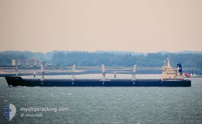
VERITY
Bulk Carrier
Current Trip
PANAMA
| Time Travelled | 3 days |
|---|---|
| Remaining Time | --- |
| Distance Travelled | 772.16 nm |
| Remaining Distance | --- |
| AVG Speed | 11.9 Knots |
| MAX Speed | 13 Knots |
| AVG Wind | 11.9 knots |
| MAX Wind | 18 knots |
| MIN Temp | 15°C / 59°F |
| MAX Temp | 25.8°C / 78.44°F |
| Dybgang | 11.1 m |
| Position Modtaget | 6 d siden |
Current Position
| Longitude | -79.45109° |
|---|---|
| Latitude | 8.54258° |
| Status | Under way using engine |
| Fart | 13 Knots |
| Kurs | 179° |
| Område | North Pacific Ocean |
| Station | T-AIS |
| Position Modtaget | 6 d siden |
Info
Information
The current position of VERITY is in North Pacific Ocean with coordinates 8.54258° / -79.45109° as reported on 2024-08-31 23:50 by AIS to our vessel tracker app. The vessel's current speed is 13 Knots
The vessel VERITY (IMO: 9577604, MMSI: 538004179) is a Bulk Carrier that was built in 2012 ( 12 år gamle ). It's sailing under the flag of [MH] Marshall Is.
In this page you can find informations about the vessels current position, last detected port calls, and current voyage information. If the vessels is not in coverage by AIS you will find the latest position.
The current position of VERITY is detected by our AIS receivers and we are not responsible for the reliability of the data. The last position was recorded while the vessel was in Coverage by the Ais receivers of our vessel tracking app.
The current draught of VERITY as reported by AIS is 11.1 meters
Weather
| Temperature | 15.7°C / 60.26°F |
|---|---|
| Wind Speed | 9 knots |
| Direction | 170° S |
| Pressure | 1012.1 hPa |
| Humidity | 85.3 % |
| Cloud Coverage | 11 % |
Featured Company
Last Port Calls
| Port | Arrival | Departure | Time In Port |
|---|---|---|---|
| 2024-09-02 18:09 | 2024-09-04 13:13 | 1 d | |
| 2024-08-18 02:43 | 2024-08-20 19:30 | 2 d | |
| 2024-08-07 12:21 | 2024-08-13 00:01 | 5 d | |
| 2024-07-30 15:44 | 2024-08-02 05:31 | 2 d | |
| 2024-07-06 03:38 | 2024-07-10 09:23 | 4 d |
Most Visited Ports (Last year)
| Port | Arrivals | |
|---|---|---|
| 3 | ||
| 2 | ||
| 2 | ||
| 2 | ||
| 1 | ||
| 1 |
Last Trips
| Origin | Departure | Destination | Arrival | Distance | |
|---|---|---|---|---|---|
| 2024-08-20 19:30 | 2024-09-02 18:09 | 2149.94 nm | |||
| 2024-08-13 00:01 | 2024-08-18 02:43 | 417.26 nm | |||
| 2024-08-02 05:31 | 2024-08-07 12:21 | 418.74 nm | |||
| 2024-07-10 09:23 | 2024-07-30 15:44 | 5632.70 nm | |||
| 2024-06-28 08:50 | 2024-07-06 03:38 | 259.13 nm |
Events
| Tid | Hændelsen | Detaljer | Position / Dest | Info |
|---|---|---|---|---|
| 2024-09-07 11:10 | STOP Sejllads | 3.52 nm, North West of CALLAO |
-12.02084 / -77.20343
PANAMA
|
Fart: 0.3 kn Kurs: 136° |
| 2024-09-04 18:19 | START Sejllads | 1.03 nm, North of MANTA |
-.92237 / -80.71735
PANAMA
|
Fart: 4.2 kn Kurs: 351° |
| 2024-09-04 18:13 | Afsejlet fra sidste havn |
|
-.92792 / -80.71722
PANAMA
|
Fart: 1 kn Kurs: 329° |
| 2024-09-02 23:09 | Skibe i havn |
|
-.93217 / -80.71909
[EC] MANTA
|
Fart: 0.6 kn Kurs: 255° |
| 2024-09-02 22:43 | STOP Sejllads | 0.63 nm, North East of MANTA |
-.92964 / -80.71731
PANAMA
|
Fart: 0.3 kn Kurs: 221° |
| 2024-09-02 22:25 | START Sejllads | 1.72 nm, North of MANTA |
-.91015 / -80.72173
PANAMA
|
Fart: 4.5 kn Kurs: 162° |
| 2024-09-02 22:00 | STOP Sejllads | 2.36 nm, North of MANTA |
-.89955 / -80.72505
PANAMA
|
Fart: 0.3 kn Kurs: 241° |
| 2024-08-31 23:57 | Status er ændret | Default Under way using engine |
8.51636 / -79.45094
PANAMA
|
Fart: 13 kn Kurs: 179° |
| 2024-08-31 23:50 | Udenfor Dækning |
8.54258 / -79.45109
North Pacific Ocean
|
Fart: 13 kn Kurs: 179° |
|
| 2024-08-31 23:44 | Status er ændret | Under way using engine Default |
8.56810 / -79.45121
PANAMA
|
Fart: 13.1 kn Kurs: 179° |