
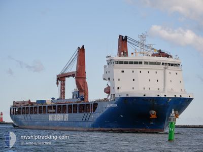
UHL FREEDOM
Cargo
Current Trip
| Time Travelled | 21 days |
|---|---|
| Remaining Time | --- |
| Distance Travelled | 5232.93 nm |
| Remaining Distance | --- |
| AVG Speed | 13 Noeuds |
| MAX Speed | 18.6 Noeuds |
| AVG Wind | 18.3 knots |
| MAX Wind | 33.2 knots |
| MIN Temp | 4.6°C / 40.28°F |
| MAX Temp | 28°C / 82.4°F |
| Tirant d eau | 7 m |
| Position reçue | 1 d depuis |
Current Position
| Longitude | --- |
|---|---|
| Latitude | --- |
| Etat | Under way using engine |
| Vitesse | 14.2 Noeuds |
| Parcours | 308.4° |
| Zone | Malacca Strait |
| Station | T-AIS |
| Position reçue | 1 d depuis |
Info
Information
The current position of UHL FREEDOM is in Malacca Strait with coordinates 2.16576° / 101.98559° as reported on 2026-01-07 13:06 by AIS to our vessel tracker app. The vessel's current speed is 14.2 Noeuds and is heading at the port of LAS PALMAS. The estimated time of arrival as calculated by MyShipTracking vessel tracking app is 2026-02-05 08:00 LT
The vessel UHL FREEDOM (IMO: 9897121, MMSI: 255806351) is a Cargo It's sailing under the flag of [PT] Portugal.
In this page you can find informations about the vessels current position, last detected port calls, and current voyage information. If the vessels is not in coverage by AIS you will find the latest position.
The current position of UHL FREEDOM is detected by our AIS receivers and we are not responsible for the reliability of the data. The last position was recorded while the vessel was in Coverage by the Ais receivers of our vessel tracking app.
The current draught of UHL FREEDOM as reported by AIS is 7 meters
Weather
| Temperature | 26.6°C / 79.88°F |
|---|---|
| Wind Speed | 7 knots |
| Direction | 150° SSE |
| Pressure | 1013.4 hPa |
| Humidity | 80.7 % |
| Cloud Coverage | 100 % |
Featured Company
Last Port Calls
| Port | Arrival | Departure | Time In Port |
|---|---|---|---|
| 2025-12-16 18:24 | 2025-12-17 23:06 | 1 d | |
| 2025-12-05 19:05 | 2025-12-06 18:21 | 23 h | |
| 2025-11-26 00:41 | 2025-12-01 21:06 | 5 d |
Most Visited Ports (Last year)
| Port | Arrivals | |
|---|---|---|
| 2 | ||
| 1 | ||
| 1 | ||
| 1 | ||
| 1 | ||
| 1 |
Last Trips
| Origin | Departure | Destination | Arrival | Distance | |
|---|---|---|---|---|---|
| 2025-12-06 18:21 | 2025-12-16 18:24 | 3121.87 nm | |||
| 2025-12-01 21:06 | 2025-12-05 19:05 | 1366.11 nm | |||
| 2025-10-23 08:28 | 2025-11-26 00:41 | 6440.17 nm |
Events
| Heure | Evenement | Détails | Position/ Destination | Info |
|---|---|---|---|---|
| 2026-01-07 13:13 | Etat Changé | Default Under way using engine |
2.18104 / 101.96673
ES LPA
|
Vitesse: 14.2 kn Parcours: 308.4° |
| 2026-01-07 13:06 | Hors de la zone couverte |
2.16576 / 101.98559
Malacca Strait
ES LPA
|
Vitesse: 14.2 kn Parcours: 308.4° |
|
| 2026-01-07 13:02 | Etat Changé | Under way using engine Default |
2.15565 / 101.99823
ES LPA
|
Vitesse: 14.3 kn Parcours: 308° |
| 2026-01-07 12:53 | Etat Changé | Default Under way using engine |
2.13201 / 102.02737
ES LPA
|
Vitesse: 14.4 kn Parcours: 309.5° |
| 2026-01-07 11:48 | Etat Changé | Under way using engine Default |
1.95664 / 102.23331
ES LPA
|
Vitesse: 15.5 kn Parcours: 311° |
| 2026-01-07 11:41 | Etat Changé | Default Under way using engine |
1.93592 / 102.25668
ES LPA
|
Vitesse: 15.7 kn Parcours: 294.5° |
| 2026-01-07 11:21 | Changement de zone | Malaysian part of the Malacca Strait Malaysian part of the Singapore Strait |
1.89639 / 102.33418
Malacca Strait
ES LPA
|
Vitesse: 16.2 kn Parcours: 293.6° |
| 2026-01-07 11:19 | Etat Changé | Under way using engine Default |
1.89333 / 102.34126
ES LPA
|
Vitesse: 16.4 kn Parcours: 294° |
| 2026-01-07 11:17 | Dans la zone couverte |
1.89639 / 102.33418
Malacca Strait
ES LPA
|
Vitesse: 16.2 kn Parcours: 293.6° |
|
| 2026-01-07 07:45 | Démarrage |
1.48048 / 103.20009
ES LPA
|
Vitesse: 5.9 kn Parcours: 237° |