
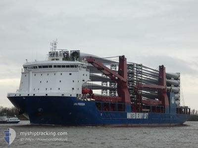
UHL FREEDOM
Cargo
Current Trip
| Time Travelled | 9 days |
|---|---|
| Remaining Time | --- |
| Distance Travelled | 2837.01 nm |
| Remaining Distance | --- |
| AVG Speed | 14.1 Knots |
| MAX Speed | 17.2 Knots |
| AVG Wind | 13.8 knots |
| MAX Wind | 25 knots |
| MIN Temp | 21.2°C / 70.16°F |
| MAX Temp | 31.1°C / 87.98°F |
| Dybgang | 7.2 m |
| Position Modtaget | 1 d siden |
Current Position
| Longitude | 54.77686° |
|---|---|
| Latitude | -20.94547° |
| Status | Under way using engine |
| Fart | 13.9 Knots |
| Kurs | 233.3° |
| Område | Indian Ocean |
| Station | T-AIS |
| Position Modtaget | 1 d siden |
Info
Information
The current position of UHL FREEDOM is in Indian Ocean with coordinates -20.94547° / 54.77686° as reported on 2024-05-08 21:47 by AIS to our vessel tracker app. The vessel's current speed is 13.9 Knots and is heading at the port of EMDEN. The estimated time of arrival as calculated by MyShipTracking vessel tracking app is 2024-06-01 15:00 LT
The vessel UHL FREEDOM (IMO: 9897121, MMSI: 255806351) is a Cargo It's sailing under the flag of [PT] Portugal.
In this page you can find informations about the vessels current position, last detected port calls, and current voyage information. If the vessels is not in coverage by AIS you will find the latest position.
The current position of UHL FREEDOM is detected by our AIS receivers and we are not responsible for the reliability of the data. The last position was recorded while the vessel was in Coverage by the Ais receivers of our vessel tracking app.
The current draught of UHL FREEDOM as reported by AIS is 7.2 meters
Weather
| Temperature | 25°C / 77°F |
|---|---|
| Wind Speed | 20 knots |
| Direction | 46° NE |
| Pressure | 1020.5 hPa |
| Humidity | 67.8 % |
| Cloud Coverage | 3 % |
Featured Company
Most Visited Ports (Last year)
| Port | Arrivals | |
|---|---|---|
| 2 | ||
| 2 | ||
| 2 | ||
| 2 | ||
| 1 | ||
| 1 |
Events
| Tid | Hændelsen | Detaljer | Position / Dest | Info |
|---|---|---|---|---|
| 2024-05-08 21:54 | Status er ændret | Default Under way using engine |
-20.95833 / 54.75333
EMDEN
|
Fart: 13.9 kn Kurs: 233.3° |
| 2024-05-08 21:47 | Udenfor Dækning |
-20.94547 / 54.77686
Indian Ocean
EMDEN
|
Fart: 13.9 kn Kurs: 233.3° |
|
| 2024-05-08 18:04 | Dybgangen er ændret | 7.2 6.1 |
-20.58933 / 55.66338
EMDEN
|
Fart: 15 kn Kurs: 257.4° |
| 2024-05-08 18:04 | Destination er ændret | EMDEN TUTICORIN |
-20.58933 / 55.66338
EMDEN
|
Fart: 15 kn Kurs: 257.4° |
| 2024-05-08 18:04 | ETA er ændret | 2024/06/01 15:00 2024/04/04 17:00 |
-20.58933 / 55.66338
EMDEN
|
Fart: 15 kn Kurs: 257.4° |
| 2024-05-08 17:59 | Ændre havområde | R�union part of the Indian Ocean Indian part of the Laccadive Sea |
-20.58458 / 55.68702
Indian Ocean
|
Fart: 15 kn Kurs: 258° |
| 2024-05-08 17:57 | Status er ændret | Under way using engine Default |
-20.58269 / 55.69614
TUTICORIN
|
Fart: 15.2 kn Kurs: 257° |
| 2024-05-08 17:46 | Indenfor Dækning |
-20.58458 / 55.68702
Indian Ocean
|
Fart: 15 kn Kurs: 258° |
|
| 2024-05-08 10:51 | START Sejllads | 1.08 nm, North West of PORT LOUIS |
-20.12853 / 57.46846
TUTICORIN
|
Fart: 3.6 kn Kurs: 250° |
| 2024-05-08 01:05 | Udenfor Dækning |
-20.12720 / 57.47231
Laccadive Sea
|
Fart: 0.1 kn Kurs: 128.6° |