
TUG RESPONSE
Tug
Current Trip
| Time Travelled | 5 h, 8 mins |
|---|---|
| Remaining Time | 1 h, 55 mins |
| Distance Travelled | 48.35 nm |
| Remaining Distance | 23.48 nm |
| AVG Speed | 9.4 Noeuds |
| MAX Speed | 12 Noeuds |
| AVG Wind | 7.6 knots |
| MAX Wind | 15.8 knots |
| MIN Temp | 9.1°C / 48.38°F |
| MAX Temp | 9.7°C / 49.46°F |
| Tirant d eau | 6.1 m |
| Position reçue | 3 m depuis |
Current Position
| Longitude | --- |
|---|---|
| Latitude | --- |
| Etat | Under way using engine |
| Vitesse | 10.1 Noeuds |
| Parcours | 128.2° |
| Zone | The Coastal Waters of Southeast Alaska and British Columbia |
| Station | T-AIS |
| Position reçue | 3 m depuis |
Info
Information
The current position of TUG RESPONSE is in The Coastal Waters of Southeast Alaska and British Columbia with coordinates 48.32811° / -123.11884° as reported on 2025-12-11 19:22 by AIS to our vessel tracker app. The vessel's current speed is 10.1 Noeuds and is heading at the port of ANACORTES. The estimated time of arrival as calculated by MyShipTracking vessel tracking app is 2025-12-11 13:20 LT
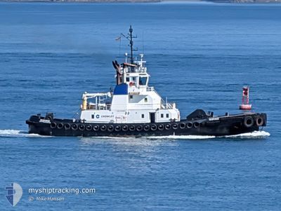
The vessel TUG RESPONSE (IMO: 9258806, MMSI: 368430490) is a Tug that was built in 2002 ( 23 Age ). It's sailing under the flag of [US] USA.
In this page you can find informations about the vessels current position, last detected port calls, and current voyage information. If the vessels is not in coverage by AIS you will find the latest position.
The current position of TUG RESPONSE is detected by our AIS receivers and we are not responsible for the reliability of the data. The last position was recorded while the vessel was in Coverage by the Ais receivers of our vessel tracking app.
The current draught of TUG RESPONSE as reported by AIS is 6.1 meters
Weather
| Temperature | 8.9°C / 48.02°F |
|---|---|
| Wind Speed | 7 knots |
| Direction | 158° SSE |
| Pressure | 1021.7 hPa |
| Humidity | 93.3 % |
| Cloud Coverage | 100 % |
Featured Company
Last Port Calls
| Port | Arrival | Departure | Time In Port |
|---|---|---|---|
| 2025-12-11 05:41 | 2025-12-11 06:17 | 35 m | |
| 2025-12-11 03:20 | 2025-12-11 04:46 | 1 h | |
| 2025-12-10 13:43 | 2025-12-10 14:24 | 41 m | |
| 2025-12-10 11:35 | 2025-12-10 12:33 | 57 m | |
| 2025-12-10 05:53 | 2025-12-10 06:38 | 44 m | |
| 2025-12-09 21:18 | 2025-12-09 21:23 | 4 m | |
| 2025-12-09 19:53 | 2025-12-09 20:27 | 34 m | |
| 2025-12-09 14:15 | 2025-12-09 15:15 | 59 m | |
| 2025-12-09 11:12 | 2025-12-09 12:31 | 1 h | |
| 2025-12-08 16:03 | 2025-12-09 03:06 | 11 h |
Most Visited Ports (Last year)
| Port | Arrivals | |
|---|---|---|
| 58 | ||
| 57 | ||
| 24 | ||
| 16 | ||
| 9 | ||
| 7 |
Last Trips
| Origin | Departure | Destination | Arrival | Distance | |
|---|---|---|---|---|---|
| 2025-12-11 04:46 | 2025-12-11 05:41 | 2.71 nm | |||
| 2025-12-10 14:24 | 2025-12-11 03:20 | 44.94 nm | |||
| 2025-12-10 12:33 | 2025-12-10 13:43 | 1.22 nm | |||
| 2025-12-10 06:38 | 2025-12-10 11:35 | 33.85 nm | |||
| 2025-12-09 21:23 | 2025-12-10 05:53 | 3.78 nm | |||
| 2025-12-09 20:27 | 2025-12-09 21:18 | 2.71 nm | |||
| 2025-12-09 15:15 | 2025-12-09 19:53 | 5.45 nm | |||
| 2025-12-09 12:31 | 2025-12-09 14:15 | 6.35 nm | |||
| 2025-12-09 03:06 | 2025-12-09 11:12 | 68.21 nm | |||
| 2025-12-08 11:03 | 2025-12-08 16:03 | 38.16 nm |
Events
| Heure | Evenement | Détails | Position/ Destination | Info |
|---|---|---|---|---|
| 2025-12-11 19:06 | Changement de zone | United States part of the The Coastal Waters of Southeast Alaska and British Columbia Canadian part of the The Coastal Waters of Southeast Alaska and British Columbia |
48.35563 / -123.17708
The Coastal Waters of Southeast Alaska and British Columbia
BUOY R
|
Vitesse: 10.8 kn Parcours: 124.1° |
| 2025-12-11 17:58 | Changement de zone | Canadian part of the The Coastal Waters of Southeast Alaska and British Columbia United States part of the The Coastal Waters of Southeast Alaska and British Columbia |
48.53903 / -123.21736
The Coastal Waters of Southeast Alaska and British Columbia
BUOY R
|
Vitesse: 9.9 kn Parcours: 173.5° |
| 2025-12-11 16:58 | Changement de zone | United States part of the The Coastal Waters of Southeast Alaska and British Columbia Canadian part of the The Coastal Waters of Southeast Alaska and British Columbia |
48.69131 / -123.24898
The Coastal Waters of Southeast Alaska and British Columbia
BUOY R
|
Vitesse: 7.9 kn Parcours: 192.5° |
| 2025-12-11 15:40 | Changement de zone | Canadian part of the The Coastal Waters of Southeast Alaska and British Columbia United States part of the The Coastal Waters of Southeast Alaska and British Columbia |
48.79090 / -123.01348
The Coastal Waters of Southeast Alaska and British Columbia
BUOY R
|
Vitesse: 7.4 kn Parcours: 219.8° |
| 2025-12-11 14:17 | PORT DE DEPART |
|
48.82835 / -122.72485
BUOY R
|
Vitesse: 2.8 kn Parcours: 285° |
| 2025-12-11 14:16 | Démarrage |
48.82796 / -122.72395
[US] FERNDALE
|
Vitesse: 3.1 kn Parcours: 288° |
|
| 2025-12-11 13:45 | Arret |
48.82531 / -122.72123
[US] FERNDALE
|
Vitesse: 0.3 kn Parcours: 63° |
|
| 2025-12-11 13:44 | Démarrage |
48.82527 / -122.72198
[US] FERNDALE
|
Vitesse: 3.2 kn Parcours: 102° |
|
| 2025-12-11 13:41 | Port d'arrivée |
|
48.82530 / -122.72304
[US] FERNDALE
|
Vitesse: 0.7 kn Parcours: 75° |
| 2025-12-11 13:24 | Arret | 0.22 nm, West of FERNDALE |
48.82567 / -122.72475
BUOY R
|
Vitesse: 0.3 kn Parcours: 126° |