
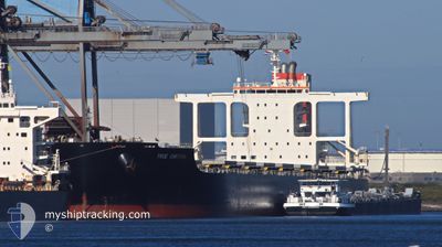
TRUE CARTIER
Cargo
Current Trip
| Time Travelled | 9 days |
|---|---|
| Remaining Time | --- |
| Distance Travelled | 435.20 nm |
| Remaining Distance | --- |
| AVG Speed | 8.8 Noeuds |
| MAX Speed | 14.1 Noeuds |
| AVG Wind | 9.9 knots |
| MAX Wind | 21.4 knots |
| MIN Temp | 22.9°C / 73.22°F |
| MAX Temp | 28.3°C / 82.94°F |
| Tirant d eau | 8.9 m |
| Position reçue | 13 h, 27 m depuis |
Current Position
| Longitude | -44.02666° |
|---|---|
| Latitude | -23.20385° |
| Etat | At anchor |
| Vitesse | |
| Parcours | 273° |
| Zone | South Atlantic Ocean |
| Station | T-AIS |
| Position reçue | 13 h, 27 m depuis |
Info
Information
The current position of TRUE CARTIER is in South Atlantic Ocean with coordinates -23.20385° / -44.02666° as reported on 2024-05-04 20:45 by AIS to our vessel tracker app. The vessel's current speed is 0 Noeuds
The vessel TRUE CARTIER (IMO: 9691553, MMSI: 636019005) is a Cargo It's sailing under the flag of [LR] Liberia.
In this page you can find informations about the vessels current position, last detected port calls, and current voyage information. If the vessels is not in coverage by AIS you will find the latest position.
The current position of TRUE CARTIER is detected by our AIS receivers and we are not responsible for the reliability of the data. The last position was recorded while the vessel was in Coverage by the Ais receivers of our vessel tracking app.
The current draught of TRUE CARTIER as reported by AIS is 8.9 meters
Weather
| Temperature | 23.8°C / 74.84°F |
|---|---|
| Wind Speed | 7 knots |
| Direction | 34° NE |
| Pressure | 1016.6 hPa |
| Humidity | 78 % |
| Cloud Coverage | 1 % |
Featured Company
Last Port Calls
| Port | Arrival | Departure | Time In Port |
|---|---|---|---|
| 2024-04-17 09:23 | 2024-04-25 15:20 | 8 d |
Most Visited Ports (Last year)
| Port | Arrivals | |
|---|---|---|
| 2 | ||
| 1 | ||
| 1 | ||
| 1 | ||
| 1 | ||
| 1 |
Last Trips
| Origin | Departure | Destination | Arrival | Distance |
|---|
Events
| Heure | Evenement | Détails | Position/ Destination | Info |
|---|---|---|---|---|
| 2024-05-04 20:48 | Etat Changé | Default At anchor |
-23.20384 / -44.02668
GUAIBA
|
Vitesse: Parcours: 273° |
| 2024-05-04 20:45 | Etat Changé | At anchor Default |
-23.20385 / -44.02666
GUAIBA
|
Vitesse: 0.2 kn Parcours: 277° |
| 2024-05-04 20:45 | Dans la zone couverte |
-23.20385 / -44.02666
South Atlantic Ocean
|
Vitesse: Parcours: 195.1° |
|
| 2024-05-04 20:45 | Hors de la zone couverte |
-23.20385 / -44.02666
South Atlantic Ocean
|
Vitesse: Parcours: 195.1° |
|
| 2024-05-04 18:39 | Etat Changé | Default At anchor |
-23.20410 / -44.02679
GUAIBA
|
Vitesse: 0.1 kn Parcours: 260° |
| 2024-05-04 18:30 | Hors de la zone couverte |
-23.20372 / -44.02699
South Atlantic Ocean
|
Vitesse: 0.1 kn Parcours: 151.7° |
|
| 2024-05-04 15:09 | Etat Changé | At anchor Default |
-23.20226 / -44.02718
GUAIBA
|
Vitesse: 0.1 kn Parcours: 239° |
| 2024-05-04 14:51 | Etat Changé | Default At anchor |
-23.20210 / -44.02712
GUAIBA
|
Vitesse: 0.1 kn Parcours: 246° |
| 2024-05-04 12:33 | Etat Changé | At anchor Default |
-23.20222 / -44.02693
GUAIBA
|
Vitesse: Parcours: 255° |
| 2024-05-04 11:21 | Hors de la zone couverte |
-23.20241 / -44.02681
South Atlantic Ocean
|
Vitesse: 0.1 kn Parcours: 336.4° |