

TOSTE R
Trailing Suction Hopper Dredger

Current Trip
UDERWATER DREDGING
| Time Travelled | 1 day |
|---|---|
| Remaining Time | --- |
| Distance Travelled | 114.21 nm |
| Remaining Distance | --- |
| AVG Speed | 7.4 Noeuds |
| MAX Speed | 8 Noeuds |
| AVG Wind | 10 knots |
| MAX Wind | 13.8 knots |
| MIN Temp | 5°C / 41°F |
| MAX Temp | 7.5°C / 45.5°F |
| Tirant d eau | 2.7 m |
| Position reçue | 6 m depuis |
Current Position
| Longitude | --- |
|---|---|
| Latitude | --- |
| Etat | Moored |
| Vitesse | |
| Parcours | 75° |
| Zone | Baltic Sea |
| Station | T-AIS |
| Position reçue | 6 m depuis |
Information
The current position of TOSTE R is in Baltic Sea with coordinates 54.45765° / 13.84882° as reported on 2025-03-27 13:31 by AIS to our vessel tracker app. The vessel's current speed is 0 Noeuds
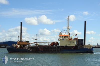
The vessel TOSTE R (IMO: 9042087, MMSI: 219000615) is a Trailing Suction Hopper Dredger that was built in 1992 ( 33 Age ). It's sailing under the flag of [DK] Denmark.
In this page you can find informations about the vessels current position, last detected port calls, and current voyage information. If the vessels is not in coverage by AIS you will find the latest position.
The current position of TOSTE R is detected by our AIS receivers and we are not responsible for the reliability of the data. The last position was recorded while the vessel was in Coverage by the Ais receivers of our vessel tracking app.
The current draught of TOSTE R as reported by AIS is 2.7 meters
Weather
| Temperature | 7.1°C / 44.78°F |
|---|---|
| Wind Speed | 11 knots |
| Direction | 280° W |
| Pressure | 1018.9 hPa |
| Humidity | 81.8 % |
| Cloud Coverage | 17 % |


Featured Company
Last Port Calls
| Port | Arrival | Departure | Time In Port |
|---|---|---|---|
| 2025-03-26 05:14 | 2025-03-26 10:54 | 5 h | |
| 2025-03-21 19:19 | 2025-03-24 00:24 | 2 d | |
| 2025-03-16 19:39 | 2025-03-18 13:14 | 1 d | |
| 2025-03-15 07:17 | 2025-03-15 15:13 | 7 h | |
| 2025-03-10 11:42 | 2025-03-10 12:17 | 35 m | |
| 2025-03-09 17:03 | 2025-03-10 04:26 | 11 h | |
| 2025-03-05 01:57 | 2025-03-05 14:06 | 12 h | |
| 2025-03-04 08:47 | 2025-03-04 12:19 | 3 h | |
| 2025-03-04 04:57 | 2025-03-04 07:07 | 2 h | |
| 2025-03-04 01:14 | 2025-03-04 03:01 | 1 h |
Most Visited Ports (Last year)
| Port | Arrivals | |
|---|---|---|
| 2181 | ||
| 119 | ||
| 23 | ||
| 15 | ||
| 12 | ||
| 10 |
Last Trips
| Origin | Departure | Destination | Arrival | Distance | |
|---|---|---|---|---|---|
| 2025-03-24 00:24 | 2025-03-26 05:14 | 218.78 nm | |||
| 2025-03-18 13:14 | 2025-03-21 19:19 | 315.12 nm | |||
| 2025-03-15 15:13 | 2025-03-16 19:39 | 106.40 nm | |||
| 2025-03-10 12:17 | 2025-03-15 07:17 | 414.11 nm | |||
| 2025-03-10 04:26 | 2025-03-10 11:42 | 29.09 nm | |||
| 2025-03-05 14:06 | 2025-03-09 17:03 | 311.01 nm | |||
| 2025-03-04 12:19 | 2025-03-05 01:57 | 104.15 nm | |||
| 2025-03-04 07:07 | 2025-03-04 08:47 | 9.91 nm | |||
| 2025-03-04 03:01 | 2025-03-04 04:57 | 10.53 nm | |||
| 2025-03-03 23:53 | 2025-03-04 01:14 | 9.73 nm |
Events
| Heure | Evenement | Détails | Position/ Destination | Info |
|---|---|---|---|---|
| 2025-03-27 13:31 | Etat Changé | Moored Default |
54.45765 / 13.84882
UDERWATER DREDGING
|
Vitesse: Parcours: 75° |
| 2025-03-27 13:16 | Etat Changé | Default Moored |
54.45767 / 13.84881
UDERWATER DREDGING
|
Vitesse: Parcours: 75° |
| 2025-03-27 12:49 | Etat Changé | Moored Default |
54.45776 / 13.84875
UDERWATER DREDGING
|
Vitesse: 0.1 kn Parcours: 74° |
| 2025-03-27 12:19 | Etat Changé | Default Moored |
54.45779 / 13.84876
UDERWATER DREDGING
|
Vitesse: Parcours: 75° |
| 2025-03-27 12:07 | Etat Changé | Moored Default |
54.45780 / 13.84877
UDERWATER DREDGING
|
Vitesse: Parcours: 75° |
| 2025-03-27 11:52 | Etat Changé | Default Moored |
54.45782 / 13.84876
UDERWATER DREDGING
|
Vitesse: Parcours: 75° |
| 2025-03-27 11:40 | Arret | 7.93 nm, South East of SASSNITZ |
54.45797 / 13.84864
UDERWATER DREDGING
|
Vitesse: Parcours: 77° |
| 2025-03-27 11:25 | Etat Changé | Moored Default |
54.43659 / 13.86510
UDERWATER DREDGING
|
Vitesse: 7.9 kn Parcours: 334° |
| 2025-03-27 11:22 | Etat Changé | Default Moored |
54.43093 / 13.86990
UDERWATER DREDGING
|
Vitesse: 7.9 kn Parcours: 333.9° |
| 2025-03-27 11:16 | Etat Changé | Moored Default |
54.41841 / 13.88064
UDERWATER DREDGING
|
Vitesse: 7.9 kn Parcours: 333° |