
TIANJIN HIGHWAY
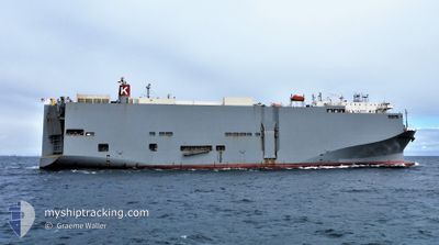
Vehicles Carrier
Current Trip
| Time Travelled | 7 days |
|---|---|
| Remaining Time | 3 days |
| Distance Travelled | 3102.89 nm |
| Remaining Distance | 1572.81 nm |
| AVG Speed | 15.5 Noeuds |
| MAX Speed | 20.6 Noeuds |
| AVG Wind | 19.7 knots |
| MAX Wind | 25 knots |
| MIN Temp | 12.9°C / 55.22°F |
| MAX Temp | 29.6°C / 85.28°F |
| Tirant d eau | 7.6 m |
| Position reçue | 2 d depuis |
Current Position
| Longitude | 114.26453° |
|---|---|
| Latitude | -17.10070° |
| Etat | Under way using engine |
| Vitesse | 18.7 Noeuds |
| Parcours | 10° |
| Zone | Indian Ocean |
| Station | T-AIS |
| Position reçue | 2 d depuis |
Info
Information
The current position of TIANJIN HIGHWAY is in Indian Ocean with coordinates -17.10070° / 114.26453° as reported on 2024-05-07 02:01 by AIS to our vessel tracker app. The vessel's current speed is 18.7 Noeuds and is heading at the port of LAEM CHABANG. The estimated time of arrival as calculated by MyShipTracking vessel tracking app is 2024-05-12 03:42 LT
The vessel TIANJIN HIGHWAY (IMO: 9294355, MMSI: 371559000) is a Vehicles Carrier that was built in 2005 ( 19 Age ). It's sailing under the flag of [PA] Panama.
In this page you can find informations about the vessels current position, last detected port calls, and current voyage information. If the vessels is not in coverage by AIS you will find the latest position.
The current position of TIANJIN HIGHWAY is detected by our AIS receivers and we are not responsible for the reliability of the data. The last position was recorded while the vessel was in Coverage by the Ais receivers of our vessel tracking app.
The current draught of TIANJIN HIGHWAY as reported by AIS is 7.6 meters
Weather
| Temperature | 28.8°C / 83.84°F |
|---|---|
| Wind Speed | 9 knots |
| Direction | 95° E |
| Pressure | 1011 hPa |
| Humidity | 75.5 % |
| Cloud Coverage | 100 % |
Featured Company
Last Port Calls
| Port | Arrival | Departure | Time In Port |
|---|---|---|---|
| 2024-04-30 16:42 | 2024-05-01 13:22 | 20 h | |
| 2024-04-25 23:11 | 2024-04-27 14:47 | 1 d | |
| 2024-04-23 11:27 | 2024-04-23 21:29 | 10 h | |
| 2024-04-20 20:24 | 2024-04-21 11:43 | 15 h | |
| 2024-04-10 23:54 | 2024-04-11 06:46 | 6 h | |
| 2024-04-08 22:04 | 2024-04-09 08:24 | 10 h | |
| 2024-04-07 22:00 | 2024-04-08 05:33 | 7 h | |
| 2024-04-04 21:22 | 2024-04-06 03:57 | 1 d | |
| 2024-03-22 21:16 | 2024-03-23 06:21 | 9 h | |
| 2024-03-17 03:23 | 2024-03-19 02:43 | 1 d |
Last Trips
| Origin | Departure | Destination | Arrival | Distance | |
|---|---|---|---|---|---|
| 2024-04-28 00:47 | 2024-05-01 02:12 | 976.16 nm | |||
| 2024-04-24 07:29 | 2024-04-26 09:11 | 602.39 nm | |||
| 2024-04-21 21:43 | 2024-04-23 21:27 | 701.00 nm | |||
| 2024-04-11 15:46 | 2024-04-21 06:24 | 3655.68 nm | |||
| 2024-04-09 17:24 | 2024-04-11 08:54 | 397.57 nm | |||
| 2024-04-08 14:33 | 2024-04-09 07:04 | 241.00 nm | |||
| 2024-04-06 12:57 | 2024-04-08 07:00 | 44.15 nm | |||
| 2024-03-22 23:21 | 2024-04-05 06:22 | 5324.46 nm | |||
| 2024-03-18 19:43 | 2024-03-22 14:16 | 909.93 nm | |||
| 2024-03-03 09:47 | 2024-03-16 20:23 | 5677.82 nm |
Events
| Heure | Evenement | Détails | Position/ Destination | Info |
|---|---|---|---|---|
| 2024-05-07 02:08 | Etat Changé | Default Under way using engine |
-17.06470 / 114.27140
TH LCH
|
Vitesse: 18.7 kn Parcours: 10° |
| 2024-05-07 02:01 | Hors de la zone couverte |
-17.10070 / 114.26453
Indian Ocean
TH LCH
|
Vitesse: 18.7 kn Parcours: 10° |
|
| 2024-05-07 01:59 | Etat Changé | Under way using engine Default |
-17.11033 / 114.26270
TH LCH
|
Vitesse: 18.8 kn Parcours: 10° |
| 2024-05-07 01:26 | Etat Changé | Default Under way using engine |
-17.27697 / 114.23050
TH LCH
|
Vitesse: 18.1 kn Parcours: 10° |
| 2024-05-07 00:29 | Etat Changé | Under way using engine Default |
-17.56183 / 114.18303
TH LCH
|
Vitesse: 18.1 kn Parcours: 9° |
| 2024-05-07 00:14 | Etat Changé | Default Under way using engine |
-17.63632 / 114.17038
TH LCH
|
Vitesse: 18.2 kn Parcours: 9° |
| 2024-05-06 23:44 | Etat Changé | Under way using engine Default |
-17.78983 / 114.14442
TH LCH
|
Vitesse: 18.1 kn Parcours: 8° |
| 2024-05-06 23:44 | Dans la zone couverte |
-17.78833 / 114.14467
Indian Ocean
TH LCH
|
Vitesse: 18.1 kn Parcours: 9° |
|
| 2024-05-04 07:11 | Etat Changé | Default Under way using engine |
-35.26770 / 116.77030
TH LCH
|
Vitesse: 15.3 kn Parcours: 273° |
| 2024-05-04 07:06 | Hors de la zone couverte |
-35.26960 / 116.79930
Indian Ocean
TH LCH
|
Vitesse: 15.3 kn Parcours: 273° |