

THUN LIFFEY
Tanker

Current Trip
GB PEM
| Time Travelled | 18 h, 32 mins |
|---|---|
| Remaining Time | --- |
| Distance Travelled | 82.46 nm |
| Remaining Distance | --- |
| AVG Speed | 9.6 Noeuds |
| MAX Speed | 13 Noeuds |
| AVG Wind | 28.2 knots |
| MAX Wind | 38 knots |
| MIN Temp | 9.8°C / 49.64°F |
| MAX Temp | 12.5°C / 54.5°F |
| Tirant d eau | 7 m |
| Position reçue | 1 d depuis |
Current Position
| Longitude | --- |
|---|---|
| Latitude | --- |
| Etat | Moored |
| Vitesse | |
| Parcours | 266° |
| Zone | Celtic Sea |
| Station | T-AIS |
| Position reçue | 1 d depuis |
Information
The current position of THUN LIFFEY is in Celtic Sea with coordinates 51.69764° / -5.04584° as reported on 2025-02-20 09:17 by AIS to our vessel tracker app. The vessel's current speed is 0 Noeuds
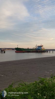
The vessel THUN LIFFEY (IMO: 9829007, MMSI: 244333000) is a Tanker It's sailing under the flag of [NL] Netherlands.
In this page you can find informations about the vessels current position, last detected port calls, and current voyage information. If the vessels is not in coverage by AIS you will find the latest position.
The current position of THUN LIFFEY is detected by our AIS receivers and we are not responsible for the reliability of the data. The last position was recorded while the vessel was in Coverage by the Ais receivers of our vessel tracking app.
The current draught of THUN LIFFEY as reported by AIS is 7 meters
Weather
| Temperature | 9.7°C / 49.46°F |
|---|---|
| Wind Speed | 9 knots |
| Direction | 214° SW |
| Pressure | 1004.6 hPa |
| Humidity | 87.8 % |
| Cloud Coverage | 100 % |


Featured Company
Last Port Calls
| Port | Arrival | Departure | Time In Port |
|---|---|---|---|
| 2025-02-20 07:09 | 2025-02-21 02:47 | 19 h | |
| 2025-02-18 11:54 | 2025-02-19 16:00 | 1 d | |
| 2025-02-16 09:52 | 2025-02-17 21:29 | 1 d | |
| 2025-02-14 14:47 | 2025-02-15 17:50 | 1 d | |
| 2025-02-11 09:47 | 2025-02-12 18:05 | 1 d | |
| 2025-02-09 01:03 | 2025-02-09 01:16 | 12 m | |
| 2025-02-06 23:25 | 2025-02-07 23:17 | 23 h | |
| 2025-02-04 15:11 | 2025-02-06 01:10 | 1 d | |
| 2025-02-02 08:07 | 2025-02-03 16:54 | 1 d | |
| 2025-01-31 18:37 | 2025-02-01 10:18 | 15 h |
Last Trips
| Origin | Departure | Destination | Arrival | Distance | |
|---|---|---|---|---|---|
| 2025-02-19 16:00 | 2025-02-20 07:09 | 120.81 nm | |||
| 2025-02-17 21:29 | 2025-02-18 11:54 | 135.88 nm | |||
| 2025-02-15 17:50 | 2025-02-16 09:52 | 117.86 nm | |||
| 2025-02-12 18:05 | 2025-02-14 14:47 | 140.25 nm | |||
| 2025-02-09 01:16 | 2025-02-11 09:47 | 190.99 nm | |||
| 2025-02-07 23:17 | 2025-02-09 01:03 | 200.72 nm | |||
| 2025-02-06 01:10 | 2025-02-06 23:25 | 210.43 nm | |||
| 2025-02-03 16:54 | 2025-02-04 15:11 | 227.03 nm | |||
| 2025-02-01 10:18 | 2025-02-02 08:07 | 93.83 nm | |||
| 2025-01-31 06:21 | 2025-01-31 18:37 | 37.98 nm |
Events
| Heure | Evenement | Détails | Position/ Destination | Info |
|---|---|---|---|---|
| 2025-02-21 14:26 | Démarrage | 9.85 nm, South of PORTHCAWL |
51.31697 / -3.63193
GB PEM
|
Vitesse: 4.4 kn Parcours: 95° |
| 2025-02-21 11:44 | Arret | 9.74 nm, South of PORTHCAWL |
51.31995 / -3.62568
GB PEM
|
Vitesse: 0.1 kn Parcours: 162° |
| 2025-02-21 02:47 | PORT DE DEPART |
|
51.69587 / -5.11789
GB PEM
|
Vitesse: 10.3 kn Parcours: 264° |
| 2025-02-21 02:32 | Démarrage |
51.69819 / -5.05230
[GB] PEMBROKE
|
Vitesse: 6 kn Parcours: 263° |
|
| 2025-02-20 09:23 | Etat Changé | Default Moored |
51.69766 / -5.04584
[GB] PEMBROKE
|
Vitesse: Parcours: 266° |
| 2025-02-20 09:17 | Hors de la zone couverte |
51.69764 / -5.04584
Celtic Sea
[GB] PEMBROKE
|
Vitesse: Parcours: 82.3° |
|
| 2025-02-20 07:47 | Etat Changé | Moored Under way using engine |
51.69765 / -5.04585
[GB] PEMBROKE
|
Vitesse: Parcours: 266° |
| 2025-02-20 07:36 | Arret |
51.69783 / -5.04578
[GB] PEMBROKE
|
Vitesse: 0.3 kn Parcours: 261° |
|
| 2025-02-20 07:09 | Port d'arrivée |
|
51.69522 / -5.09046
[GB] PEMBROKE
|
Vitesse: 8.3 kn Parcours: 93.4° |
| 2025-02-20 04:00 | Changement de zone | United Kingdom part of the Celtic Sea Irish part of the Irish Sea and St. George's Channel |
51.73970 / -5.41588
Celtic Sea
GB PEM
|
Vitesse: 9.7 kn Parcours: 147.5° |