

THUN LIFFEY
Tanker

Current Trip
GB PEM
| Time Travelled | 5 h, 18 mins |
|---|---|
| Remaining Time | --- |
| Distance Travelled | 41.28 nm |
| Remaining Distance | --- |
| AVG Speed | 10.4 Knots |
| MAX Speed | 12.4 Knots |
| AVG Wind | 21.2 knots |
| MAX Wind | 25 knots |
| MIN Temp | 9.3°C / 48.74°F |
| MAX Temp | 9.8°C / 49.64°F |
| Dybgang | 6.4 m |
| Position Modtaget | 2 d siden |
Current Position
| Longitude | --- |
|---|---|
| Latitude | --- |
| Status | Under way using engine |
| Fart | 8.6 Knots |
| Kurs | 266.1° |
| Område | Celtic Sea |
| Station | T-AIS |
| Position Modtaget | 2 d siden |
Information
The current position of THUN LIFFEY is in Celtic Sea with coordinates 51.75704° / -5.31548° as reported on 2025-03-26 20:53 by AIS to our vessel tracker app. The vessel's current speed is 8.6 Knots
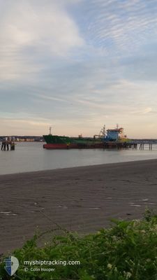
The vessel THUN LIFFEY (IMO: 9829007, MMSI: 244333000) is a Tanker It's sailing under the flag of [NL] Netherlands.
In this page you can find informations about the vessels current position, last detected port calls, and current voyage information. If the vessels is not in coverage by AIS you will find the latest position.
The current position of THUN LIFFEY is detected by our AIS receivers and we are not responsible for the reliability of the data. The last position was recorded while the vessel was in Coverage by the Ais receivers of our vessel tracking app.
The current draught of THUN LIFFEY as reported by AIS is 6.4 meters
Weather
| Temperature | 9.7°C / 49.46°F |
|---|---|
| Wind Speed | 23 knots |
| Direction | 223° SW |
| Pressure | 1017.2 hPa |
| Humidity | 97.1 % |
| Cloud Coverage | 100 % |


Featured Company
Last Port Calls
| Port | Arrival | Departure | Time In Port |
|---|---|---|---|
| 2025-03-26 22:51 | 2025-03-29 12:44 | 2 d | |
| 2025-03-24 16:22 | 2025-03-25 17:24 | 1 d | |
| 2025-03-19 21:03 | 2025-03-21 20:25 | 1 d | |
| 2025-02-28 05:32 | 2025-03-16 09:41 | 16 d | |
| 2025-02-21 23:58 | 2025-02-24 16:12 | 2 d | |
| 2025-02-20 07:09 | 2025-02-21 02:47 | 19 h | |
| 2025-02-18 11:54 | 2025-02-19 16:00 | 1 d | |
| 2025-02-16 09:52 | 2025-02-17 21:29 | 1 d | |
| 2025-02-14 14:47 | 2025-02-15 17:50 | 1 d | |
| 2025-02-11 09:47 | 2025-02-12 18:05 | 1 d |
Last Trips
| Origin | Departure | Destination | Arrival | Distance | |
|---|---|---|---|---|---|
| 2025-03-25 17:24 | 2025-03-26 22:51 | 125.08 nm | |||
| 2025-03-21 20:25 | 2025-03-24 16:22 | 668.73 nm | |||
| 2025-03-16 09:41 | 2025-03-19 21:03 | 205.05 nm | |||
| 2025-02-24 16:12 | 2025-02-28 05:32 | 783.56 nm | |||
| 2025-02-21 02:47 | 2025-02-21 23:58 | 119.57 nm | |||
| 2025-02-19 16:00 | 2025-02-20 07:09 | 120.81 nm | |||
| 2025-02-17 21:29 | 2025-02-18 11:54 | 135.88 nm | |||
| 2025-02-15 17:50 | 2025-02-16 09:52 | 117.86 nm | |||
| 2025-02-12 18:05 | 2025-02-14 14:47 | 140.25 nm | |||
| 2025-02-09 01:16 | 2025-02-11 09:47 | 190.99 nm |
Events
| Tid | Hændelsen | Detaljer | Position / Dest | Info |
|---|---|---|---|---|
| 2025-03-29 12:44 | Afsejlet fra sidste havn |
|
51.69574 / -5.10304
GB PEM
|
Fart: 8.2 kn Kurs: 264° |
| 2025-03-29 12:36 | START Sejllads |
51.69690 / -5.06428
[GB] PEMBROKE
|
Fart: 8.2 kn Kurs: 264° |
|
| 2025-03-26 23:29 | STOP Sejllads |
51.69749 / -5.05197
[GB] PEMBROKE
|
Fart: Kurs: 89° |
|
| 2025-03-26 22:51 | Skibe i havn |
|
51.69673 / -5.09064
[GB] PEMBROKE
|
Fart: 9.9 kn Kurs: 96° |
| 2025-03-26 21:00 | Status er ændret | Default Under way using engine |
51.74825 / -5.33564
GB PEM
|
Fart: 8.6 kn Kurs: 266.1° |
| 2025-03-26 20:53 | Udenfor Dækning |
51.75704 / -5.31548
Celtic Sea
|
Fart: 8.6 kn Kurs: 266.1° |
|
| 2025-03-26 20:49 | Status er ændret | Under way using engine Default |
51.75769 / -5.29972
GB PEM
|
Fart: 8.7 kn Kurs: 268° |
| 2025-03-26 20:40 | Status er ændret | Default Under way using engine |
51.75742 / -5.26609
GB PEM
|
Fart: 1.6 kn Kurs: 1° |
| 2025-03-26 20:40 | START Sejllads | 11.79 nm, West of PEMBROKE |
51.75742 / -5.26609
GB PEM
|
Fart: 7.2 kn Kurs: 275° |
| 2025-03-26 20:34 | Status er ændret | Under way using engine Default |
51.75580 / -5.25504
GB PEM
|
Fart: 0.1 kn Kurs: 57° |