
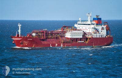
THETAGAS
Tanker
Current Trip
| Time Travelled | 8 days |
|---|---|
| Remaining Time | 1 day |
| Distance Travelled | 2570.63 nm |
| Remaining Distance | 546.78 nm |
| AVG Speed | 13.3 Noeuds |
| MAX Speed | 16.3 Noeuds |
| AVG Wind | 11 knots |
| MAX Wind | 29 knots |
| MIN Temp | 7.2°C / 44.96°F |
| MAX Temp | 20.4°C / 68.72°F |
| Tirant d eau | 6.9 m |
| Position reçue | 38 m depuis |
Current Position
| Longitude | 17.41157° |
|---|---|
| Latitude | 38.54223° |
| Etat | Under way using engine |
| Vitesse | 13.8 Noeuds |
| Parcours | 38° |
| Zone | Ionian Sea |
| Station | T-AIS |
| Position reçue | 38 m depuis |
Info
Information
The current position of THETAGAS is in Ionian Sea with coordinates 38.54223° / 17.41157° as reported on 2024-05-07 22:45 by AIS to our vessel tracker app. The vessel's current speed is 13.8 Noeuds and is heading at the port of VENEZIA. The estimated time of arrival as calculated by MyShipTracking vessel tracking app is 2024-05-09 14:17 LT
The vessel THETAGAS (IMO: 9368792, MMSI: 305178000) is a Tanker It's sailing under the flag of [AG] Antigua Barbuda.
In this page you can find informations about the vessels current position, last detected port calls, and current voyage information. If the vessels is not in coverage by AIS you will find the latest position.
The current position of THETAGAS is detected by our AIS receivers and we are not responsible for the reliability of the data. The last position was recorded while the vessel was in Coverage by the Ais receivers of our vessel tracking app.
The current draught of THETAGAS as reported by AIS is 6.9 meters
Weather
| Temperature | 18.1°C / 64.58°F |
|---|---|
| Wind Speed | 16 knots |
| Direction | 216° SW |
| Pressure | 1015 hPa |
| Humidity | 82.5 % |
| Cloud Coverage | 100 % |
Featured Company
Last Port Calls
| Port | Arrival | Departure | Time In Port |
|---|---|---|---|
| 2024-04-27 19:20 | 2024-04-29 06:01 | 1 d | |
| 2024-04-22 22:44 | 2024-04-23 08:24 | 9 h | |
| 2024-04-18 08:58 | 2024-04-20 22:47 | 2 d | |
| 2024-04-13 08:18 | 2024-04-14 10:41 | 1 d | |
| 2024-04-08 15:16 | 2024-04-10 05:07 | 1 d | |
| 2024-04-03 14:49 | 2024-04-04 14:55 | 1 d | |
| 2024-03-03 02:14 | 2024-03-06 03:08 | 3 d |
Most Visited Ports (Last year)
| Port | Arrivals | |
|---|---|---|
| 13 | ||
| 9 | ||
| 6 | ||
| 3 | ||
| 3 | ||
| 2 |
Last Trips
| Origin | Departure | Destination | Arrival | Distance | |
|---|---|---|---|---|---|
| 2024-04-23 10:24 | 2024-04-27 21:20 | 1328.42 nm | |||
| 2024-04-20 23:47 | 2024-04-23 00:44 | 625.47 nm | |||
| 2024-04-14 12:41 | 2024-04-18 09:58 | 874.94 nm | |||
| 2024-04-10 08:07 | 2024-04-13 10:18 | 683.60 nm | |||
| 2024-04-04 16:55 | 2024-04-08 18:16 | 678.42 nm | |||
| 2024-03-05 21:08 | 2024-04-03 16:49 | 6792.64 nm | |||
| 2024-02-06 22:20 | 2024-03-02 20:14 | 5740.11 nm |
Events
| Heure | Evenement | Détails | Position/ Destination | Info |
|---|---|---|---|---|
| 2024-05-07 22:53 | Etat Changé | Default Under way using engine |
38.56695 / 17.43675
ITPMA
|
Vitesse: 13.8 kn Parcours: 38° |
| 2024-05-07 22:43 | Etat Changé | Under way using engine Default |
38.53565 / 17.40470
ITPMA
|
Vitesse: 14 kn Parcours: 39° |
| 2024-05-07 22:43 | Dans la zone couverte |
38.53565 / 17.40470
Ionian Sea
ITPMA
|
Vitesse: 13.8 kn Parcours: 38° |
|
| 2024-05-07 21:16 | Etat Changé | Default Under way using engine |
38.27575 / 17.13583
ITPMA
|
Vitesse: 13.8 kn Parcours: 38° |
| 2024-05-07 21:10 | Hors de la zone couverte |
38.25513 / 17.11508
Ionian Sea
ITPMA
|
Vitesse: 13.8 kn Parcours: 38° |
|
| 2024-05-07 21:08 | Etat Changé | Under way using engine Default |
38.25118 / 17.11110
ITPMA
|
Vitesse: 13.8 kn Parcours: 39° |
| 2024-05-07 20:47 | Etat Changé | Default Under way using engine |
38.18823 / 17.04720
ITPMA
|
Vitesse: 13.8 kn Parcours: 38° |
| 2024-05-07 20:46 | Etat Changé | Under way using engine Default |
38.18510 / 17.04407
ITPMA
|
Vitesse: 13.7 kn Parcours: 38° |
| 2024-05-07 20:46 | Dans la zone couverte |
38.18510 / 17.04407
Ionian Sea
ITPMA
|
Vitesse: 13.8 kn Parcours: 38° |
|
| 2024-05-07 19:05 | Hors de la zone couverte |
37.88187 / 16.73342
Ionian Sea
ITPMA
|
Vitesse: 14 kn Parcours: 39° |