
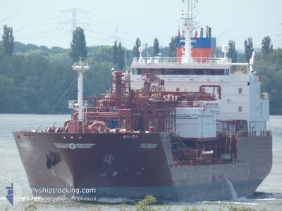
TAUGAS
Tanker
Current Trip
| Time Travelled | 5 days |
|---|---|
| Remaining Time | --- |
| Distance Travelled | 1664.26 nm |
| Remaining Distance | --- |
| AVG Speed | 11.8 Noeuds |
| MAX Speed | 16.7 Noeuds |
| AVG Wind | 10 knots |
| MAX Wind | 22 knots |
| MIN Temp | 11.4°C / 52.52°F |
| MAX Temp | 20.6°C / 69.08°F |
| Tirant d eau | 7.9 m |
| Position reçue | 4 d depuis |
Current Position
| Longitude | -71.92270° |
|---|---|
| Latitude | 39.06427° |
| Etat | Under way using engine |
| Vitesse | 12.1 Noeuds |
| Parcours | 83.6° |
| Zone | North Atlantic Ocean |
| Station | T-AIS |
| Position reçue | 4 d depuis |
Info
Information
The current position of TAUGAS is in North Atlantic Ocean with coordinates 39.06427° / -71.92270° as reported on 2024-05-08 00:00 by AIS to our vessel tracker app. The vessel's current speed is 12.1 Noeuds and is heading at the port of STENUNGSUND. The estimated time of arrival as calculated by MyShipTracking vessel tracking app is 2024-05-19 20:00 LT
The vessel TAUGAS (IMO: 9675080, MMSI: 304067000) is a Tanker It's sailing under the flag of [AG] Antigua Barbuda.
In this page you can find informations about the vessels current position, last detected port calls, and current voyage information. If the vessels is not in coverage by AIS you will find the latest position.
The current position of TAUGAS is detected by our AIS receivers and we are not responsible for the reliability of the data. The last position was recorded while the vessel was in Coverage by the Ais receivers of our vessel tracking app.
The current draught of TAUGAS as reported by AIS is 7.9 meters
Weather
| Temperature | 14.4°C / 57.92°F |
|---|---|
| Wind Speed | 17 knots |
| Direction | 137° SE |
| Pressure | 1026.3 hPa |
| Humidity | 90.2 % |
| Cloud Coverage | 100 % |
Featured Company
Last Port Calls
| Port | Arrival | Departure | Time In Port |
|---|---|---|---|
| 2024-05-06 12:22 | 2024-05-07 06:18 | 17 h | |
| 2024-04-23 05:11 | 2024-04-24 20:56 | 1 d | |
| 2024-04-05 04:17 | 2024-04-06 06:10 | 1 d | |
| 2024-03-30 03:09 | 2024-03-30 22:01 | 18 h |
Most Visited Ports (Last year)
| Port | Arrivals | |
|---|---|---|
| 3 | ||
| 3 | ||
| 2 | ||
| 2 | ||
| 2 | ||
| 2 |
Last Trips
| Origin | Departure | Destination | Arrival | Distance | |
|---|---|---|---|---|---|
| 2024-04-24 21:56 | 2024-05-06 08:22 | 3214.94 nm | |||
| 2024-04-06 01:10 | 2024-04-23 06:11 | 4677.10 nm | |||
| 2024-03-30 17:01 | 2024-04-04 23:17 | 77.68 nm | |||
| 2024-02-26 11:17 | 2024-03-29 22:09 | 5626.31 nm |
Events
| Heure | Evenement | Détails | Position/ Destination | Info |
|---|---|---|---|---|
| 2024-05-08 00:09 | Etat Changé | Default Under way using engine |
39.06795 / -71.88156
US MAH>SE STE
|
Vitesse: 12.1 kn Parcours: 83.6° |
| 2024-05-08 00:00 | Hors de la zone couverte |
39.06427 / -71.92270
North Atlantic Ocean
US MAH>SE STE
|
Vitesse: 12.1 kn Parcours: 83.6° |
|
| 2024-05-07 23:53 | Etat Changé | Under way using engine Default |
39.06211 / -71.94976
US MAH>SE STE
|
Vitesse: 12 kn Parcours: 83° |
| 2024-05-07 23:45 | Dans la zone couverte |
39.06296 / -71.93909
North Atlantic Ocean
US MAH>SE STE
|
Vitesse: 12.1 kn Parcours: 84.4° |
|
| 2024-05-07 22:24 | Etat Changé | Default Under way using engine |
39.00834 / -72.32333
US MAH>SE STE
|
Vitesse: 11.9 kn Parcours: 79.7° |
| 2024-05-07 22:21 | Hors de la zone couverte |
39.00707 / -72.33827
North Atlantic Ocean
US MAH>SE STE
|
Vitesse: 11.9 kn Parcours: 79.7° |
|
| 2024-05-07 20:12 | Etat Changé | Under way using engine Default |
38.96123 / -72.88141
US MAH>SE STE
|
Vitesse: 11 kn Parcours: 81° |
| 2024-05-07 20:09 | Etat Changé | Default Under way using engine |
38.95833 / -72.89167
US MAH>SE STE
|
Vitesse: 11.6 kn Parcours: 81.6° |
| 2024-05-07 19:49 | Etat Changé | Under way using engine Default |
38.95020 / -72.97440
US MAH>SE STE
|
Vitesse: 11 kn Parcours: 80° |
| 2024-05-07 19:42 | Etat Changé | Default Under way using engine |
38.94500 / -73.00333
US MAH>SE STE
|
Vitesse: 11.4 kn Parcours: 80.7° |