

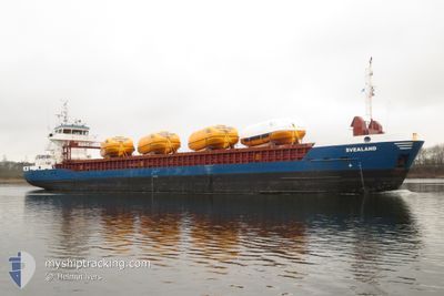
SVEALAND
General Cargo

Current Trip
| Time Travelled | 6 h, 56 mins |
|---|---|
| Remaining Time | --- |
| Distance Travelled | 64.53 nm |
| Remaining Distance | --- |
| AVG Speed | 9.9 Noeuds |
| MAX Speed | 11.6 Noeuds |
| AVG Wind | 12.6 knots |
| MAX Wind | 17.3 knots |
| MIN Temp | 5.2°C / 41.36°F |
| MAX Temp | 10.1°C / 50.18°F |
| Tirant d eau | 3 m |
| Position reçue | 2 m depuis |
Current Position
| Longitude | --- |
|---|---|
| Latitude | --- |
| Etat | Under way using engine |
| Vitesse | 9.3 Noeuds |
| Parcours | 113.8° |
| Zone | Baltic Sea |
| Station | T-AIS |
| Position reçue | 2 m depuis |
Information
The current position of SVEALAND is in Baltic Sea with coordinates 58.44168° / 18.34068° as reported on 2025-03-27 17:32 by AIS to our vessel tracker app. The vessel's current speed is 9.3 Noeuds and is heading at the port of RIGA. The estimated time of arrival as calculated by MyShipTracking vessel tracking app is 2025-03-28 21:00 LT
The vessel SVEALAND (IMO: 9195743, MMSI: 211815120) is a General Cargo that was built in 2001 ( 24 Age ). It's sailing under the flag of [DE] Germany.
In this page you can find informations about the vessels current position, last detected port calls, and current voyage information. If the vessels is not in coverage by AIS you will find the latest position.
The current position of SVEALAND is detected by our AIS receivers and we are not responsible for the reliability of the data. The last position was recorded while the vessel was in Coverage by the Ais receivers of our vessel tracking app.
The current draught of SVEALAND as reported by AIS is 3 meters
Weather
| Temperature | 5.2°C / 41.36°F |
|---|---|
| Wind Speed | 17 knots |
| Direction | 216° SW |
| Pressure | 1009.2 hPa |
| Humidity | 84.9 % |
| Cloud Coverage | 95 % |


Featured Company
Last Port Calls
| Port | Arrival | Departure | Time In Port |
|---|---|---|---|
| 2025-03-25 20:54 | 2025-03-27 11:38 | 1 d | |
| 2025-03-20 06:59 | 2025-03-21 15:09 | 1 d | |
| 2025-03-15 00:38 | 2025-03-17 13:53 | 2 d | |
| 2025-03-11 09:18 | 2025-03-13 17:14 | 2 d | |
| 2025-03-08 22:54 | 2025-03-10 13:51 | 1 d | |
| 2025-03-05 09:15 | 2025-03-06 22:31 | 1 d | |
| 2025-03-02 11:15 | 2025-03-04 15:08 | 2 d | |
| 2025-02-28 18:49 | 2025-03-01 16:40 | 21 h | |
| 2025-02-28 06:25 | 2025-02-28 14:14 | 7 h | |
| 2025-02-27 17:03 | 2025-02-27 17:08 | 5 m |
Last Trips
| Origin | Departure | Destination | Arrival | Distance | |
|---|---|---|---|---|---|
| 2025-03-21 15:09 | 2025-03-25 20:54 | 404.32 nm | |||
| 2025-03-17 13:53 | 2025-03-20 06:59 | 507.74 nm | |||
| 2025-03-13 17:14 | 2025-03-15 00:38 | 257.37 nm | |||
| 2025-03-10 13:51 | 2025-03-11 09:18 | 143.39 nm | |||
| 2025-03-06 22:31 | 2025-03-08 22:54 | 409.04 nm | |||
| 2025-03-04 15:08 | 2025-03-05 09:15 | 153.62 nm | |||
| 2025-03-01 16:40 | 2025-03-02 11:15 | 155.01 nm | |||
| 2025-02-28 14:14 | 2025-02-28 18:49 | 41.74 nm | |||
| 2025-02-27 17:08 | 2025-02-28 06:25 | 88.89 nm | |||
| 2025-02-27 08:25 | 2025-02-27 17:03 | 49.28 nm |
Events
| Heure | Evenement | Détails | Position/ Destination | Info |
|---|---|---|---|---|
| 2025-03-27 17:28 | Etat Changé | Under way using engine Default |
58.44488 / 18.32566
LVRIX
|
Vitesse: 9 kn Parcours: 112° |
| 2025-03-27 17:10 | Etat Changé | Default Under way using engine |
58.46093 / 18.24117
LVRIX
|
Vitesse: 9.5 kn Parcours: 106.5° |
| 2025-03-27 12:45 | Changement d'ETA | 2025/03/28 19:00 |
58.61102 / 16.98860
LVRIX
|
Vitesse: 11 kn Parcours: 82.3° |
| 2025-03-27 12:27 | Changement d'ETA | 2025/03/28 19:00 |
58.60484 / 16.88251
LVRIX
|
Vitesse: 11.1 kn Parcours: 89° |
| 2025-03-27 12:03 | Changement d'ETA | 2025/03/28 19:00 |
58.62271 / 16.74151
LVRIX
|
Vitesse: 11.4 kn Parcours: 99.5° |
| 2025-03-27 10:38 | PORT DE DEPART |
|
58.62009 / 16.26034
LVRIX
|
Vitesse: 9.3 kn Parcours: 66° |
| 2025-03-27 10:02 | Démarrage |
58.60861 / 16.19090
[SE] NORRKOPING
|
Vitesse: 3.1 kn Parcours: 339° |
|
| 2025-03-27 09:56 | Etat Changé | Under way using engine Moored |
58.60757 / 16.19168
[SE] NORRKOPING
|
Vitesse: Parcours: 324° |
| 2025-03-27 09:15 | Etat Changé | Moored Default |
58.60752 / 16.19164
[SE] NORRKOPING
|
Vitesse: Parcours: 324° |
| 2025-03-27 09:12 | Etat Changé | Default Moored |
58.60755 / 16.19162
[SE] NORRKOPING
|
Vitesse: Parcours: 324° |