
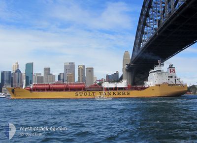
STOLT PERSEVERANCE
Oil/Chemical Tanker
Current Trip
| Time Travelled | 1 day |
|---|---|
| Remaining Time | --- |
| Distance Travelled | 232.81 nm |
| Remaining Distance | --- |
| AVG Speed | 8.2 Noeuds |
| MAX Speed | 14.5 Noeuds |
| AVG Wind | 8.4 knots |
| MAX Wind | 17.3 knots |
| MIN Temp | 5.7°C / 42.26°F |
| MAX Temp | 16.2°C / 61.16°F |
| Tirant d eau | 11.2 m |
| Position reçue | 20 h, 18 m depuis |
Current Position
| Longitude | --- |
|---|---|
| Latitude | --- |
| Etat | Under way using engine |
| Vitesse | 12.5 Noeuds |
| Parcours | 171.6° |
| Zone | Gulf of Mexico |
| Station | T-AIS |
| Position reçue | 20 h, 18 m depuis |
Info
Information
The current position of STOLT PERSEVERANCE is in Gulf of Mexico with coordinates 29.73969° / -93.34025° as reported on 2025-12-05 11:18 by AIS to our vessel tracker app. The vessel's current speed is 12.5 Noeuds
The vessel STOLT PERSEVERANCE (IMO: 9124471, MMSI: 319605000) is a Oil/Chemical Tanker that was built in 2001 ( 24 Age ). It's sailing under the flag of [KY] Cayman Is.
In this page you can find informations about the vessels current position, last detected port calls, and current voyage information. If the vessels is not in coverage by AIS you will find the latest position.
The current position of STOLT PERSEVERANCE is detected by our AIS receivers and we are not responsible for the reliability of the data. The last position was recorded while the vessel was in Coverage by the Ais receivers of our vessel tracking app.
The current draught of STOLT PERSEVERANCE as reported by AIS is 11.2 meters
Weather
| Temperature | 14.5°C / 58.1°F |
|---|---|
| Wind Speed | 2 knots |
| Direction | 348° NNW |
| Pressure | 1016.3 hPa |
| Humidity | 71.1 % |
| Cloud Coverage | 100 % |
Featured Company
Last Port Calls
| Port | Arrival | Departure | Time In Port |
|---|---|---|---|
| 2025-12-02 12:34 | 2025-12-05 01:04 | 2 d | |
| 2025-11-21 14:10 | 2025-11-25 22:11 | 4 d | |
| 2025-11-01 12:56 | 2025-11-03 08:38 | 1 d | |
| 2025-10-21 17:21 | 2025-10-31 04:54 | 9 d | |
| 2025-10-17 09:11 | 2025-10-17 10:20 | 1 h | |
| 2025-10-15 11:02 | 2025-10-15 12:56 | 1 h |
Last Trips
| Origin | Departure | Destination | Arrival | Distance | |
|---|---|---|---|---|---|
| 2025-11-25 22:11 | 2025-12-02 12:34 | 631.93 nm | |||
| 2025-11-03 08:38 | 2025-11-21 14:10 | 5490.02 nm | |||
| 2025-10-31 04:54 | 2025-11-01 12:56 | 107.78 nm | |||
| 2025-10-17 10:20 | 2025-10-21 17:21 | 353.86 nm | |||
| 2025-10-15 12:56 | 2025-10-17 09:11 | 3.34 nm | |||
| 2025-09-29 10:42 | 2025-10-15 11:02 | 4740.24 nm |
Events
| Heure | Evenement | Détails | Position/ Destination | Info |
|---|---|---|---|---|
| 2025-12-06 02:27 | Arret | 16.8 nm, East of GALVESTON |
29.26079 / -94.48018
USHOU
|
Vitesse: 0.3 kn Parcours: 53° |
| 2025-12-05 11:20 | Etat Changé | Default Under way using engine |
29.73458 / -93.33944
USHOU
|
Vitesse: 12.5 kn Parcours: 171.6° |
| 2025-12-05 11:18 | Hors de la zone couverte |
29.73969 / -93.34025
Gulf of Mexico
USHOU
|
Vitesse: 12.5 kn Parcours: 171.6° |
|
| 2025-12-05 07:04 | PORT DE DEPART |
|
30.20409 / -93.27795
USHOU
|
Vitesse: 2.7 kn Parcours: 201° |
| 2025-12-05 06:53 | Démarrage |
30.21456 / -93.28054
[US] LAKE CHARLES
|
Vitesse: 3.1 kn Parcours: 168° |
|
| 2025-12-05 06:47 | Etat Changé | Under way using engine Moored |
30.21624 / -93.28132
[US] LAKE CHARLES
|
Vitesse: Parcours: 175° |
| 2025-12-05 06:16 | Etat Changé | Moored Default |
30.21630 / -93.28133
[US] LAKE CHARLES
|
Vitesse: Parcours: 175° |
| 2025-12-05 06:15 | Changement d'ETA | 2025/12/05 14:00 2025/12/06 14:00 |
30.21630 / -93.28131
[US] LAKE CHARLES
|
Vitesse: Parcours: 175° |
| 2025-12-05 06:13 | Etat Changé | Default Moored |
30.21630 / -93.28132
[US] LAKE CHARLES
|
Vitesse: Parcours: 175° |
| 2025-12-05 05:40 | Changement de destination | USHOU USLCH |
30.21631 / -93.28132
[US] LAKE CHARLES
|
Vitesse: Parcours: 175° |