
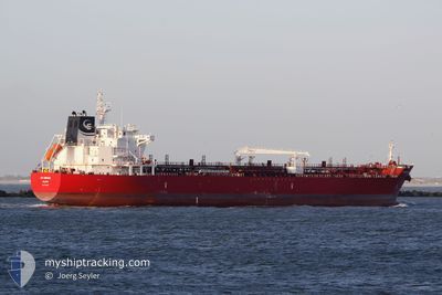
STI BRONX
Tanker
Current Trip
AUDRW
| Time Travelled | 12 days |
|---|---|
| Remaining Time | --- |
| Distance Travelled | 1533.12 nm |
| Remaining Distance | --- |
| AVG Speed | 9.3 Noeuds |
| MAX Speed | 15.1 Noeuds |
| AVG Wind | 5.2 knots |
| MAX Wind | 15 knots |
| MIN Temp | 23.2°C / 73.76°F |
| MAX Temp | 29.8°C / 85.64°F |
| Tirant d eau | 11.8 m |
| Position reçue | 13 d depuis |
Current Position
| Longitude | 130.87787° |
|---|---|
| Latitude | -12.48837° |
| Etat | Moored |
| Vitesse | |
| Parcours | 128° |
| Zone | Timor Sea |
| Station | T-AIS |
| Position reçue | 13 d depuis |
Info
Information
The current position of STI BRONX is in Timor Sea with coordinates -12.48837° / 130.87787° as reported on 2024-04-20 03:47 by AIS to our vessel tracker app. The vessel's current speed is 0 Noeuds
The vessel STI BRONX (IMO: 9706839, MMSI: 538005418) is a Tanker It's sailing under the flag of [MH] Marshall Is.
In this page you can find informations about the vessels current position, last detected port calls, and current voyage information. If the vessels is not in coverage by AIS you will find the latest position.
The current position of STI BRONX is detected by our AIS receivers and we are not responsible for the reliability of the data. The last position was recorded while the vessel was in Coverage by the Ais receivers of our vessel tracking app.
The current draught of STI BRONX as reported by AIS is 11.8 meters
Weather
| Temperature | 28.8°C / 83.84°F |
|---|---|
| Wind Speed | 10 knots |
| Direction | 118° ESE |
| Pressure | 1007.7 hPa |
| Humidity | 80.1 % |
| Cloud Coverage | 75 % |
Featured Company
Last Port Calls
| Port | Arrival | Departure | Time In Port |
|---|---|---|---|
| 2024-04-18 07:16 | 2024-04-21 02:33 | 2 d | |
| 2024-04-08 11:08 | 2024-04-10 02:55 | 1 d | |
| 2024-04-05 20:58 | 2024-04-07 11:03 | 1 d | |
| 2024-03-28 13:13 | 2024-03-30 00:50 | 1 d | |
| 2024-03-06 08:07 | 2024-03-07 10:58 | 1 d |
Most Visited Ports (Last year)
| Port | Arrivals | |
|---|---|---|
| 3 | ||
| 2 | ||
| 2 | ||
| 1 | ||
| 1 | ||
| 1 |
Last Trips
| Origin | Departure | Destination | Arrival | Distance | |
|---|---|---|---|---|---|
| 2024-04-10 10:55 | 2024-04-18 16:46 | 1989.44 nm | |||
| 2024-04-07 19:03 | 2024-04-08 19:08 | 10.45 nm | |||
| 2024-03-30 08:50 | 2024-04-06 04:58 | 474.69 nm | |||
| 2024-03-07 13:58 | 2024-03-28 21:13 | 3814.08 nm | |||
| 2024-02-14 14:41 | 2024-03-06 11:07 | 4603.88 nm |
Events
| Heure | Evenement | Détails | Position/ Destination | Info |
|---|---|---|---|---|
| 2024-04-30 00:58 | Arret |
-1.39598 / 122.48702
AUDRW
|
Vitesse: 0.3 kn Parcours: 219° |
|
| 2024-04-29 20:27 | Démarrage |
-1.36845 / 122.60857
AUDRW
|
Vitesse: 3.3 kn Parcours: 292° |
|
| 2024-04-29 13:55 | Arret |
-1.45743 / 122.49896
AUDRW
|
Vitesse: 0.1 kn Parcours: 184° |
|
| 2024-04-29 12:15 | Démarrage |
-1.37536 / 122.58329
AUDRW
|
Vitesse: 3.2 kn Parcours: 206° |
|
| 2024-04-29 07:59 | Arret |
-1.46870 / 122.52445
AUDRW
|
Vitesse: Parcours: 227° |
|
| 2024-04-29 07:07 | Démarrage |
-1.43446 / 122.60677
AUDRW
|
Vitesse: 5.9 kn Parcours: 235° |
|
| 2024-04-29 03:43 | Arret |
-1.47272 / 122.54736
AUDRW
|
Vitesse: 0.1 kn Parcours: 200° |
|
| 2024-04-28 18:57 | Démarrage |
-1.59997 / 122.56785
AUDRW
|
Vitesse: 4.1 kn Parcours: 199° |
|
| 2024-04-28 14:23 | Arret |
-1.65579 / 122.54597
AUDRW
|
Vitesse: 0.3 kn Parcours: 280° |
|
| 2024-04-28 03:35 | Arret |
-1.71100 / 122.54459
AUDRW
|
Vitesse: 0.3 kn Parcours: 320° |