
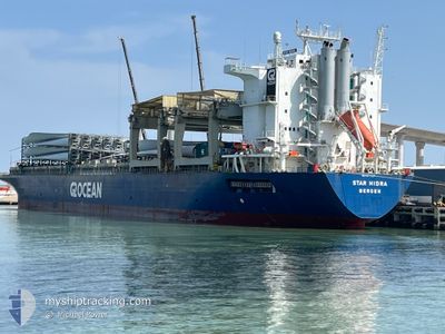
STAR HIDRA
General Cargo
Current Trip
| Time Travelled | 1 day |
|---|---|
| Remaining Time | --- |
| Distance Travelled | 410.12 nm |
| Remaining Distance | --- |
| AVG Speed | 9.5 Noeuds |
| MAX Speed | 12.4 Noeuds |
| AVG Wind | 10.7 knots |
| MAX Wind | 18 knots |
| MIN Temp | 26.6°C / 79.88°F |
| MAX Temp | 28.1°C / 82.58°F |
| Tirant d eau | 10 m |
| Position reçue | 1 m depuis |
Current Position
| Longitude | --- |
|---|---|
| Latitude | --- |
| Etat | Under way using engine |
| Vitesse | 0.5 Noeuds |
| Parcours | 174° |
| Zone | South China Sea |
| Station | T-AIS |
| Position reçue | 1 m depuis |
Info
Information
The current position of STAR HIDRA is in South China Sea with coordinates 22.51566° / 120.15099° as reported on 2024-10-07 03:33 by AIS to our vessel tracker app. The vessel's current speed is 0.5 Noeuds
The vessel STAR HIDRA (IMO: 9071569, MMSI: 258964000) is a General Cargo that was built in 1994 ( 30 Age ). It's sailing under the flag of [NO] Norway.
In this page you can find informations about the vessels current position, last detected port calls, and current voyage information. If the vessels is not in coverage by AIS you will find the latest position.
The current position of STAR HIDRA is detected by our AIS receivers and we are not responsible for the reliability of the data. The last position was recorded while the vessel was in Coverage by the Ais receivers of our vessel tracking app.
The current draught of STAR HIDRA as reported by AIS is 10 meters
Weather
| Temperature | 28.1°C / 82.58°F |
|---|---|
| Wind Speed | 8 knots |
| Direction | 258° WSW |
| Pressure | 1013.6 hPa |
| Humidity | 76.1 % |
| Cloud Coverage | 99 % |
Featured Company
Events
| Heure | Evenement | Détails | Position/ Destination | Info |
|---|---|---|---|---|
| 2024-10-07 02:43 | Tirant d'eau modifié | 10 7.3 |
22.52259 / 120.14704
TWKHH
|
Vitesse: 0.4 kn Parcours: 157° |
| 2024-10-07 02:43 | Changement de destination | TWKHH BRPCL |
22.52259 / 120.14704
TWKHH
|
Vitesse: 0.4 kn Parcours: 157° |
| 2024-10-07 02:43 | Changement d'ETA | 2024/10/07 02:00 2024/08/23 05:30 |
22.52259 / 120.14704
TWKHH
|
Vitesse: 0.4 kn Parcours: 157° |
| 2024-10-07 02:07 | Arret | 8.68 nm, West of KAOHSIUNG |
22.52514 / 120.14385
BRPCL
|
Vitesse: 0.3 kn Parcours: 143° |
| 2024-10-07 01:37 | Etat Changé | Under way using engine Default |
22.52382 / 120.10135
BRPCL
|
Vitesse: 5.9 kn Parcours: 92° |
| 2024-10-07 01:33 | Etat Changé | Default Under way using engine |
22.52412 / 120.09454
BRPCL
|
Vitesse: 5.4 kn Parcours: 92.7° |
| 2024-10-07 01:18 | Démarrage | 12.58 nm, West of KAOHSIUNG |
22.52545 / 120.07173
BRPCL
|
Vitesse: 3.9 kn Parcours: 88° |
| 2024-10-07 00:46 | Arret | 12.83 nm, West of KAOHSIUNG |
22.52764 / 120.06669
BRPCL
|
Vitesse: 0.3 kn Parcours: 50° |
| 2024-10-07 00:24 | Etat Changé | Under way using engine Default |
22.52751 / 120.03809
BRPCL
|
Vitesse: 10.1 kn Parcours: 90° |
| 2024-10-07 00:21 | Etat Changé | Default Under way using engine |
22.52766 / 120.02794
BRPCL
|
Vitesse: 9.7 kn Parcours: 81.5° |