
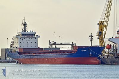
SIYA
General Cargo
Current Trip
| Time Travelled | 11 days |
|---|---|
| Remaining Time | --- |
| Distance Travelled | 224.19 nm |
| Remaining Distance | --- |
| AVG Speed | 10.6 Noeuds |
| MAX Speed | 10.6 Noeuds |
| AVG Wind | 8.9 knots |
| MAX Wind | 16 knots |
| MIN Temp | -0.1°C / 31.82°F |
| MAX Temp | 13.7°C / 56.66°F |
| Tirant d eau | 4.6 m |
| Position reçue | 2 m depuis |
Current Position
| Longitude | --- |
|---|---|
| Latitude | --- |
| Etat | At anchor |
| Vitesse | |
| Parcours | --- |
| Zone | Sea of Marmara |
| Station | T-AIS |
| Position reçue | 2 m depuis |
Info
Information
The current position of SIYA is in Sea of Marmara with coordinates 40.97767° / 28.91891° as reported on 2025-03-07 04:24 by AIS to our vessel tracker app. The vessel's current speed is 0 Noeuds and is heading at the port of NEMRUT. The estimated time of arrival as calculated by MyShipTracking vessel tracking app is 2025-03-08 15:00 LT
The vessel SIYA (IMO: 9442108, MMSI: 636020512) is a General Cargo that was built in 2007 ( 18 Age ). It's sailing under the flag of [LR] Liberia.
In this page you can find informations about the vessels current position, last detected port calls, and current voyage information. If the vessels is not in coverage by AIS you will find the latest position.
The current position of SIYA is detected by our AIS receivers and we are not responsible for the reliability of the data. The last position was recorded while the vessel was in Coverage by the Ais receivers of our vessel tracking app.
The current draught of SIYA as reported by AIS is 4.6 meters
Weather
| Temperature | 6.2°C / 43.16°F |
|---|---|
| Wind Speed | 7 knots |
| Direction | 35° NE |
| Pressure | 1025 hPa |
| Humidity | 57.2 % |
| Cloud Coverage | 1 % |
Featured Company
Last Port Calls
| Port | Arrival | Departure | Time In Port |
|---|---|---|---|
| 2025-02-21 21:38 | 2025-02-23 16:40 | 1 d | |
| 2025-02-06 18:53 | 2025-02-07 20:27 | 1 d | |
| 2025-02-03 12:47 | 2025-02-05 21:51 | 2 d | |
| 2025-01-16 08:23 | 2025-01-22 16:16 | 6 d | |
| 2025-01-01 11:32 | 2025-01-10 23:10 | 9 d |
Last Trips
| Origin | Departure | Destination | Arrival | Distance | |
|---|---|---|---|---|---|
| 2025-02-07 21:27 | 2025-02-21 23:38 | 2809.92 nm | |||
| 2025-02-05 22:51 | 2025-02-06 19:53 | 171.29 nm | |||
| 2025-01-22 17:16 | 2025-02-03 13:47 | 1516.62 nm | |||
| 2025-01-11 00:10 | 2025-01-16 09:23 | 412.71 nm | |||
| 2024-12-26 21:24 | 2025-01-01 12:32 | 975.08 nm |
Events
| Heure | Evenement | Détails | Position/ Destination | Info |
|---|---|---|---|---|
| 2025-03-06 14:15 | Etat Changé | At anchor Default |
40.97966 / 28.92055
TRNEM
|
Vitesse: 0.1 kn Parcours: 246° |
| 2025-03-06 14:12 | Etat Changé | Default At anchor |
40.97973 / 28.92063
TRNEM
|
Vitesse: 0.1 kn Parcours: 240° |
| 2025-03-06 08:22 | Etat Changé | At anchor Under way using engine |
40.97849 / 28.92069
TRNEM
|
Vitesse: 0.2 kn Parcours: 295° |
| 2025-03-06 08:20 | Arret | 1.26 nm, East of ZEYTINBURNU |
40.97848 / 28.92057
TRNEM
|
Vitesse: 0.3 kn Parcours: 296° |
| 2025-03-06 06:14 | Changement de zone | Turkish part of the Sea of Marmara Turkish part of the Black Sea |
41.22550 / 29.12681
Sea of Marmara
TRNEM
|
Vitesse: 10.1 kn Parcours: 191.8° |
| 2025-03-06 05:07 | Démarrage | 9.09 nm, North of RUMELI FENERI |
41.37966 / 29.07149
TRNEM
|
Vitesse: 3.4 kn Parcours: 155° |
| 2025-03-06 04:44 | Arret | 9.26 nm, North of RUMELI FENERI |
41.38198 / 29.06778
TRNEM
|
Vitesse: 0.3 kn Parcours: 121° |
| 2025-03-06 02:56 | Changement de zone | Turkish part of the Black Sea Bulgarian part of the Black Sea |
41.49638 / 29.10481
Black Sea
TRNEM
|
Vitesse: 11.8 kn Parcours: 179.5° |
| 2025-03-06 02:55 | Changement de destination | TRNEM ORDER |
41.49863 / 29.10477
TRNEM
|
Vitesse: 12 kn Parcours: 177.8° |
| 2025-03-06 02:55 | Changement d'ETA | 2025/03/08 15:00 2025/02/23 20:00 |
41.49863 / 29.10477
TRNEM
|
Vitesse: 12 kn Parcours: 177.8° |