

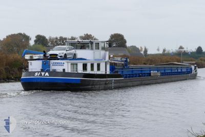
SITA
Not available

Current Trip
SITA is out of coverage. Learn how you can join the community and extend the coverage to your area by clicking here!
Unknown
Destination Port
ETA*
2026-03-30 20:00 UTC
| Time Travelled | 4 days |
|---|---|
| Remaining Time | --- |
| Distance Travelled | 103.36 nm |
| Remaining Distance | --- |
| AVG Speed | 5.6 Noeuds |
| MAX Speed | 6.7 Noeuds |
| AVG Wind | 6.7 knots |
| MAX Wind | 9.7 knots |
| MIN Temp | 4.5°C / 40.1°F |
| MAX Temp | 14°C / 57.2°F |
| Tirant d eau | 0 m |
| Position reçue | 1 d depuis |
Current Position
| Longitude | --- |
|---|---|
| Latitude | --- |
| Etat | Under way using engine |
| Vitesse | 4.4 Noeuds |
| Parcours | 30.9° |
| Zone | North Sea |
| Station | T-AIS |
| Position reçue | 1 d depuis |
Information
The current position of SITA is in North Sea with coordinates 52.82434° / 7.26946° as reported on 2025-04-11 07:48 by AIS to our vessel tracker app. The vessel's current speed is 4.4 Noeuds
The vessel SITA (MMSI: 244395729) is a Not available It's sailing under the flag of [NL] Netherlands.
In this page you can find informations about the vessels current position, last detected port calls, and current voyage information. If the vessels is not in coverage by AIS you will find the latest position.
The current position of SITA is detected by our AIS receivers and we are not responsible for the reliability of the data. The last position was recorded while the vessel was in Coverage by the Ais receivers of our vessel tracking app.
Weather
| Temperature | 8.5°C / 47.3°F |
|---|---|
| Wind Speed | 9 knots |
| Direction | 270° W |
| Pressure | 1021 hPa |
| Humidity | 78.9 % |
| Cloud Coverage | --- |


Featured Company
Limited time offer - Install a base station receiver to your area and list your company on MyShipTracking Free forever!
Last Port Calls
| Port | Arrival | Departure | Time In Port |
|---|---|---|---|
| 2025-04-08 10:00 | 2025-04-08 13:49 | 3 h | |
| 2025-04-07 11:19 | 2025-04-07 13:15 | 1 h | |
| 2025-04-03 15:36 | 2025-04-07 11:15 | 3 d | |
| 2025-04-02 08:24 | 2025-04-02 09:08 | 44 m | |
| 2025-04-02 05:51 | 2025-04-02 06:21 | 29 m | |
| 2025-03-31 13:43 | 2025-03-31 14:10 | 27 m | |
| 2025-03-31 05:17 | 2025-03-31 08:15 | 2 h | |
| 2025-03-30 07:46 | 2025-03-31 04:09 | 20 h | |
| 2025-03-29 11:01 | 2025-03-29 11:16 | 15 m | |
| 2025-03-26 07:02 | 2025-03-28 15:58 | 2 d |
Last Trips
| Origin | Departure | Destination | Arrival | Distance | |
|---|---|---|---|---|---|
| 2025-04-07 15:15 | 2025-04-08 12:00 | 47.99 nm | |||
| 2025-04-07 13:15 | 2025-04-07 13:19 | 0.29 nm | |||
| 2025-04-02 11:08 | 2025-04-03 17:36 | 95.25 nm | |||
| 2025-04-02 08:21 | 2025-04-02 10:24 | 11.58 nm | |||
| 2025-03-31 16:10 | 2025-04-02 07:51 | 113.62 nm | |||
| 2025-03-31 10:15 | 2025-03-31 15:43 | 34.27 nm | |||
| 2025-03-31 06:09 | 2025-03-31 07:17 | 7.46 nm | |||
| 2025-03-29 12:16 | 2025-03-30 09:46 | 29.28 nm | |||
| 2025-03-28 16:58 | 2025-03-29 12:01 | 70.88 nm | |||
| 2025-03-24 14:37 | 2025-03-26 08:02 | 135.73 nm |
Events
| Heure | Evenement | Détails | Position/ Destination | Info |
|---|---|---|---|---|
| 2025-04-11 07:48 | Hors de la zone couverte |
52.82434 / 7.26946
North Sea
|
Vitesse: 4.4 kn Parcours: 30.9° |
|
| 2025-04-11 07:39 | Dans la zone couverte |
52.81781 / 7.24919
North Sea
|
Vitesse: 6.2 kn Parcours: 56° |
|
| 2025-04-10 05:30 | Hors de la zone couverte |
52.37801 / 7.88171
North Sea
|
Vitesse: 5.4 kn Parcours: 263.2° |
|
| 2025-04-10 03:55 | Démarrage | 4.1 nm, East of BRAMSCHE |
52.41292 / 8.10564
|
Vitesse: 3.5 kn Parcours: 269.5° |
| 2025-04-09 19:27 | Arret | 4.21 nm, East of BRAMSCHE |
52.41308 / 8.10870
|
Vitesse: 0.3 kn Parcours: 511° |
| 2025-04-09 18:18 | Dans la zone couverte |
52.35844 / 8.23245
North Sea
|
Vitesse: 3.9 kn Parcours: 319.2° |
|
| 2025-04-09 13:27 | Hors de la zone couverte |
52.30179 / 8.91675
North Sea
|
Vitesse: 5.6 kn Parcours: 264.1° |
|
| 2025-04-09 12:35 | Dans la zone couverte |
52.30187 / 9.03235
North Sea
|
Vitesse: 3.2 kn Parcours: 234.8° |
|
| 2025-04-09 05:27 | Hors de la zone couverte |
52.37505 / 9.18481
North Sea
|
Vitesse: Parcours: 511° |
|
| 2025-04-09 04:30 | Dans la zone couverte |
52.37506 / 9.18478
North Sea
|
Vitesse: Parcours: 511° |