

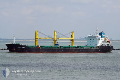
SIDER KING
Bulk Carrier

Current Trip
| Time Travelled | 5 days |
|---|---|
| Remaining Time | --- |
| Distance Travelled | 694.74 nm |
| Remaining Distance | --- |
| AVG Speed | 11.2 Noeuds |
| MAX Speed | 13.2 Noeuds |
| AVG Wind | 6.9 knots |
| MAX Wind | 21 knots |
| MIN Temp | 12.8°C / 55.04°F |
| MAX Temp | 21.9°C / 71.42°F |
| Tirant d eau | 10 m |
| Position reçue | 1 m depuis |
Current Position
| Longitude | --- |
|---|---|
| Latitude | --- |
| Etat | Under way using engine |
| Vitesse | 10.7 Noeuds |
| Parcours | 311.8° |
| Zone | Aegean Sea |
| Station | T-AIS |
| Position reçue | 1 m depuis |
Information
The current position of SIDER KING is in Aegean Sea with coordinates 35.99566° / 27.35585° as reported on 2025-03-28 20:23 by AIS to our vessel tracker app. The vessel's current speed is 10.7 Noeuds and is heading at the port of SETE. The estimated time of arrival as calculated by MyShipTracking vessel tracking app is 2025-04-02 14:00 LT
The vessel SIDER KING (IMO: 9615913, MMSI: 255806375) is a Bulk Carrier that was built in 2011 ( 14 Age ). It's sailing under the flag of [PT] Portugal.
In this page you can find informations about the vessels current position, last detected port calls, and current voyage information. If the vessels is not in coverage by AIS you will find the latest position.
The current position of SIDER KING is detected by our AIS receivers and we are not responsible for the reliability of the data. The last position was recorded while the vessel was in Coverage by the Ais receivers of our vessel tracking app.
The current draught of SIDER KING as reported by AIS is 10 meters
Weather
| Temperature | 16.2°C / 61.16°F |
|---|---|
| Wind Speed | 9 knots |
| Direction | 284° WNW |
| Pressure | 1008.5 hPa |
| Humidity | 72.6 % |
| Cloud Coverage | --- |


Featured Company
Last Port Calls
| Port | Arrival | Departure | Time In Port |
|---|---|---|---|
| 2025-03-19 00:35 | 2025-03-23 08:35 | 4 d | |
| 2025-03-16 01:10 | 2025-03-17 01:33 | 1 d | |
| 2025-02-22 11:46 | 2025-02-28 06:55 | 5 d | |
| 2025-02-15 10:49 | 2025-02-20 23:17 | 5 d | |
| 2025-02-14 22:38 | 2025-02-15 08:38 | 10 h | |
| 2025-02-02 08:08 | 2025-02-03 19:46 | 1 d | |
| 2025-01-09 10:12 | 2025-01-29 16:24 | 20 d | |
| 2025-01-04 04:46 |
Last Trips
| Origin | Departure | Destination | Arrival | Distance | |
|---|---|---|---|---|---|
| 2025-03-17 01:33 | 2025-03-19 00:35 | 17.27 nm | |||
| 2025-02-28 06:55 | 2025-03-16 01:10 | 3040.74 nm | |||
| 2025-02-20 23:17 | 2025-02-22 11:46 | 301.86 nm | |||
| 2025-02-03 19:46 | 2025-02-15 10:49 | 2905.90 nm | |||
| 2025-02-03 19:46 | 2025-02-14 22:38 | 2885.36 nm | |||
| 2025-01-29 16:24 | 2025-02-02 08:08 | 228.80 nm | |||
| 2025-01-04 04:46 | 2025-01-09 10:12 | 902.09 nm |
Events
| Heure | Evenement | Détails | Position/ Destination | Info |
|---|---|---|---|---|
| 2025-03-28 19:05 | Changement de zone | Greek part of the Aegean Sea Greek part of the Mediterranean Sea - Eastern Basin |
35.82645 / 27.55378
Aegean Sea
FRSET
|
Vitesse: 10.6 kn Parcours: 315.9° |
| 2025-03-28 19:05 | Etat Changé | Under way using engine Default |
35.82645 / 27.55378
FRSET
|
Vitesse: 10.7 kn Parcours: 270° |
| 2025-03-28 18:25 | Etat Changé | Default Under way using engine |
35.76227 / 27.67065
FRSET
|
Vitesse: 10.5 kn Parcours: 268.9° |
| 2025-03-28 13:14 | Changement de zone | Greek part of the Mediterranean Sea - Eastern Basin Turkish part of the Mediterranean Sea - Eastern Basin |
35.79840 / 28.77803
Mediterranean Sea - Eastern Basin
FRSET
|
Vitesse: 10.3 kn Parcours: 263.8° |
| 2025-03-28 11:24 | Changement de zone | Turkish part of the Mediterranean Sea - Eastern Basin Greek part of the Mediterranean Sea - Eastern Basin |
35.81526 / 29.17826
Mediterranean Sea - Eastern Basin
FRSET
|
Vitesse: 11.1 kn Parcours: 269° |
| 2025-03-28 11:08 | Dans la zone couverte |
35.81620 / 29.23578
Mediterranean Sea - Eastern Basin
FRSET
|
Vitesse: 11.3 kn Parcours: 266.9° |
|
| 2025-03-28 09:41 | Hors de la zone couverte |
35.82681 / 29.57824
Mediterranean Sea - Eastern Basin
FRSET
|
Vitesse: 11.5 kn Parcours: 265.9° |
|
| 2025-03-28 09:15 | Tirant d'eau modifié | 10 5.4 |
35.83275 / 29.67977
FRSET
|
Vitesse: 11.6 kn Parcours: 266.7° |
| 2025-03-28 09:15 | Changement de destination | FRSET TRYIK |
35.83275 / 29.67977
FRSET
|
Vitesse: 11.6 kn Parcours: 266.7° |
| 2025-03-28 09:15 | Changement d'ETA | 2025/04/02 12:00 2025/03/24 16:30 |
35.83275 / 29.67977
FRSET
|
Vitesse: 11.6 kn Parcours: 266.7° |