
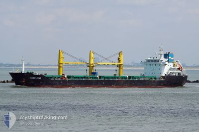
SIDER KING
Bulk Carrier
Current Trip
| Time Travelled | 12 days |
|---|---|
| Remaining Time | --- |
| Distance Travelled | 2741.08 nm |
| Remaining Distance | --- |
| AVG Speed | 10.5 Knots |
| MAX Speed | 12.9 Knots |
| AVG Wind | 15.6 knots |
| MAX Wind | 30.3 knots |
| MIN Temp | 11.8°C / 53.24°F |
| MAX Temp | 21.6°C / 70.88°F |
| Dybgang | 9.6 m |
| Position Modtaget | 5 d siden |
Current Position
| Longitude | --- |
|---|---|
| Latitude | --- |
| Status | Under way using engine |
| Fart | 12.1 Knots |
| Kurs | 111.8° |
| Område | Mediterranean Sea - Eastern Basin |
| Station | T-AIS |
| Position Modtaget | 5 d siden |
Info
Information
The current position of SIDER KING is in Mediterranean Sea - Eastern Basin with coordinates 36.27076° / 14.57521° as reported on 2024-11-21 10:30 by AIS to our vessel tracker app. The vessel's current speed is 12.1 Knots
The vessel SIDER KING (IMO: 9615913, MMSI: 255806375) is a Bulk Carrier that was built in 2011 ( 13 år gamle ). It's sailing under the flag of [PT] Portugal.
In this page you can find informations about the vessels current position, last detected port calls, and current voyage information. If the vessels is not in coverage by AIS you will find the latest position.
The current position of SIDER KING is detected by our AIS receivers and we are not responsible for the reliability of the data. The last position was recorded while the vessel was in Coverage by the Ais receivers of our vessel tracking app.
The current draught of SIDER KING as reported by AIS is 9.6 meters
Weather
| Temperature | 17.5°C / 63.5°F |
|---|---|
| Wind Speed | 10 knots |
| Direction | 325° NW |
| Pressure | 1021.2 hPa |
| Humidity | 53.4 % |
| Cloud Coverage | 30 % |
Featured Company
Last Port Calls
| Port | Arrival | Departure | Time In Port |
|---|---|---|---|
| 2024-11-11 11:43 | 2024-11-13 22:50 | 2 d | |
| 2024-11-03 18:01 | 2024-11-08 08:39 | 4 d | |
| 2024-10-16 13:59 | 2024-10-22 12:01 | 5 d | |
| 2024-10-11 18:54 | 2024-10-15 23:16 | 4 d | |
| 2024-10-02 17:31 | 2024-10-07 17:04 | 4 d | |
| 2024-09-22 19:05 | 2024-09-24 13:21 | 1 d | |
| 2024-09-14 09:55 | 2024-09-15 07:27 | 21 h | |
| 2024-09-05 22:22 | 2024-09-11 23:04 | 6 d | |
| 2024-09-01 13:00 | 2024-09-02 19:19 | 1 d |
Most Visited Ports (Last year)
| Port | Arrivals | |
|---|---|---|
| 5 | ||
| 4 | ||
| 3 | ||
| 3 | ||
| 2 | ||
| 2 |
Last Trips
| Origin | Departure | Destination | Arrival | Distance | |
|---|---|---|---|---|---|
| 2024-11-08 08:39 | 2024-11-11 11:43 | 885.30 nm | |||
| 2024-10-22 12:01 | 2024-11-03 18:01 | 3046.46 nm | |||
| 2024-10-15 23:16 | 2024-10-16 13:59 | 2.79 nm | |||
| 2024-10-07 17:04 | 2024-10-11 18:54 | 888.82 nm | |||
| 2024-09-24 13:21 | 2024-10-02 17:31 | 1428.07 nm | |||
| 2024-09-15 07:27 | 2024-09-22 19:05 | 1853.65 nm | |||
| 2024-09-11 23:04 | 2024-09-14 09:55 | 538.61 nm | |||
| 2024-09-02 19:19 | 2024-09-05 22:22 | 538.16 nm | |||
| 2024-08-30 15:43 | 2024-09-01 13:00 | 498.84 nm |
Events
| Tid | Hændelsen | Detaljer | Position / Dest | Info |
|---|---|---|---|---|
| 2024-11-26 16:45 | START Sejllads | 4.98 nm, North West of EL DEKHEILA |
31.21995 / 29.76088
EGALY
|
Fart: 4.9 kn Kurs: 96° |
| 2024-11-24 17:06 | STOP Sejllads | 5.17 nm, North West of EL DEKHEILA |
31.21768 / 29.74943
EGALY
|
Fart: 0.3 kn Kurs: 354° |
| 2024-11-21 10:36 | Status er ændret | Default Under way using engine |
36.26204 / 14.60153
EGALY
|
Fart: 12.1 kn Kurs: 111.8° |
| 2024-11-21 10:30 | Udenfor Dækning |
36.27076 / 14.57521
Mediterranean Sea - Eastern Basin
EGALY
|
Fart: 12.1 kn Kurs: 111.8° |
|
| 2024-11-21 10:17 | Status er ændret | Under way using engine Default |
36.28660 / 14.52589
EGALY
|
Fart: 12 kn Kurs: 112° |
| 2024-11-21 10:12 | Status er ændret | Default Under way using engine |
36.29248 / 14.50781
EGALY
|
Fart: 12 kn Kurs: 112° |
| 2024-11-21 09:41 | Status er ændret | Under way using engine Default |
36.32975 / 14.38740
EGALY
|
Fart: 12 kn Kurs: 111° |
| 2024-11-21 09:37 | Status er ændret | Default Under way using engine |
36.33493 / 14.37131
EGALY
|
Fart: 12 kn Kurs: 111.1° |
| 2024-11-21 08:30 | Ændre havområde | Maltese part of the Mediterranean Sea - Eastern Basin Algerian part of the Mediterranean Sea - Western Basin |
36.41931 / 14.10777
Mediterranean Sea - Eastern Basin
EGALY
|
Fart: 11.9 kn Kurs: 112.5° |
| 2024-11-21 08:29 | Status er ændret | Under way using engine Default |
36.42079 / 14.10338
EGALY
|
Fart: 12 kn Kurs: 111° |