
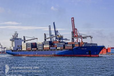
SEASPAN LOGA
Container Ship
Current Trip
GTSTC
| Time Travelled | 1 h, 26 mins |
|---|---|
| Remaining Time | --- |
| Distance Travelled | 18.13 nm |
| Remaining Distance | --- |
| AVG Speed | 14.6 Noeuds |
| MAX Speed | 19.1 Noeuds |
| AVG Wind | 3.4 knots |
| MAX Wind | 6.2 knots |
| MIN Temp | 27.8°C / 82.04°F |
| MAX Temp | 29.4°C / 84.92°F |
| Tirant d eau | 9.5 m |
| Position reçue | 11 d depuis |
Current Position
| Longitude | -79.72658° |
|---|---|
| Latitude | 24.84269° |
| Etat | Under way using engine |
| Vitesse | 17.8 Noeuds |
| Parcours | 198.1° |
| Zone | North Atlantic Ocean |
| Station | T-AIS |
| Position reçue | 11 d depuis |
Info
Information
The current position of SEASPAN LOGA is in North Atlantic Ocean with coordinates 24.84269° / -79.72658° as reported on 2024-09-11 04:00 by AIS to our vessel tracker app. The vessel's current speed is 17.8 Noeuds
The vessel SEASPAN LOGA (IMO: 9320001, MMSI: 477308400) is a Container Ship that was built in 2005 ( 19 Age ). It's sailing under the flag of [HK] Hong Kong.
In this page you can find informations about the vessels current position, last detected port calls, and current voyage information. If the vessels is not in coverage by AIS you will find the latest position.
The current position of SEASPAN LOGA is detected by our AIS receivers and we are not responsible for the reliability of the data. The last position was recorded while the vessel was in Coverage by the Ais receivers of our vessel tracking app.
The current draught of SEASPAN LOGA as reported by AIS is 9.5 meters
Weather
| Temperature | 28.4°C / 83.12°F |
|---|---|
| Wind Speed | 5 knots |
| Direction | 95° E |
| Pressure | 1008.5 hPa |
| Humidity | 71.8 % |
| Cloud Coverage | 69 % |
Featured Company
Last Port Calls
| Port | Arrival | Departure | Time In Port |
|---|---|---|---|
| 2024-09-21 15:03 | 2024-09-22 11:19 | 20 h | |
| 2024-09-20 12:17 | 2024-09-21 07:55 | 19 h | |
| 2024-09-16 19:38 | 2024-09-18 11:15 | 1 d | |
| 2024-09-14 03:52 | 2024-09-14 18:21 | 14 h | |
| 2024-09-13 06:47 | 2024-09-13 22:55 | 16 h | |
| 2024-09-10 05:23 | 2024-09-10 18:09 | 12 h | |
| 2024-09-10 04:51 | 2024-09-10 05:02 | 11 m | |
| 2024-09-08 03:36 | 2024-09-09 01:36 | 21 h | |
| 2024-09-07 04:52 | 2024-09-07 13:07 | 8 h | |
| 2024-09-05 15:18 | 2024-09-06 03:30 | 12 h |
Most Visited Ports (Last year)
| Port | Arrivals | |
|---|---|---|
| 23 | ||
| 20 | ||
| 19 | ||
| 19 | ||
| 17 | ||
| 12 |
Last Trips
| Origin | Departure | Destination | Arrival | Distance | |
|---|---|---|---|---|---|
| 2024-09-21 07:55 | 2024-09-21 15:03 | 66.83 nm | |||
| 2024-09-18 11:15 | 2024-09-20 12:17 | 780.15 nm | |||
| 2024-09-14 18:21 | 2024-09-16 19:38 | 782.62 nm | |||
| 2024-09-13 22:55 | 2024-09-14 03:52 | 66.27 nm | |||
| 2024-09-10 18:09 | 2024-09-13 06:47 | 927.64 nm | |||
| 2024-09-10 05:02 | 2024-09-10 05:23 | 0.82 nm | |||
| 2024-09-09 01:36 | 2024-09-10 04:51 | 411.63 nm | |||
| 2024-09-07 13:07 | 2024-09-08 03:36 | 231.45 nm | |||
| 2024-09-06 03:30 | 2024-09-07 04:52 | 374.08 nm | |||
| 2024-09-02 00:29 | 2024-09-05 15:18 | 303.19 nm |
Events
| Heure | Evenement | Détails | Position/ Destination | Info |
|---|---|---|---|---|
| 2024-09-22 17:19 | PORT DE DEPART |
|
15.71050 / -88.61803
GTSTC
|
Vitesse: 6.2 kn Parcours: 357° |
| 2024-09-22 17:15 | Démarrage |
15.70078 / -88.61869
[GT] PUERTO SANTO TOMAS
|
Vitesse: 6.2 kn Parcours: 357° |
|
| 2024-09-21 21:15 | Arret |
15.69634 / -88.61720
[GT] PUERTO SANTO TOMAS
|
Vitesse: 0.3 kn Parcours: 242° |
|
| 2024-09-21 21:03 | Port d'arrivée |
|
15.69996 / -88.61693
[GT] PUERTO SANTO TOMAS
|
Vitesse: 2.8 kn Parcours: 145° |
| 2024-09-21 17:43 | Démarrage | 10.41 nm, North East of LIVINGSTON |
15.97773 / -88.66637
GTSTC
|
Vitesse: 6 kn Parcours: 199° |
| 2024-09-21 17:03 | Arret | 10.29 nm, South East of PUNTA GORDA |
15.98253 / -88.67039
GTSTC
|
Vitesse: 0.3 kn Parcours: 225° |
| 2024-09-21 13:55 | PORT DE DEPART |
|
15.84343 / -87.96906
GTSTC
|
Vitesse: 7.4 kn Parcours: 263° |
| 2024-09-21 13:48 | Démarrage |
15.83769 / -87.95762
[HN] PUERTO CORTES
|
Vitesse: 7.4 kn Parcours: 263° |
|
| 2024-09-20 18:52 | Arret |
15.83794 / -87.94087
[HN] PUERTO CORTES
|
Vitesse: Parcours: 332° |
|
| 2024-09-20 18:17 | Port d'arrivée |
|
15.83637 / -87.95683
[HN] PUERTO CORTES
|
Vitesse: 4.3 kn Parcours: 182° |