
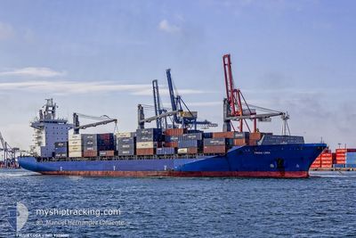
SEASPAN LOGA
Container Ship
Current Trip
| Time Travelled | 1 day |
|---|---|
| Remaining Time | 15 h, 0 mins |
| Distance Travelled | 489.35 nm |
| Remaining Distance | 399.32 nm |
| AVG Speed | 16.4 Knots |
| MAX Speed | 17.7 Knots |
| AVG Wind | 12.2 knots |
| MAX Wind | 18 knots |
| MIN Temp | 22.4°C / 72.32°F |
| MAX Temp | 26.9°C / 80.42°F |
| Dybgang | 10.4 m |
| Position Modtaget | 8 d siden |
Current Position
| Longitude | --- |
|---|---|
| Latitude | --- |
| Status | Under way using engine |
| Fart | 13.1 Knots |
| Kurs | 238.6° |
| Område | North Atlantic Ocean |
| Station | T-AIS |
| Position Modtaget | 8 d siden |
Info
Information
The current position of SEASPAN LOGA is in North Atlantic Ocean with coordinates 23.96436° / -80.93139° as reported on 2025-02-09 04:52 by AIS to our vessel tracker app. The vessel's current speed is 13.1 Knots and is heading at the port of PUERTO SANTO TOMAS. The estimated time of arrival as calculated by MyShipTracking vessel tracking app is 2025-02-18 00:35 LT
The vessel SEASPAN LOGA (IMO: 9320001, MMSI: 477308400) is a Container Ship that was built in 2005 ( 20 år gamle ). It's sailing under the flag of [HK] Hong Kong.
In this page you can find informations about the vessels current position, last detected port calls, and current voyage information. If the vessels is not in coverage by AIS you will find the latest position.
The current position of SEASPAN LOGA is detected by our AIS receivers and we are not responsible for the reliability of the data. The last position was recorded while the vessel was in Coverage by the Ais receivers of our vessel tracking app.
The current draught of SEASPAN LOGA as reported by AIS is 10.4 meters
Weather
| Temperature | 26.8°C / 80.24°F |
|---|---|
| Wind Speed | 13 knots |
| Direction | 67° ENE |
| Pressure | 1015 hPa |
| Humidity | 77.5 % |
| Cloud Coverage | 75 % |
Featured Company
Last Port Calls
| Port | Arrival | Departure | Time In Port |
|---|---|---|---|
| 2025-02-14 18:17 | 2025-02-16 03:19 | 1 d | |
| 2025-02-11 08:39 | 2025-02-12 19:22 | 1 d | |
| 2025-02-07 20:12 | 2025-02-08 09:02 | 12 h | |
| 2025-02-07 19:40 | 2025-02-07 19:51 | 10 m | |
| 2025-02-04 17:58 | 2025-02-06 00:04 | 1 d | |
| 2025-01-27 23:50 | 2025-01-28 09:37 | 9 h | |
| 2025-01-17 08:23 | 2025-01-18 02:04 | 17 h | |
| 2025-01-16 02:38 | 2025-01-16 17:52 | 15 h | |
| 2025-01-11 10:53 | 2025-01-11 23:14 | 12 h | |
| 2025-01-10 06:06 | 2025-01-10 17:25 | 11 h |
Most Visited Ports (Last year)
| Port | Arrivals | |
|---|---|---|
| 24 | ||
| 22 | ||
| 22 | ||
| 22 | ||
| 21 | ||
| 13 |
Last Trips
| Origin | Departure | Destination | Arrival | Distance | |
|---|---|---|---|---|---|
| 2025-02-12 19:22 | 2025-02-14 18:17 | 135.75 nm | |||
| 2025-02-08 09:02 | 2025-02-11 08:39 | 930.42 nm | |||
| 2025-02-07 19:51 | 2025-02-07 20:12 | 0.98 nm | |||
| 2025-02-06 00:04 | 2025-02-07 19:40 | 437.15 nm | |||
| 2025-01-28 09:37 | 2025-02-04 17:58 | 908.86 nm | |||
| 2025-01-18 02:04 | 2025-01-27 23:50 | 3106.57 nm | |||
| 2025-01-16 17:52 | 2025-01-17 08:23 | 81.20 nm | |||
| 2025-01-11 23:14 | 2025-01-16 02:38 | 1288.77 nm | |||
| 2025-01-10 17:25 | 2025-01-11 10:53 | 230.47 nm | |||
| 2025-01-08 08:46 | 2025-01-10 06:06 | 556.38 nm |
Events
| Tid | Hændelsen | Detaljer | Position / Dest | Info |
|---|---|---|---|---|
| 2025-02-16 09:19 | Afsejlet fra sidste havn |
|
15.84660 / -87.96978
GTSTC
|
Fart: 4.7 kn Kurs: 266° |
| 2025-02-16 09:06 | START Sejllads |
15.83876 / -87.94844
[HN] PUERTO CORTES
|
Fart: 4.7 kn Kurs: 266° |
|
| 2025-02-15 00:46 | STOP Sejllads |
15.83811 / -87.94106
[HN] PUERTO CORTES
|
Fart: 0.2 kn Kurs: 331° |
|
| 2025-02-15 00:17 | Skibe i havn |
|
15.83667 / -87.95864
[HN] PUERTO CORTES
|
Fart: 3.3 kn Kurs: 117° |
| 2025-02-13 23:39 | START Sejllads | 11.64 nm, North West of OMOA |
15.96125 / -88.12961
GTSTC
|
Fart: 3.9 kn Kurs: 11° |
| 2025-02-13 13:58 | STOP Sejllads | 13.4 nm, North West of PUERTO CORTES |
16.01300 / -88.08160
GTSTC
|
Fart: 0.3 kn Kurs: 323° |
| 2025-02-13 01:23 | START Sejllads | 0.87 nm, North of PUERTO SANTO TOMAS |
15.71297 / -88.61753
GTSTC
|
Fart: 9.2 kn Kurs: 8° |
| 2025-02-13 01:22 | Afsejlet fra sidste havn |
|
15.71297 / -88.61753
GTSTC
|
Fart: 0.7 kn Kurs: 326° |
| 2025-02-11 14:51 | STOP Sejllads |
15.69713 / -88.61588
[GT] PUERTO SANTO TOMAS
|
Fart: 0.3 kn Kurs: 62° |
|
| 2025-02-11 14:39 | Skibe i havn |
|
15.69991 / -88.61815
[GT] PUERTO SANTO TOMAS
|
Fart: 3.4 kn Kurs: 172° |