
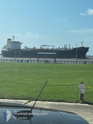
SEAKAY VALOR
Oil/Chemical Tanker
Current Trip
USSAB
| Time Travelled | 1 day |
|---|---|
| Remaining Time | --- |
| Distance Travelled | 33.15 nm |
| Remaining Distance | --- |
| AVG Speed | 8.1 Noeuds |
| MAX Speed | 12.4 Noeuds |
| AVG Wind | 7 knots |
| MAX Wind | 11 knots |
| MIN Temp | 6°C / 42.8°F |
| MAX Temp | 7.7°C / 45.86°F |
| Tirant d eau | 8.9 m |
| Position reçue | 4 m depuis |
Current Position
| Longitude | --- |
|---|---|
| Latitude | --- |
| Etat | Moored |
| Vitesse | |
| Parcours | 64° |
| Zone | Gulf of Mexico |
| Station | T-AIS |
| Position reçue | 4 m depuis |
Information
The current position of SEAKAY VALOR is in Gulf of Mexico with coordinates 30.03522° / -94.03624° as reported on 2025-02-25 01:21 by AIS to our vessel tracker app. The vessel's current speed is 0 Noeuds
The vessel SEAKAY VALOR (IMO: 9353541, MMSI: 367381000) is a Oil/Chemical Tanker that was built in 2008 ( 17 Age ). It's sailing under the flag of [US] USA.
In this page you can find informations about the vessels current position, last detected port calls, and current voyage information. If the vessels is not in coverage by AIS you will find the latest position.
The current position of SEAKAY VALOR is detected by our AIS receivers and we are not responsible for the reliability of the data. The last position was recorded while the vessel was in Coverage by the Ais receivers of our vessel tracking app.
The current draught of SEAKAY VALOR as reported by AIS is 8.9 meters
Weather
| Temperature | 13°C / 55.4°F |
|---|---|
| Wind Speed | 5 knots |
| Direction | 99° E |
| Pressure | 1016.9 hPa |
| Humidity | 84.6 % |
| Cloud Coverage | 5 % |
Featured Company
Last Port Calls
| Port | Arrival | Departure | Time In Port |
|---|---|---|---|
| 2025-02-23 02:29 | |||
| 2025-02-23 02:16 | |||
| 2025-02-17 06:55 | 2025-02-19 15:10 | 2 d | |
| 2025-01-28 22:52 | 2025-01-30 22:49 | 1 d | |
| 2025-01-23 21:09 | 2025-01-25 22:14 | 2 d | |
| 2025-01-15 21:43 | 2025-01-17 22:30 | 2 d | |
| 2025-01-05 07:28 | 2025-01-06 19:31 | 1 d | |
| 2024-12-30 09:45 | 2025-01-01 17:10 | 2 d | |
| 2024-12-29 09:23 | 2024-12-29 23:27 | 14 h | |
| 2024-12-24 19:21 | 2024-12-26 23:17 | 2 d |
Most Visited Ports (Last year)
| Port | Arrivals | |
|---|---|---|
| 9 | ||
| 9 | ||
| 7 | ||
| 7 | ||
| 6 | ||
| 4 |
Last Trips
| Origin | Departure | Destination | Arrival | Distance | |
|---|---|---|---|---|---|
| 2025-02-19 10:10 | 2025-02-22 20:29 | 683.70 nm | |||
| 2025-01-30 17:49 | 2025-02-17 01:55 | 1444.20 nm | |||
| 2025-01-25 16:14 | 2025-01-28 17:52 | 720.73 nm | |||
| 2025-01-17 17:30 | 2025-01-23 15:09 | 1681.16 nm | |||
| 2025-01-06 14:31 | 2025-01-15 16:43 | 2350.43 nm | |||
| 2025-01-01 11:10 | 2025-01-05 02:28 | 990.24 nm | |||
| 2024-12-29 17:27 | 2024-12-30 03:45 | 95.76 nm | |||
| 2024-12-26 18:17 | 2024-12-29 03:23 | 816.16 nm | |||
| 2024-12-22 01:47 | 2024-12-24 14:21 | 776.77 nm | |||
| 2024-12-18 03:50 | 2024-12-20 05:06 | 710.46 nm |
Events
| Heure | Evenement | Détails | Position/ Destination | Info |
|---|---|---|---|---|
| 2025-02-24 23:15 | Etat Changé | Moored Default |
30.03524 / -94.03626
USSAB
|
Vitesse: Parcours: 64° |
| 2025-02-24 23:12 | Etat Changé | Default Moored |
30.03524 / -94.03628
USSAB
|
Vitesse: Parcours: 64° |
| 2025-02-23 19:42 | Etat Changé | Moored Default |
30.03522 / -94.03628
USSAB
|
Vitesse: Parcours: 64° |
| 2025-02-23 19:33 | Etat Changé | Default Moored |
30.03524 / -94.03624
USSAB
|
Vitesse: Parcours: 64° |
| 2025-02-23 17:59 | Etat Changé | Moored Default |
30.03521 / -94.03625
USSAB
|
Vitesse: Parcours: 64° |
| 2025-02-23 17:54 | Etat Changé | Default Moored |
30.03522 / -94.03625
USSAB
|
Vitesse: Parcours: 64° |
| 2025-02-23 15:56 | Etat Changé | Moored Default |
30.03520 / -94.03625
USSAB
|
Vitesse: Parcours: 64° |
| 2025-02-23 15:53 | Etat Changé | Default Moored |
30.03522 / -94.03628
USSAB
|
Vitesse: Parcours: 64° |
| 2025-02-23 14:56 | Etat Changé | Moored Default |
30.03521 / -94.03627
USSAB
|
Vitesse: Parcours: 64° |
| 2025-02-23 14:53 | Etat Changé | Default Moored |
30.03523 / -94.03627
USSAB
|
Vitesse: Parcours: 64° |