

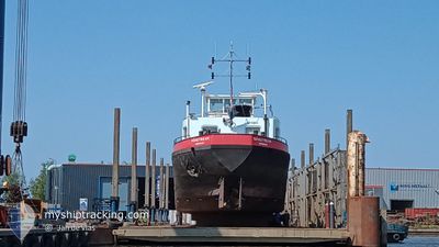
SANSTREAM
Cargo

Current Trip
DEN HELDER
| Time Travelled | 15 days |
|---|---|
| Remaining Time | --- |
| Distance Travelled | 16.46 nm |
| Remaining Distance | --- |
| AVG Speed | 4.8 Noeuds |
| MAX Speed | 6.3 Noeuds |
| AVG Wind | 1.1 knots |
| MAX Wind | 10 knots |
| MIN Temp | -4.2°C / 24.44°F |
| MAX Temp | 7.3°C / 45.14°F |
| Tirant d eau | 0.2 m |
| Position reçue | 2 m depuis |
Current Position
| Longitude | --- |
|---|---|
| Latitude | --- |
| Etat | Under way using engine |
| Vitesse | |
| Parcours | --- |
| Zone | North Sea |
| Station | T-AIS |
| Position reçue | 2 m depuis |
Information
The current position of SANSTREAM is in North Sea with coordinates 53.00187° / 5.65398° as reported on 2025-03-02 01:40 by AIS to our vessel tracker app. The vessel's current speed is 0 Noeuds
The vessel SANSTREAM (MMSI: 244700803) is a Cargo It's sailing under the flag of [NL] Netherlands.
In this page you can find informations about the vessels current position, last detected port calls, and current voyage information. If the vessels is not in coverage by AIS you will find the latest position.
The current position of SANSTREAM is detected by our AIS receivers and we are not responsible for the reliability of the data. The last position was recorded while the vessel was in Coverage by the Ais receivers of our vessel tracking app.
The current draught of SANSTREAM as reported by AIS is 0.2 meters
Weather
| Temperature | 1.7°C / 35.06°F |
|---|---|
| Wind Speed | 3 knots |
| Direction | 283° WNW |
| Pressure | 1035.7 hPa |
| Humidity | 90.2 % |
| Cloud Coverage | 100 % |


Featured Company
Last Port Calls
| Port | Arrival | Departure | Time In Port |
|---|---|---|---|
| 2025-02-14 12:07 | 2025-02-14 12:24 | 16 m | |
| 2025-02-13 22:32 | 2025-02-14 09:49 | 11 h | |
| 2025-02-13 09:49 | 2025-02-13 20:36 | 10 h | |
| 2025-02-12 22:54 | 2025-02-13 08:45 | 9 h | |
| 2025-02-12 12:50 | 2025-02-12 15:01 | 2 h | |
| 2025-02-12 09:45 | 2025-02-12 12:08 | 2 h | |
| 2025-02-11 21:21 | 2025-02-12 09:27 | 12 h | |
| 2025-02-11 12:16 | 2025-02-11 19:11 | 6 h | |
| 2025-02-11 01:09 | 2025-02-11 10:43 | 9 h | |
| 2025-02-10 09:40 | 2025-02-10 12:03 | 2 h |
Last Trips
| Origin | Departure | Destination | Arrival | Distance | |
|---|---|---|---|---|---|
| 2025-02-14 09:49 | 2025-02-14 12:07 | 6.42 nm | |||
| 2025-02-13 20:36 | 2025-02-13 22:32 | 9.83 nm | |||
| 2025-02-13 08:45 | 2025-02-13 09:49 | 7.53 nm | |||
| 2025-02-12 15:01 | 2025-02-12 22:54 | 20.95 nm | |||
| 2025-02-12 12:08 | 2025-02-12 12:50 | 2.20 nm | |||
| 2025-02-12 09:27 | 2025-02-12 09:45 | 0.93 nm | |||
| 2025-02-11 19:11 | 2025-02-11 21:21 | 10.12 nm | |||
| 2025-02-11 10:43 | 2025-02-11 12:16 | 7.46 nm | |||
| 2025-02-10 12:03 | 2025-02-11 01:09 | 20.58 nm | |||
| 2025-02-10 07:37 | 2025-02-10 09:40 | 9.74 nm |
Events
| Heure | Evenement | Détails | Position/ Destination | Info |
|---|---|---|---|---|
| 2025-03-01 16:35 | Etat Changé | Under way using engine Default |
53.00184 / 5.65396
DEN HELDER
|
Vitesse: Parcours: -1° |
| 2025-03-01 16:29 | Etat Changé | Default Under way using engine |
53.00185 / 5.65403
DEN HELDER
|
Vitesse: Parcours: 511° |
| 2025-03-01 16:13 | Etat Changé | Under way using engine Default |
53.00182 / 5.65404
DEN HELDER
|
Vitesse: Parcours: -1° |
| 2025-03-01 16:04 | Etat Changé | Default Under way using engine |
53.00181 / 5.65405
DEN HELDER
|
Vitesse: Parcours: 511° |
| 2025-03-01 15:28 | Etat Changé | Under way using engine Default |
53.00188 / 5.65404
DEN HELDER
|
Vitesse: Parcours: -1° |
| 2025-03-01 15:18 | Etat Changé | Default Under way using engine |
53.00189 / 5.65406
DEN HELDER
|
Vitesse: Parcours: 511° |
| 2025-02-25 08:38 | Etat Changé | Under way using engine Default |
53.00195 / 5.65394
DEN HELDER
|
Vitesse: Parcours: -1° |
| 2025-02-25 08:26 | Dans la zone couverte |
53.00196 / 5.65400
North Sea
|
Vitesse: Parcours: 0° |
|
| 2025-02-25 07:40 | Etat Changé | Default Under way using engine |
53.00191 / 5.65393
DEN HELDER
|
Vitesse: Parcours: 511° |
| 2025-02-25 07:22 | Hors de la zone couverte |
53.00188 / 5.65395
North Sea
|
Vitesse: Parcours: 0° |