
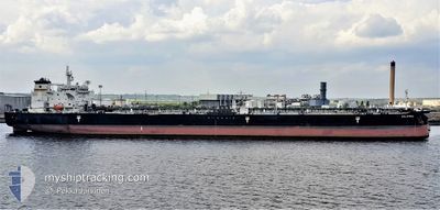
SALAMINA
Crude Oil Tanker
Current Trip
| Time Travelled | 24 days |
|---|---|
| Remaining Time | --- |
| Distance Travelled | 3332.67 nm |
| Remaining Distance | --- |
| AVG Speed | 11.3 Noeuds |
| MAX Speed | 16.6 Noeuds |
| AVG Wind | 10 knots |
| MAX Wind | 27 knots |
| MIN Temp | 22°C / 71.6°F |
| MAX Temp | 30°C / 86°F |
| Tirant d eau | 7.9 m |
| Position reçue | 3 d depuis |
Current Position
| Longitude | --- |
|---|---|
| Latitude | --- |
| Etat | Under way using engine |
| Vitesse | 11.7 Noeuds |
| Parcours | 2.6° |
| Zone | Caribbean Sea |
| Station | T-AIS |
| Position reçue | 3 d depuis |
Info
Information
The current position of SALAMINA is in Caribbean Sea with coordinates 9.81755° / -79.96559° as reported on 2025-02-26 18:08 by AIS to our vessel tracker app. The vessel's current speed is 11.7 Noeuds
The vessel SALAMINA (IMO: 9382968, MMSI: 636014128) is a Crude Oil Tanker that was built in 2009 ( 16 Age ). It's sailing under the flag of [LR] Liberia.
In this page you can find informations about the vessels current position, last detected port calls, and current voyage information. If the vessels is not in coverage by AIS you will find the latest position.
The current position of SALAMINA is detected by our AIS receivers and we are not responsible for the reliability of the data. The last position was recorded while the vessel was in Coverage by the Ais receivers of our vessel tracking app.
The current draught of SALAMINA as reported by AIS is 7.9 meters
Weather
| Temperature | 23.8°C / 74.84°F |
|---|---|
| Wind Speed | 6 knots |
| Direction | 337° NNW |
| Pressure | 1015.8 hPa |
| Humidity | 73.3 % |
| Cloud Coverage | 5 % |
Featured Company
Last Port Calls
| Port | Arrival | Departure | Time In Port |
|---|---|---|---|
| 2025-02-02 11:07 | 2025-02-05 19:51 | 3 d | |
| 2025-01-06 02:50 | 2025-01-07 07:01 | 1 d |
Most Visited Ports (Last year)
| Port | Arrivals | |
|---|---|---|
| 3 | ||
| 3 | ||
| 3 | ||
| 2 | ||
| 2 | ||
| 1 |
Last Trips
| Origin | Departure | Destination | Arrival | Distance | |
|---|---|---|---|---|---|
| 2025-01-07 02:01 | 2025-02-02 07:07 | 1713.89 nm | |||
| 2024-12-02 06:38 | 2025-01-05 21:50 | 4090.76 nm |
Events
| Heure | Evenement | Détails | Position/ Destination | Info |
|---|---|---|---|---|
| 2025-02-26 18:16 | Etat Changé | Default Under way using engine |
9.84877 / -79.96398
PA BLB > PA CTB
|
Vitesse: 11.7 kn Parcours: 2.6° |
| 2025-02-26 18:08 | Hors de la zone couverte |
9.81755 / -79.96559
Caribbean Sea
PA BLB > PA CTB
|
Vitesse: 11.7 kn Parcours: 2.6° |
|
| 2025-02-26 15:49 | Detecté en mer | Panamanian part of the Caribbean Sea |
9.37139 / -79.91879
Caribbean Sea
PA BLB > PA CTB
|
Vitesse: 12.1 kn Parcours: 359.9° |
| 2025-02-26 15:06 | Démarrage | 3.87 nm, South of CRISTOBAL |
9.28260 / -79.92132
PA BLB > PA CTB
|
Vitesse: 3.4 kn Parcours: 1° |
| 2025-02-26 13:20 | Arret | 5.07 nm, South of CRISTOBAL |
9.26264 / -79.92375
PA BLB > PA CTB
|
Vitesse: 0.2 kn Parcours: 1° |
| 2025-02-26 12:13 | Etat Changé | Under way using engine Default |
9.18398 / -79.85573
PA BLB > PA CTB
|
Vitesse: 11.1 kn Parcours: 271° |
| 2025-02-26 12:03 | Etat Changé | Default Under way using engine |
9.17192 / -79.82807
PA BLB > PA CTB
|
Vitesse: 13.5 kn Parcours: 326.1° |
| 2025-02-26 11:36 | Etat Changé | Under way using engine Default |
9.11989 / -79.75775
PA BLB > PA CTB
|
Vitesse: 13 kn Parcours: 280° |
| 2025-02-26 11:29 | Etat Changé | Default Under way using engine |
9.11885 / -79.72993
PA BLB > PA CTB
|
Vitesse: 12.3 kn Parcours: 278.8° |
| 2025-02-26 11:03 | Etat Changé | Under way using engine Default |
9.08720 / -79.67966
PA BLB > PA CTB
|
Vitesse: 6.8 kn Parcours: 337° |