
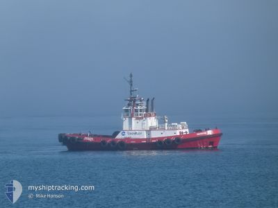
PROTECTOR
Tug
Current Trip
| Trip Time | 7 h, 52 mins |
|---|---|
| Trip Distance | 23.01 nm |
| AVG Speed | 8.1 Noeuds |
| MAX Speed | 9.3 Noeuds |
| Tirant d eau | 5.8 m |
| AVG Wind | 8.6 knots |
| MAX Wind | 15.3 knots |
| MIN Temp | 4°C / 39.2°F |
| MAX Temp | 7.3°C / 45.14°F |
| Position reçue | 1 m depuis |
Current Position
| Longitude | --- |
|---|---|
| Latitude | --- |
| Etat | Under way using engine |
| Vitesse | 0.8 Noeuds |
| Parcours | 54° |
| Zone | The Coastal Waters of Southeast Alaska and British Columbia |
| Station | T-AIS |
| Position reçue | 1 m depuis |
Info
Information
The current position of PROTECTOR is in The Coastal Waters of Southeast Alaska and British Columbia with coordinates 48.84275° / -122.72594° as reported on 2026-03-22 10:51 by AIS to our vessel tracker app. The vessel's current speed is 0.8 Noeuds and is currently inside the port of ALCOA INTALCO.
The vessel PROTECTOR (IMO: 9139828, MMSI: 366887970) is a Tug that was built in 1996 ( 30 Age ). It's sailing under the flag of [US] USA.
In this page you can find informations about the vessels current position, last detected port calls, and current voyage information. If the vessels is not in coverage by AIS you will find the latest position.
The current position of PROTECTOR is detected by our AIS receivers and we are not responsible for the reliability of the data. The last position was recorded while the vessel was in Coverage by the Ais receivers of our vessel tracking app.
The current draught of PROTECTOR as reported by AIS is 5.8 meters
Weather
| Temperature | 6.7°C / 44.06°F |
|---|---|
| Wind Speed | 14 knots |
| Direction | 168° SSE |
| Pressure | 1028.3 hPa |
| Humidity | 75.6 % |
| Cloud Coverage | 98 % |
Featured Company
Last Port Calls
| Port | Arrival | Departure | Time In Port |
|---|---|---|---|
| 2026-03-22 03:45 | |||
| 2026-03-21 18:23 | 2026-03-21 19:53 | 1 h | |
| 2026-03-21 15:09 | 2026-03-21 15:40 | 31 m | |
| 2026-03-21 12:43 | 2026-03-21 13:16 | 33 m | |
| 2026-03-20 17:34 | 2026-03-21 08:40 | 15 h | |
| 2026-03-20 06:28 | 2026-03-20 16:34 | 10 h | |
| 2026-03-20 00:35 | 2026-03-20 06:23 | 5 h | |
| 2026-03-19 21:03 | 2026-03-19 21:44 | 40 m | |
| 2026-03-19 00:31 | 2026-03-19 01:11 | 39 m | |
| 2026-03-18 18:34 | 2026-03-18 19:35 | 1 h |
Most Visited Ports (Last year)
| Port | Arrivals | |
|---|---|---|
| 179 | ||
| 175 | ||
| 82 | ||
| 62 | ||
| 56 | ||
| 47 |
Last Trips
| Origin | Departure | Destination | Arrival | Distance | |
|---|---|---|---|---|---|
| 2026-03-21 19:53 | 2026-03-22 03:45 | 23.01 nm | |||
| 2026-03-21 15:40 | 2026-03-21 18:23 | 24.00 nm | |||
| 2026-03-21 13:16 | 2026-03-21 15:09 | 6.48 nm | |||
| 2026-03-21 08:40 | 2026-03-21 12:43 | 23.45 nm | |||
| 2026-03-20 16:34 | 2026-03-20 17:34 | 0.62 nm | |||
| 2026-03-20 06:23 | 2026-03-20 06:28 | 0.78 nm | |||
| 2026-03-19 21:44 | 2026-03-20 00:35 | 23.02 nm | |||
| 2026-03-19 01:11 | 2026-03-19 21:03 | 37.05 nm | |||
| 2026-03-18 19:35 | 2026-03-19 00:31 | 23.15 nm | |||
| 2026-03-18 14:20 | 2026-03-18 18:34 | 23.35 nm |
Events
| Heure | Evenement | Détails | Position/ Destination | Info |
|---|---|---|---|---|
| 2026-03-22 10:45 | Port d'arrivée |
|
48.84191 / -122.72472
[US] ALCOA INTALCO
|
Vitesse: 0.6 kn Parcours: 353° |
| 2026-03-22 10:20 | Arret | --- |
48.84231 / -122.72611
XX XXX>US^0U5P
|
Vitesse: 0.3 kn Parcours: 358° |
| 2026-03-22 08:14 | Démarrage | --- |
48.58850 / -122.61717
XX XXX>US^0U5P
|
Vitesse: 5.7 kn Parcours: 2° |
| 2026-03-22 08:14 | Etat Changé | Under way using engine At anchor |
48.58749 / -122.61721
XX XXX>US^0U5P
|
Vitesse: 4.8 kn Parcours: 4° |
| 2026-03-22 06:41 | Etat Changé | At anchor Default |
48.58660 / -122.61862
XX XXX>US^0U5P
|
Vitesse: 0.1 kn Parcours: 103° |
| 2026-03-22 06:33 | Etat Changé | Default At anchor |
48.58500 / -122.61833
XX XXX>US^0U5P
|
Vitesse: Parcours: 103° |
| 2026-03-22 06:23 | Etat Changé | At anchor Default |
48.58660 / -122.61862
XX XXX>US^0U5P
|
Vitesse: Parcours: 99° |
| 2026-03-22 06:17 | Etat Changé | Default At anchor |
48.58657 / -122.61866
XX XXX>US^0U5P
|
Vitesse: Parcours: 101° |
| 2026-03-22 06:11 | Etat Changé | At anchor Default |
48.58657 / -122.61861
XX XXX>US^0U5P
|
Vitesse: Parcours: -1° |
| 2026-03-22 06:02 | Etat Changé | Default At anchor |
48.58661 / -122.61865
XX XXX>US^0U5P
|
Vitesse: Parcours: 102° |