

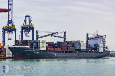
SHIRIN M
Container Ship

Current Trip
| Time Travelled | 10 h, 29 mins |
|---|---|
| Remaining Time | --- |
| Distance Travelled | 155.15 nm |
| Remaining Distance | --- |
| AVG Speed | 15.7 Noeuds |
| MAX Speed | 16.5 Noeuds |
| AVG Wind | 20.2 knots |
| MAX Wind | 29.4 knots |
| MIN Temp | 5.1°C / 41.18°F |
| MAX Temp | 10.7°C / 51.26°F |
| Tirant d eau | 10.5 m |
| Position reçue | 6 h, 25 m depuis |
Current Position
| Longitude | --- |
|---|---|
| Latitude | --- |
| Etat | Under way using engine |
| Vitesse | 16.1 Noeuds |
| Parcours | 205° |
| Zone | Aegean Sea |
| Station | T-AIS |
| Position reçue | 6 h, 25 m depuis |
Information
The current position of SHIRIN M is in Aegean Sea with coordinates 36.97033° / 23.41533° as reported on 2025-02-19 19:20 by AIS to our vessel tracker app. The vessel's current speed is 16.1 Noeuds and is heading at the port of SOUTHAMPTON. The estimated time of arrival as calculated by MyShipTracking vessel tracking app is 2025-02-27 03:00 LT
The vessel SHIRIN M (IMO: 9339583, MMSI: 636017112) is a Container Ship that was built in 2007 ( 18 Age ). It's sailing under the flag of [LR] Liberia.
In this page you can find informations about the vessels current position, last detected port calls, and current voyage information. If the vessels is not in coverage by AIS you will find the latest position.
The current position of SHIRIN M is detected by our AIS receivers and we are not responsible for the reliability of the data. The last position was recorded while the vessel was in Coverage by the Ais receivers of our vessel tracking app.
The current draught of SHIRIN M as reported by AIS is 10.5 meters
Weather
| Temperature | 10.7°C / 51.26°F |
|---|---|
| Wind Speed | 22 knots |
| Direction | 94° E |
| Pressure | 1025.5 hPa |
| Humidity | 76.8 % |
| Cloud Coverage | 100 % |


Featured Company
Last Port Calls
| Port | Arrival | Departure | Time In Port |
|---|---|---|---|
| 2025-02-19 00:00 | 2025-02-19 17:16 | 17 h | |
| 2025-02-14 10:45 | 2025-02-14 23:20 | 12 h | |
| 2025-02-13 05:29 | 2025-02-13 15:30 | 10 h | |
| 2025-02-12 01:09 | 2025-02-12 23:44 | 22 h | |
| 2025-02-09 13:52 | 2025-02-10 13:35 | 23 h | |
| 2025-02-03 18:28 | 2025-02-04 20:27 | 1 d | |
| 2025-01-19 07:51 | 2025-01-20 11:26 | 1 d | |
| 2025-01-15 14:47 | 2025-01-16 18:34 | 1 d | |
| 2025-01-14 06:58 | 2025-01-14 14:23 | 7 h | |
| 2025-01-02 05:14 | 2025-01-03 07:33 | 1 d |
Most Visited Ports (Last year)
| Port | Arrivals | |
|---|---|---|
| 17 | ||
| 8 | ||
| 7 | ||
| 6 | ||
| 3 | ||
| 2 |
Last Trips
| Origin | Departure | Destination | Arrival | Distance | |
|---|---|---|---|---|---|
| 2025-02-14 23:20 | 2025-02-19 00:00 | 216.82 nm | |||
| 2025-02-13 15:30 | 2025-02-14 10:45 | 286.89 nm | |||
| 2025-02-12 23:44 | 2025-02-13 05:29 | 61.65 nm | |||
| 2025-02-10 13:35 | 2025-02-12 01:09 | 66.11 nm | |||
| 2025-02-04 20:27 | 2025-02-09 13:52 | 415.60 nm | |||
| 2025-01-20 11:26 | 2025-02-03 18:28 | 2998.78 nm | |||
| 2025-01-16 18:34 | 2025-01-19 07:51 | 130.21 nm | |||
| 2025-01-14 14:23 | 2025-01-15 14:47 | 180.23 nm | |||
| 2025-01-03 07:33 | 2025-01-14 06:58 | 299.70 nm | |||
| 2024-12-26 03:53 | 2025-01-02 05:14 | 203.16 nm |
Events
| Heure | Evenement | Détails | Position/ Destination | Info |
|---|---|---|---|---|
| 2025-02-19 19:27 | Etat Changé | Default Under way using engine |
36.94167 / 23.39833
GBSOU
|
Vitesse: 16.1 kn Parcours: 205° |
| 2025-02-19 19:20 | Hors de la zone couverte |
36.97033 / 23.41533
Aegean Sea
GBSOU
|
Vitesse: 16.1 kn Parcours: 205° |
|
| 2025-02-19 19:15 | Etat Changé | Under way using engine Default |
36.99200 / 23.42883
GBSOU
|
Vitesse: 16 kn Parcours: 206° |
| 2025-02-19 19:15 | Dans la zone couverte |
36.98317 / 23.42333
Aegean Sea
GBSOU
|
Vitesse: 16 kn Parcours: 207° |
|
| 2025-02-19 18:07 | Etat Changé | Default Under way using engine |
37.25917 / 23.60183
GBSOU
|
Vitesse: 16.3 kn Parcours: 207° |
| 2025-02-19 18:01 | Hors de la zone couverte |
37.28567 / 23.61917
Aegean Sea
GBSOU
|
Vitesse: 16.3 kn Parcours: 207° |
|
| 2025-02-19 16:04 | Changement d'ETA | 2025/02/27 03:00 2026/01/01 03:00 |
37.78283 / 23.63617
GBSOU
|
Vitesse: 15.8 kn Parcours: 154° |
| 2025-02-19 15:58 | Changement d'ETA | 2026/01/01 03:00 2025/02/27 03:00 |
37.80633 / 23.62150
GBSOU
|
Vitesse: 15.7 kn Parcours: 158° |
| 2025-02-19 15:16 | Démarrage | 0.47 nm, North East of PSYTTALEIA |
37.94917 / 23.59450
GBSOU
|
Vitesse: 3.2 kn Parcours: 133° |
| 2025-02-19 15:16 | PORT DE DEPART |
|
37.94933 / 23.59417
GBSOU
|
Vitesse: 2.4 kn Parcours: 127° |