
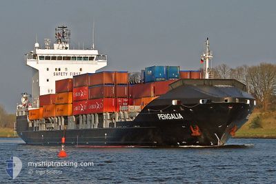
PENGALIA
Container Ship
Current Trip
| Time Travelled | 1 day |
|---|---|
| Remaining Time | 17 h, 10 mins |
| Distance Travelled | 422.84 nm |
| Remaining Distance | 233.41 nm |
| AVG Speed | 13.6 Noeuds |
| MAX Speed | 15.1 Noeuds |
| AVG Wind | 6.4 knots |
| MAX Wind | 18.8 knots |
| MIN Temp | 10°C / 50°F |
| MAX Temp | 14.9°C / 58.82°F |
| Tirant d eau | 6.1 m |
| Position reçue | 6 m depuis |
Current Position
| Longitude | --- |
|---|---|
| Latitude | --- |
| Etat | Under way using engine |
| Vitesse | 13.3 Noeuds |
| Parcours | 323.4° |
| Zone | Aegean Sea |
| Station | T-AIS |
| Position reçue | 6 m depuis |
Info
Information
The current position of PENGALIA is in Aegean Sea with coordinates 37.66319° / 25.82701° as reported on 2025-02-27 14:56 by AIS to our vessel tracker app. The vessel's current speed is 13.3 Noeuds and is heading at the port of THESSALONIKI. The estimated time of arrival as calculated by MyShipTracking vessel tracking app is 2025-02-28 10:12 LT
The vessel PENGALIA (IMO: 9440588, MMSI: 255806347) is a Container Ship that was built in 2008 ( 17 Age ). It's sailing under the flag of [PT] Portugal.
In this page you can find informations about the vessels current position, last detected port calls, and current voyage information. If the vessels is not in coverage by AIS you will find the latest position.
The current position of PENGALIA is detected by our AIS receivers and we are not responsible for the reliability of the data. The last position was recorded while the vessel was in Coverage by the Ais receivers of our vessel tracking app.
The current draught of PENGALIA as reported by AIS is 6.1 meters
Weather
| Temperature | 13.2°C / 55.76°F |
|---|---|
| Wind Speed | 18 knots |
| Direction | 190° S |
| Pressure | 1019.4 hPa |
| Humidity | 85.2 % |
| Cloud Coverage | 100 % |
Featured Company
Last Port Calls
| Port | Arrival | Departure | Time In Port |
|---|---|---|---|
| 2025-02-25 14:43 | 2025-02-26 10:09 | 19 h | |
| 2025-02-21 16:50 | 2025-02-23 18:41 | 2 d | |
| 2025-02-18 14:41 | 2025-02-19 16:37 | 1 d | |
| 2025-02-14 18:49 | 2025-02-16 17:30 | 1 d | |
| 2025-02-11 15:19 | 2025-02-12 18:24 | 1 d | |
| 2025-02-07 08:26 | 2025-02-09 18:52 | 2 d | |
| 2025-02-04 05:21 | 2025-02-04 22:52 | 17 h | |
| 2025-01-31 15:21 | 2025-02-02 10:07 | 1 d | |
| 2025-01-28 08:14 | 2025-01-29 01:45 | 17 h | |
| 2025-01-23 18:30 | 2025-01-26 13:15 | 2 d |
Most Visited Ports (Last year)
| Port | Arrivals | |
|---|---|---|
| 58 | ||
| 52 |
Last Trips
| Origin | Departure | Destination | Arrival | Distance | |
|---|---|---|---|---|---|
| 2025-02-23 18:41 | 2025-02-25 14:43 | 658.48 nm | |||
| 2025-02-19 16:37 | 2025-02-21 16:50 | 659.01 nm | |||
| 2025-02-16 17:30 | 2025-02-18 14:41 | 656.91 nm | |||
| 2025-02-12 18:24 | 2025-02-14 18:49 | 661.15 nm | |||
| 2025-02-09 18:52 | 2025-02-11 15:19 | 660.89 nm | |||
| 2025-02-04 22:52 | 2025-02-07 08:26 | 678.38 nm | |||
| 2025-02-02 10:07 | 2025-02-04 05:21 | 659.69 nm | |||
| 2025-01-29 01:45 | 2025-01-31 15:21 | 660.76 nm | |||
| 2025-01-26 13:15 | 2025-01-28 08:14 | 656.23 nm | |||
| 2025-01-21 19:07 | 2025-01-23 18:30 | 655.89 nm |
Events
| Heure | Evenement | Détails | Position/ Destination | Info |
|---|---|---|---|---|
| 2025-02-27 11:25 | Etat Changé | Under way using engine Default |
37.08302 / 26.45904
GRSKG
|
Vitesse: 12.8 kn Parcours: 314° |
| 2025-02-27 10:58 | Etat Changé | Default Under way using engine |
37.01574 / 26.54480
GRSKG
|
Vitesse: 13.1 kn Parcours: 322.5° |
| 2025-02-27 10:41 | Etat Changé | Under way using engine Default |
36.96666 / 26.59281
GRSKG
|
Vitesse: 13.3 kn Parcours: 321° |
| 2025-02-27 10:24 | Etat Changé | Default Under way using engine |
36.91634 / 26.64138
GRSKG
|
Vitesse: 13.4 kn Parcours: 321.2° |
| 2025-02-27 09:51 | Etat Changé | Under way using engine Default |
36.82063 / 26.73657
GRSKG
|
Vitesse: 13.8 kn Parcours: 319° |
| 2025-02-27 09:38 | Dans la zone couverte |
36.82063 / 26.73657
Aegean Sea
GRSKG
|
Vitesse: 13.7 kn Parcours: 321.9° |
|
| 2025-02-27 08:08 | Etat Changé | Default Under way using engine |
36.53297 / 27.06740
GRSKG
|
Vitesse: 14.1 kn Parcours: 270.4° |
| 2025-02-27 07:44 | Hors de la zone couverte |
36.52957 / 27.18147
Aegean Sea
GRSKG
|
Vitesse: 14.1 kn Parcours: 270.4° |
|
| 2025-02-27 05:04 | Changement de zone | Greek part of the Aegean Sea Turkish part of the Aegean Sea |
36.47602 / 27.94383
Aegean Sea
GRSKG
|
Vitesse: 14.3 kn Parcours: 267.2° |
| 2025-02-27 04:55 | Changement de zone | Turkish part of the Aegean Sea Greek part of the Aegean Sea |
36.47792 / 27.98931
Aegean Sea
GRSKG
|
Vitesse: 14.2 kn Parcours: 266.3° |