
PEGASOS
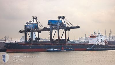
Bulk Carrier
Current Trip
| Time Travelled | 21 days |
|---|---|
| Remaining Time | 15 days |
| Distance Travelled | 5536.33 nm |
| Remaining Distance | 3526.35 nm |
| AVG Speed | 10.5 Noeuds |
| MAX Speed | 12.2 Noeuds |
| AVG Wind | 14.8 knots |
| MAX Wind | 28.9 knots |
| MIN Temp | 15.3°C / 59.54°F |
| MAX Temp | 25.3°C / 77.54°F |
| Tirant d eau | 13.5 m |
| Position reçue | 4 d depuis |
Current Position
| Longitude | 36.48922° |
|---|---|
| Latitude | -31.62400° |
| Etat | Under way using engine |
| Vitesse | 11.6 Noeuds |
| Parcours | 67.8° |
| Zone | Indian Ocean |
| Station | T-AIS |
| Position reçue | 4 d depuis |
Info
Information
The current position of PEGASOS is in Indian Ocean with coordinates -31.62400° / 36.48922° as reported on 2024-07-01 03:19 by AIS to our vessel tracker app. The vessel's current speed is 11.6 Noeuds and is heading at the port of SINGAPORE. The estimated time of arrival as calculated by MyShipTracking vessel tracking app is 2024-07-21 07:42 LT
The vessel PEGASOS (IMO: 9624653, MMSI: 636017725) is a Bulk Carrier that was built in 2012 ( 12 Age ). It's sailing under the flag of [LR] Liberia.
In this page you can find informations about the vessels current position, last detected port calls, and current voyage information. If the vessels is not in coverage by AIS you will find the latest position.
The current position of PEGASOS is detected by our AIS receivers and we are not responsible for the reliability of the data. The last position was recorded while the vessel was in Coverage by the Ais receivers of our vessel tracking app.
The current draught of PEGASOS as reported by AIS is 13.5 meters
Weather
| Temperature | 22.5°C / 72.5°F |
|---|---|
| Wind Speed | 15 knots |
| Direction | 38° NE |
| Pressure | 1020.6 hPa |
| Humidity | 66.2 % |
| Cloud Coverage | --- |
Featured Company
Most Visited Ports (Last year)
| Port | Arrivals | |
|---|---|---|
| 4 | ||
| 1 | ||
| 1 | ||
| 1 | ||
| 1 |
Last Trips
| Origin | Departure | Destination | Arrival | Distance | |
|---|---|---|---|---|---|
| 2024-04-06 13:25 | 2024-06-11 21:38 | 5964.64 nm |
Events
| Heure | Evenement | Détails | Position/ Destination | Info |
|---|---|---|---|---|
| 2024-07-01 03:21 | Etat Changé | Default Under way using engine |
-31.62140 / 36.49683
SGSIN
|
Vitesse: 11.6 kn Parcours: 67.8° |
| 2024-07-01 03:19 | Hors de la zone couverte |
-31.62400 / 36.48922
Indian Ocean
SGSIN
|
Vitesse: 11.6 kn Parcours: 67.8° |
|
| 2024-07-01 03:18 | Etat Changé | Under way using engine Default |
-31.62560 / 36.48449
SGSIN
|
Vitesse: 11.7 kn Parcours: 68° |
| 2024-07-01 03:10 | Etat Changé | Default Under way using engine |
-31.63521 / 36.45542
SGSIN
|
Vitesse: 11.7 kn Parcours: 67.9° |
| 2024-07-01 03:04 | Etat Changé | Under way using engine Default |
-31.64163 / 36.43648
SGSIN
|
Vitesse: 11.7 kn Parcours: 69° |
| 2024-07-01 02:51 | Etat Changé | Default Under way using engine |
-31.65686 / 36.39114
SGSIN
|
Vitesse: 11.7 kn Parcours: 65.6° |
| 2024-07-01 02:36 | Etat Changé | Under way using engine Default |
-31.67638 / 36.33848
SGSIN
|
Vitesse: 11.7 kn Parcours: 67° |
| 2024-07-01 02:31 | Etat Changé | Default Under way using engine |
-31.68298 / 36.32049
SGSIN
|
Vitesse: 11.7 kn Parcours: 66.4° |
| 2024-07-01 02:11 | Etat Changé | Under way using engine Default |
-31.70859 / 36.25006
SGSIN
|
Vitesse: 12 kn Parcours: 67° |
| 2024-07-01 01:54 | Etat Changé | Default Under way using engine |
-31.72920 / 36.18905
SGSIN
|
Vitesse: 11.9 kn Parcours: 68.6° |