
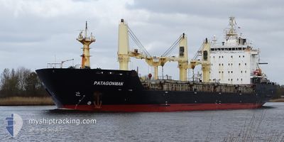
PATAGONMAN
Bulk Carrier
Current Trip
| Time Travelled | 2 days |
|---|---|
| Remaining Time | 1 day |
| Distance Travelled | 737.20 nm |
| Remaining Distance | 707.23 nm |
| AVG Speed | 11.8 Noeuds |
| MAX Speed | 13.8 Noeuds |
| AVG Wind | 14.6 knots |
| MAX Wind | 28 knots |
| MIN Temp | 22.3°C / 72.14°F |
| MAX Temp | 26.4°C / 79.52°F |
| Tirant d eau | 6.1 m |
| Position reçue | 12 d depuis |
Current Position
| Longitude | --- |
|---|---|
| Latitude | --- |
| Etat | Moored |
| Vitesse | 13.8 Noeuds |
| Parcours | 284° |
| Zone | Caribbean Sea |
| Station | T-AIS |
| Position reçue | 12 d depuis |
Info
Information
The current position of PATAGONMAN is in Caribbean Sea with coordinates 14.69250° / -61.57350° as reported on 2025-02-26 23:37 by AIS to our vessel tracker app. The vessel's current speed is 13.8 Noeuds and is heading at the port of KINGSTON (JM). The estimated time of arrival as calculated by MyShipTracking vessel tracking app is 2025-03-13 13:18 LT
The vessel PATAGONMAN (IMO: 9521851, MMSI: 563150200) is a Bulk Carrier that was built in 2012 ( 13 Age ). It's sailing under the flag of [SG] Singapore.
In this page you can find informations about the vessels current position, last detected port calls, and current voyage information. If the vessels is not in coverage by AIS you will find the latest position.
The current position of PATAGONMAN is detected by our AIS receivers and we are not responsible for the reliability of the data. The last position was recorded while the vessel was in Coverage by the Ais receivers of our vessel tracking app.
The current draught of PATAGONMAN as reported by AIS is 6.1 meters
Weather
| Temperature | 22.3°C / 72.14°F |
|---|---|
| Wind Speed | 11 knots |
| Direction | 46° NE |
| Pressure | 1014.8 hPa |
| Humidity | 65 % |
| Cloud Coverage | 5 % |
Featured Company
Last Port Calls
| Port | Arrival | Departure | Time In Port |
|---|---|---|---|
| 2025-03-06 00:52 | 2025-03-09 05:57 | 3 d | |
| 2025-02-24 04:01 | 2025-02-26 21:15 | 2 d | |
| 2025-02-20 13:33 | 2025-02-23 18:26 | 3 d | |
| 2025-02-06 12:05 | 2025-02-08 14:24 | 2 d | |
| 2025-01-04 21:31 | 2025-01-08 09:50 | 3 d | |
| 2025-01-03 12:24 | 2025-01-04 01:29 | 13 h |
Most Visited Ports (Last year)
| Port | Arrivals | |
|---|---|---|
| 8 | ||
| 8 | ||
| 4 | ||
| 4 | ||
| 3 | ||
| 2 |
Last Trips
| Origin | Departure | Destination | Arrival | Distance | |
|---|---|---|---|---|---|
| 2025-02-26 17:15 | 2025-03-05 18:52 | 2120.71 nm | |||
| 2025-02-23 14:26 | 2025-02-24 00:01 | 114.54 nm | |||
| 2025-02-08 15:24 | 2025-02-20 09:33 | 3587.42 nm | |||
| 2025-01-08 12:50 | 2025-02-06 13:05 | 4147.37 nm | |||
| 2025-01-04 03:29 | 2025-01-05 00:31 | 168.29 nm | |||
| 2024-12-20 15:00 | 2025-01-03 14:24 | 3639.79 nm |
Events
| Heure | Evenement | Détails | Position/ Destination | Info |
|---|---|---|---|---|
| 2025-03-09 05:57 | PORT DE DEPART |
|
19.20372 / -96.09793
MQFDF-JMKIN
|
Vitesse: 6.4 kn Parcours: 106° |
| 2025-03-09 05:46 | Démarrage |
19.20521 / -96.13094
[MX] VERACRUZ
|
Vitesse: 6.4 kn Parcours: 106° |
|
| 2025-03-06 01:24 | Arret |
19.20333 / -96.13467
[MX] VERACRUZ
|
Vitesse: 0.1 kn Parcours: 238° |
|
| 2025-03-06 00:52 | Port d'arrivée |
|
19.20267 / -96.12317
[MX] VERACRUZ
|
Vitesse: 7.6 kn Parcours: 267° |
| 2025-03-05 20:07 | Démarrage |
19.26017 / -95.67017
MQFDF-JMKIN
|
Vitesse: 3.7 kn Parcours: 69° |
|
| 2025-03-05 16:21 | Arret |
19.32900 / -95.72533
MQFDF-JMKIN
|
Vitesse: 0.2 kn Parcours: 330° |