
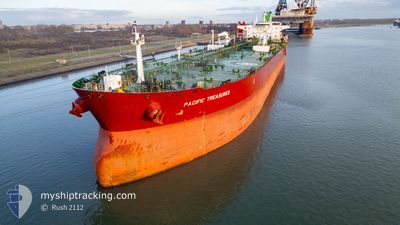
PACIFIC TREASURES
Tanker
Current Trip
| Time Travelled | 12 days |
|---|---|
| Remaining Time | --- |
| Distance Travelled | 3909.15 nm |
| Remaining Distance | --- |
| AVG Speed | 13.1 Noeuds |
| MAX Speed | 16.5 Noeuds |
| AVG Wind | 14.7 knots |
| MAX Wind | 29 knots |
| MIN Temp | 12°C / 53.6°F |
| MAX Temp | 26.5°C / 79.7°F |
| Tirant d eau | 13 m |
| Position reçue | 7 d depuis |
Current Position
| Longitude | -78.00401° |
|---|---|
| Latitude | 32.09661° |
| Etat | Under way using engine |
| Vitesse | 16.1 Noeuds |
| Parcours | 50.3° |
| Zone | North Atlantic Ocean |
| Station | T-AIS |
| Position reçue | 7 d depuis |
Info
Information
The current position of PACIFIC TREASURES is in North Atlantic Ocean with coordinates 32.09661° / -78.00401° as reported on 2024-04-20 09:56 by AIS to our vessel tracker app. The vessel's current speed is 16.1 Noeuds and is heading at the port of ROTTERDAM. The estimated time of arrival as calculated by MyShipTracking vessel tracking app is 2024-05-03 13:00 LT
The vessel PACIFIC TREASURES (IMO: 9732242, MMSI: 538006773) is a Tanker It's sailing under the flag of [MH] Marshall Is.
In this page you can find informations about the vessels current position, last detected port calls, and current voyage information. If the vessels is not in coverage by AIS you will find the latest position.
The current position of PACIFIC TREASURES is detected by our AIS receivers and we are not responsible for the reliability of the data. The last position was recorded while the vessel was in Coverage by the Ais receivers of our vessel tracking app.
The current draught of PACIFIC TREASURES as reported by AIS is 13 meters
Weather
| Temperature | 13.8°C / 56.84°F |
|---|---|
| Wind Speed | 16 knots |
| Direction | 286° WNW |
| Pressure | 1023.6 hPa |
| Humidity | 95.7 % |
| Cloud Coverage | 100 % |
Featured Company
Last Port Calls
| Port | Arrival | Departure | Time In Port |
|---|---|---|---|
| 2024-04-14 09:38 | 2024-04-15 22:48 | 1 d | |
| 2024-04-07 23:56 | 2024-04-09 14:31 | 1 d | |
| 2024-04-04 12:55 | 2024-04-04 16:31 | 3 h | |
| 2024-03-30 07:58 | 2024-04-04 11:15 | 5 d | |
| 2024-03-27 01:31 | 2024-03-28 08:55 | 1 d | |
| 2024-03-24 02:38 | 2024-03-25 18:41 | 1 d | |
| 2024-02-22 06:27 | 2024-03-03 18:07 | 10 d | |
| 2024-02-19 17:36 | 2024-02-21 00:09 | 1 d | |
| 2024-02-17 00:14 | 2024-02-17 21:30 | 21 h | |
| 2024-02-12 05:48 | 2024-02-13 12:11 | 1 d |
Most Visited Ports (Last year)
| Port | Arrivals | |
|---|---|---|
| 4 | ||
| 3 | ||
| 3 | ||
| 2 | ||
| 2 | ||
| 2 |
Last Trips
| Origin | Departure | Destination | Arrival | Distance | |
|---|---|---|---|---|---|
| 2024-04-09 09:31 | 2024-04-14 04:38 | 289.47 nm | |||
| 2024-04-04 11:31 | 2024-04-07 18:56 | 475.13 nm | |||
| 2024-04-04 06:15 | 2024-04-04 07:55 | 21.95 nm | |||
| 2024-03-28 03:55 | 2024-03-30 02:58 | 72.70 nm | |||
| 2024-03-25 13:41 | 2024-03-26 20:31 | 94.20 nm | |||
| 2024-03-03 19:07 | 2024-03-23 21:38 | 5167.26 nm | |||
| 2024-02-21 01:09 | 2024-02-22 07:27 | 317.97 nm | |||
| 2024-02-17 22:30 | 2024-02-19 18:36 | 485.95 nm | |||
| 2024-02-13 13:11 | 2024-02-17 01:14 | 782.31 nm | |||
| 2024-02-01 20:22 | 2024-02-12 06:48 | 2757.39 nm |
Events
| Heure | Evenement | Détails | Position/ Destination | Info |
|---|---|---|---|---|
| 2024-04-20 10:12 | Etat Changé | Default Under way using engine |
32.14312 / -77.94091
USGLS >> NLRTM
|
Vitesse: 16.1 kn Parcours: 50.3° |
| 2024-04-20 09:56 | Hors de la zone couverte |
32.09661 / -78.00401
North Atlantic Ocean
USGLS >> NLRTM
|
Vitesse: 16.1 kn Parcours: 50.3° |
|
| 2024-04-20 09:34 | Etat Changé | Under way using engine Default |
32.03422 / -78.09390
USGLS >> NLRTM
|
Vitesse: 16.1 kn Parcours: 53° |
| 2024-04-20 09:17 | Dans la zone couverte |
32.03484 / -78.09302
North Atlantic Ocean
USGLS >> NLRTM
|
Vitesse: 16 kn Parcours: 50.3° |
|
| 2024-04-20 02:50 | Etat Changé | Default Under way using engine |
30.80375 / -79.49937
USGLS >> NLRTM
|
Vitesse: 15.2 kn Parcours: 5.1° |
| 2024-04-20 02:43 | Hors de la zone couverte |
30.77467 / -79.50410
North Atlantic Ocean
USGLS >> NLRTM
|
Vitesse: 15.2 kn Parcours: 5.1° |
|
| 2024-04-20 02:39 | Etat Changé | Under way using engine Default |
30.75479 / -79.50609
USGLS >> NLRTM
|
Vitesse: 15.4 kn Parcours: 12° |
| 2024-04-20 02:34 | Etat Changé | Default Under way using engine |
30.73675 / -79.50872
USGLS >> NLRTM
|
Vitesse: 15.2 kn Parcours: 11.3° |
| 2024-04-20 02:28 | Etat Changé | Under way using engine Default |
30.70808 / -79.51426
USGLS >> NLRTM
|
Vitesse: 15.1 kn Parcours: 8° |
| 2024-04-20 02:14 | Etat Changé | Default Under way using engine |
30.65326 / -79.52450
USGLS >> NLRTM
|
Vitesse: 15 kn Parcours: 8.9° |