
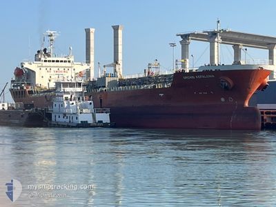
ORCHID KEFALONIA
Oil/Chemical Tanker
Current Trip
| Time Travelled | 21 h, 50 mins |
|---|---|
| Remaining Time | --- |
| Distance Travelled | 236.25 nm |
| Remaining Distance | --- |
| AVG Speed | 13.5 Noeuds |
| MAX Speed | 15 Noeuds |
| AVG Wind | 5.4 knots |
| MAX Wind | 7.8 knots |
| MIN Temp | 24.5°C / 76.1°F |
| MAX Temp | 29.6°C / 85.28°F |
| Tirant d eau | 10.2 m |
| Position reçue | 21 d depuis |
Current Position
| Longitude | 128.87333° |
|---|---|
| Latitude | 34.54267° |
| Etat | Under way using engine |
| Vitesse | 12.1 Noeuds |
| Parcours | 219° |
| Zone | Japan Sea |
| Station | T-AIS |
| Position reçue | 21 d depuis |
Info
Information
The current position of ORCHID KEFALONIA is in Japan Sea with coordinates 34.54267° / 128.87333° as reported on 2024-04-14 09:49 by AIS to our vessel tracker app. The vessel's current speed is 12.1 Noeuds and is heading at the port of ONSAN.
The vessel ORCHID KEFALONIA (IMO: 9363821, MMSI: 538009509) is a Oil/Chemical Tanker that was built in 2008 ( 16 Age ). It's sailing under the flag of [MH] Marshall Is.
In this page you can find informations about the vessels current position, last detected port calls, and current voyage information. If the vessels is not in coverage by AIS you will find the latest position.
The current position of ORCHID KEFALONIA is detected by our AIS receivers and we are not responsible for the reliability of the data. The last position was recorded while the vessel was in Coverage by the Ais receivers of our vessel tracking app.
The current draught of ORCHID KEFALONIA as reported by AIS is 10.2 meters
Weather
| Temperature | 29.4°C / 84.92°F |
|---|---|
| Wind Speed | 5 knots |
| Direction | 74° ENE |
| Pressure | 1009.7 hPa |
| Humidity | 66.6 % |
| Cloud Coverage | 88 % |
Featured Company
Last Port Calls
| Port | Arrival | Departure | Time In Port |
|---|---|---|---|
| 2024-05-02 23:16 | 2024-05-04 19:49 | 1 d | |
| 2024-04-24 02:55 | 2024-04-25 08:00 | 1 d | |
| 2024-03-20 16:43 | 2024-03-20 17:39 | 56 m | |
| 2024-03-08 16:22 | 2024-03-09 23:17 | 1 d |
Last Trips
| Origin | Departure | Destination | Arrival | Distance | |
|---|---|---|---|---|---|
| 2024-04-25 16:00 | 2024-05-03 07:16 | 2278.17 nm | |||
| 2024-03-20 10:39 | 2024-04-24 10:55 | 6792.91 nm | |||
| 2024-03-09 15:17 | 2024-03-20 09:43 | 1277.29 nm | |||
| 2024-02-27 19:02 | 2024-03-08 08:22 | 964.66 nm |
Events
| Heure | Evenement | Détails | Position/ Destination | Info |
|---|---|---|---|---|
| 2024-05-04 19:50 | Démarrage | 2.22 nm, South East of LAHAD DATU |
4.99900 / 118.38900
KR USN
|
Vitesse: 9.3 kn Parcours: 120° |
| 2024-05-04 19:49 | PORT DE DEPART |
|
4.99900 / 118.38900
KR USN
|
Vitesse: 1.6 kn Parcours: 124° |
| 2024-05-02 23:16 | Port d'arrivée |
|
5.01083 / 118.37350
[MY] LAHAD DATU
|
Vitesse: 2.3 kn Parcours: 27° |
| 2024-05-02 15:52 | Arret | 1.72 nm, South East of LAHAD DATU |
4.99467 / 118.37650
KR USN
|
Vitesse: Parcours: 333° |