
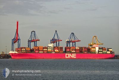
ONE MACKINAC
Cargo C
Current Trip
| Time Travelled | 12 days |
|---|---|
| Remaining Time | --- |
| Distance Travelled | 4331.58 nm |
| Remaining Distance | --- |
| AVG Speed | 14.4 Noeuds |
| MAX Speed | 19.1 Noeuds |
| AVG Wind | 14.6 knots |
| MAX Wind | 35.9 knots |
| MIN Temp | 16.6°C / 61.88°F |
| MAX Temp | 29.4°C / 84.92°F |
| Tirant d eau | 15 m |
| Position reçue | Maintenant |
Current Position
| Longitude | 18.82779° |
|---|---|
| Latitude | -34.78314° |
| Etat | Under way using engine |
| Vitesse | 14.9 Noeuds |
| Parcours | 287.2° |
| Zone | South Atlantic Ocean |
| Station | T-AIS |
| Position reçue | Maintenant |
Info
Information
The current position of ONE MACKINAC is in South Atlantic Ocean with coordinates -34.78314° / 18.82779° as reported on 2024-05-29 06:19 by AIS to our vessel tracker app. The vessel's current speed is 14.9 Noeuds and is heading at the port of ALGECIRAS. The estimated time of arrival as calculated by MyShipTracking vessel tracking app is 2024-06-13 04:00 LT
The vessel ONE MACKINAC (IMO: 9689603, MMSI: 431241000) is a Cargo C It's sailing under the flag of [JP] Japan.
In this page you can find informations about the vessels current position, last detected port calls, and current voyage information. If the vessels is not in coverage by AIS you will find the latest position.
The current position of ONE MACKINAC is detected by our AIS receivers and we are not responsible for the reliability of the data. The last position was recorded while the vessel was in Coverage by the Ais receivers of our vessel tracking app.
The current draught of ONE MACKINAC as reported by AIS is 15 meters
Weather
| Temperature | 17.3°C / 63.14°F |
|---|---|
| Wind Speed | 10 knots |
| Direction | 83° E |
| Pressure | 1013.6 hPa |
| Humidity | 80.9 % |
| Cloud Coverage | 4 % |
Featured Company
Last Port Calls
| Port | Arrival | Departure | Time In Port |
|---|---|---|---|
| 2024-05-16 03:04 | 2024-05-16 14:40 | 11 h | |
| 2024-05-05 11:40 | 2024-05-06 12:04 | 1 d | |
| 2024-04-22 21:00 | 2024-04-24 08:22 | 1 d | |
| 2024-04-20 14:32 | |||
| 2024-04-13 18:42 | 2024-04-14 13:14 | 18 h | |
| 2024-04-05 02:10 | 2024-04-06 12:37 | 1 d |
Most Visited Ports (Last year)
| Port | Arrivals | |
|---|---|---|
| 6 | ||
| 4 | ||
| 3 | ||
| 3 | ||
| 3 | ||
| 3 |
Last Trips
| Origin | Departure | Destination | Arrival | Distance | |
|---|---|---|---|---|---|
| 2024-05-06 20:04 | 2024-05-16 08:34 | 3085.34 nm | |||
| 2024-04-24 17:22 | 2024-05-05 19:40 | 1460.06 nm | |||
| 2024-04-20 22:32 | 2024-04-23 06:00 | 529.61 nm | |||
| 2024-04-06 20:37 | 2024-04-14 02:42 | 2848.32 nm | |||
| 2024-02-24 06:15 | 2024-04-05 10:10 | 9897.58 nm |
Events
| Heure | Evenement | Détails | Position/ Destination | Info |
|---|---|---|---|---|
| 2024-05-29 05:37 | Changement de destination | ESALG ESALG! |
-34.83329 / 19.03204
ESALG
|
Vitesse: 14.9 kn Parcours: 287.6° |
| 2024-05-29 05:37 | Changement d'ETA | 2024/06/13 04:00 |
-34.83329 / 19.03204
ESALG
|
Vitesse: 14.9 kn Parcours: 287.6° |
| 2024-05-29 05:09 | Etat Changé | Under way using engine Default |
-34.86704 / 19.16640
ESALG!
|
Vitesse: 14.9 kn Parcours: 288° |
| 2024-05-29 05:04 | Etat Changé | Default Under way using engine |
-34.87282 / 19.18796
ESALG!
|
Vitesse: 14.9 kn Parcours: 288.6° |
| 2024-05-29 04:54 | Etat Changé | Under way using engine Default |
-34.88604 / 19.23713
ESALG!
|
Vitesse: 14.7 kn Parcours: 288° |
| 2024-05-29 04:43 | Etat Changé | Default Under way using engine |
-34.89999 / 19.28919
ESALG!
|
Vitesse: 14.9 kn Parcours: 300.9° |
| 2024-05-29 04:15 | Etat Changé | Under way using engine Default |
-34.95851 / 19.41152
ESALG!
|
Vitesse: 14.9 kn Parcours: 289° |
| 2024-05-29 04:03 | Etat Changé | Default Under way using engine |
-34.97942 / 19.47084
ESALG!
|
Vitesse: 15 kn Parcours: 288.5° |
| 2024-05-29 03:38 | Changement de zone | South African part of the South Atlantic Ocean South African part of the Indian Ocean |
-35.01215 / 19.58806
South Atlantic Ocean
|
Vitesse: 14.9 kn Parcours: 288.6° |
| 2024-05-29 03:37 | Etat Changé | Under way using engine Default |
-35.01321 / 19.59188
ESALG!
|
Vitesse: 14.9 kn Parcours: 287° |