
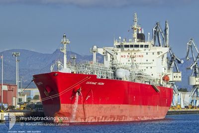
OCEANIC MOON
Lpg Tanker
Current Trip
| Time Travelled | 13 days |
|---|---|
| Remaining Time | 23 h, 29 mins |
| Distance Travelled | 3814.58 nm |
| Remaining Distance | 278.26 nm |
| AVG Speed | 12.3 Noeuds |
| MAX Speed | 14.4 Noeuds |
| AVG Wind | 14.4 knots |
| MAX Wind | 31.9 knots |
| MIN Temp | 6.6°C / 43.88°F |
| MAX Temp | 30.2°C / 86.36°F |
| Tirant d eau | 10.2 m |
| Position reçue | 2 h, 25 m depuis |
Current Position
| Longitude | --- |
|---|---|
| Latitude | --- |
| Etat | Under way using engine |
| Vitesse | 12.2 Noeuds |
| Parcours | 75.5° |
| Zone | English Channel |
| Station | T-AIS |
| Position reçue | 2 h, 25 m depuis |
Info
Information
The current position of OCEANIC MOON is in English Channel with coordinates 49.87597° / -2.55444° as reported on 2025-02-16 13:01 by AIS to our vessel tracker app. The vessel's current speed is 12.2 Noeuds and is heading at the port of ROZENBURG. The estimated time of arrival as calculated by MyShipTracking vessel tracking app is 2025-02-17 15:56 LT
The vessel OCEANIC MOON (IMO: 9447809, MMSI: 636023107) is a Lpg Tanker that was built in 2011 ( 14 Age ). It's sailing under the flag of [LR] Liberia.
In this page you can find informations about the vessels current position, last detected port calls, and current voyage information. If the vessels is not in coverage by AIS you will find the latest position.
The current position of OCEANIC MOON is detected by our AIS receivers and we are not responsible for the reliability of the data. The last position was recorded while the vessel was in Coverage by the Ais receivers of our vessel tracking app.
The current draught of OCEANIC MOON as reported by AIS is 10.2 meters
Weather
| Temperature | 6.6°C / 43.88°F |
|---|---|
| Wind Speed | 21 knots |
| Direction | 88° E |
| Pressure | 1017.5 hPa |
| Humidity | 79.3 % |
| Cloud Coverage | 100 % |
Featured Company
Last Port Calls
| Port | Arrival | Departure | Time In Port |
|---|---|---|---|
| 2025-02-01 08:13 | 2025-02-03 00:31 | 1 d | |
| 2025-01-22 11:33 | 2025-01-24 06:23 | 1 d | |
| 2025-01-02 08:06 | 2025-01-03 20:22 | 1 d | |
| 2024-12-29 12:45 | 2024-12-31 10:11 | 1 d | |
| 2024-12-24 04:37 | 2024-12-24 13:34 | 8 h |
Most Visited Ports (Last year)
| Port | Arrivals | |
|---|---|---|
| 4 | ||
| 1 | ||
| 1 | ||
| 1 | ||
| 1 | ||
| 1 |
Last Trips
| Origin | Departure | Destination | Arrival | Distance | |
|---|---|---|---|---|---|
| 2025-01-24 06:23 | 2025-02-01 08:13 | 2101.97 nm | |||
| 2025-01-03 20:22 | 2025-01-22 11:33 | 4965.64 nm | |||
| 2024-12-31 10:11 | 2025-01-02 08:06 | 513.08 nm | |||
| 2024-12-24 13:34 | 2024-12-29 12:45 | 487.07 nm | |||
| 2024-11-23 02:13 | 2024-12-24 04:37 | 9810.55 nm |
Events
| Heure | Evenement | Détails | Position/ Destination | Info |
|---|---|---|---|---|
| 2025-02-16 13:07 | Etat Changé | Default Under way using engine |
49.88104 / -2.52383
NLROZ
|
Vitesse: 12.2 kn Parcours: 75.5° |
| 2025-02-16 13:01 | Hors de la zone couverte |
49.87597 / -2.55444
English Channel
NLROZ
|
Vitesse: 12.2 kn Parcours: 75.5° |
|
| 2025-02-16 12:54 | Etat Changé | Under way using engine Default |
49.87073 / -2.59074
NLROZ
|
Vitesse: 12.3 kn Parcours: 76° |
| 2025-02-16 12:47 | Etat Changé | Default Under way using engine |
49.86540 / -2.62735
NLROZ
|
Vitesse: 12.5 kn Parcours: 79.7° |
| 2025-02-16 12:04 | Etat Changé | Under way using engine Default |
49.83126 / -2.85541
NLROZ
|
Vitesse: 12.8 kn Parcours: 78° |
| 2025-02-16 12:03 | Etat Changé | Default Under way using engine |
49.83060 / -2.85981
NLROZ
|
Vitesse: 12.7 kn Parcours: 79.1° |
| 2025-02-16 11:42 | Etat Changé | Under way using engine Default |
49.81295 / -2.97231
NLROZ
|
Vitesse: 12.9 kn Parcours: 77° |
| 2025-02-16 11:39 | Etat Changé | Default Under way using engine |
49.81050 / -2.98856
NLROZ
|
Vitesse: 12.7 kn Parcours: 77.8° |
| 2025-02-16 11:34 | Etat Changé | Under way using engine Default |
49.80605 / -3.01621
NLROZ
|
Vitesse: 12.9 kn Parcours: 75° |
| 2025-02-16 11:31 | Etat Changé | Default Under way using engine |
49.80339 / -3.03151
NLROZ
|
Vitesse: 12.8 kn Parcours: 79.3° |